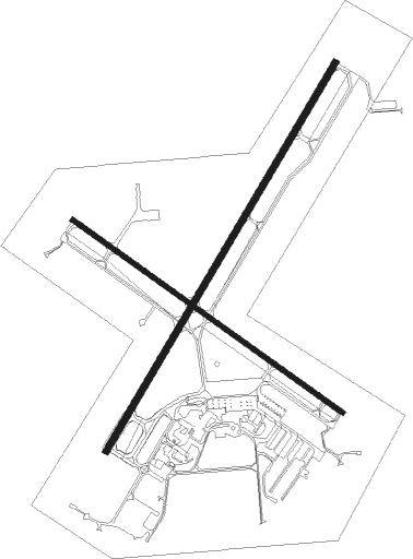
Sheboygan - Sheboygan Co Mem
Airport details
| Country | United States of America |
| State | Wisconsin |
| Region | K5 |
| Airspace | Chicago Ctr |
| Municipality | Town of Sheboygan Falls |
| Elevation | 752ft (229m) |
| Timezone | GMT -6 |
| Coordinates | 43.76978, -87.85172 |
| Magnetic var | |
| Type | land |
| Available since | X-Plane v10.40 |
| ICAO code | KSBM |
| IATA code | SBM |
| FAA code | SBM |
Communication
| Sheboygan Co Mem CTAF/UNICOM | 122.700 |
Approach frequencies
| ILS-cat-I | RW22 | 110.7 | 18.00mi |
| 3° GS | RW22 | 110.7 | 18.00mi |
Nearby Points of Interest:
Windway
-Riverbend
-David Taylor House
-Henry H. Huson House and Water Tower
-Stefanie H. Weill Center for the Performing Arts
-Henry Store Foeste Building
-Jung Shoe Manufacturing Company Factory
-Downtown Churches Historic District
-John Michael Kohler House
-Thomas M. and Bridget Blackstock House
-Sheboygan County Courthouse
-Quasius Quarry
-St. Patrick's Roman Catholic Church
-Sylvanus Wade House
-SS Atlanta
-Gooseville Mill/Grist Mill
-St. Mary's Convent
-St. Gregory's Church
-Herman C. Timm House
-Kneeland-Walker House
-St. Matthias Mission
-Thomas B. Hart House
-Saint John Evangelical Lutheran Church
-St. John of God Roman Catholic Church, Convent, and School
-St. John the Baptist Catholic Church

Nearby beacons
| code | identifier | dist | bearing | frequency |
|---|---|---|---|---|
| FAH | (SHEBOYGAN) DME | 0.1 | 109° | 110 |
| MTW | DME | 22.7 | 26° | 111 |
| BJB | WEST BEND VOR | 24 | 218° | 109.80 |
| MT | MAWOC (MANITOWOC) NDB | 26.6 | 19° | 362 |
| OS | POBER (OSHKOSH) NDB | 31.2 | 278° | 395 |
| OSH | OSHKOSH VORTAC | 33.2 | 287° | 116.75 |
| AQ | KOOKY (APPLETON) NDB | 35.7 | 309° | 407 |
| SG | DEPRE (GREEN BAY) NDB | 39.6 | 336° | 332 |
| LJT | (MILWAUKEE) DME | 40.4 | 196° | 115.65 |
| UNU | JUNEAU NDB | 42.2 | 248° | 344 |
| BAE | BADGER (MILWAUKEE) VOR/DME | 43.5 | 214° | 116.40 |
| GR | FAMIS (GREEN BAY) NDB | 43.6 | 330° | 356 |
| GRB | GREEN BAY VORTAC | 49.4 | 336° | 115.50 |
| RYV | ROCK RIVER (WATERTOWN) NDB | 52.2 | 236° | 371 |
| II | FICHY (STURGEON BAY) NDB | 61.7 | 22° | 224 |
Instrument approach procedures
| runway | airway (heading) | route (dist, bearing) |
|---|---|---|
| RW04 | TORRU (44°) | TORRU 3000ft |
| RNAV | TORRU 3000ft JAMEK (6mi, 44°) 2700ft KSBM (6mi, 44°) 796ft (5312mi, 116°) 994ft JADNI (5305mi, 297°) 3000ft JADNI (turn) | |
| RW13 | LEWKO (107°) | LEWKO ORMEE (8mi, 90°) 3000ft |
| RW13 | NEROE (215°) | NEROE CLINS (25mi, 246°) 3000ft ORMEE (12mi, 203°) 3000ft |
| RW13 | ORMEE (120°) | ORMEE 3000ft |
| RNAV | ORMEE 3000ft CONAX (6mi, 121°) 2500ft HOSLA (3mi, 121°) 1360ft KSBM (2mi, 119°) 805ft (5312mi, 116°) 1155ft ORMEE (5321mi, 296°) 3000ft ORMEE (turn) | |
| RW22 | GAYLE (288°) | GAYLE JADNI (40mi, 303°) 3000ft JADNI (turn) 3000ft |
| RNAV | JADNI 3000ft CUVUN (6mi, 224°) 2600ft VUXCY (4mi, 224°) 1300ft KSBM (2mi, 224°) 793ft (5312mi, 116°) 943ft TORRU (5319mi, 296°) 3000ft TORRU (turn) | |
| RW31 | WOKNO (346°) | WOKNO FONAB (11mi, 39°) 3000ft |
| RNAV | FONAB 3000ft DECEK (6mi, 301°) 2400ft KSBM (5mi, 302°) 779ft (5312mi, 116°) 1155ft WOKNO (5309mi, 296°) 3000ft WOKNO (turn) |
Disclaimer
The information on this website is not for real aviation. Use this data with the X-Plane flight simulator only! Data taken with kind consent from X-Plane 12 source code and data files. Content is subject to change without notice.