Schenectady - Schenectady Co
Airport details
| Country | United States of America |
| State | New York |
| Region | K6 |
| Airspace | Boston Ctr |
| Municipality | Town of Glenville |
| Elevation | 376ft (115m) |
| Timezone | GMT -5 |
| Coordinates | 42.85255, -73.92897 |
| Magnetic var | |
| Type | land |
| Available since | X-Plane v10.40 |
| ICAO code | KSCH |
| IATA code | SCH |
| FAA code | SCH |
Communication
| SCHENECTADY CO ASOS | 119.275 |
| SCHENECTADY CO CTAF | 121.300 |
| SCHENECTADY CO UNICOM | 122.950 |
| SCHENECTADY CO GROUND | 121.900 |
| SCHENECTADY CO Tower | 121.900 |
| SCHENECTADY CO ALBANY Approach/Departure | 118.050 |
Approach frequencies
| ILS-cat-I | RW04 | 109.7 | 18.00mi |
| 3° GS | RW04 | 109.7 | 18.00mi |
Nearby Points of Interest:
Cyrus Rexford House
-Johnstown Bridge
-Abraham Glen House
-Stockade Historic District
-Irving Langmuir House
-Union Street Historic District
-United States Post Office
-Schenectady City Hall
-Schenectady Armory
-General Electric Research Laboratory
-Mabee House
-Abraham Best House
-Vischer Ferry Historic District
-Charles Parker House
-Davis-Ferris Organ
-Verdoy Schoolhouse
-Ruhle Road Stone Arch Bridge
-Watervliet Shaker Historic District
-West Charlton United Presbyterian Church
-Noxon Bank Building
-Oakcliff
-John Schoolcraft House
-Lainhart Farm Complex and Dutch Barn
-Rose Hill
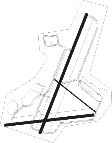
Runway info
Runway 4 / 22  | ||
| length | 2136m (7008ft) | |
| bearing | 34° / 214° | |
| width | 46m (150ft) | |
| surface | asphalt | |
| Runway 10 / 28 | ||
| length | 1480m (4856ft) | |
| bearing | 88° / 268° | |
| width | 46m (150ft) | |
| surface | asphalt | |
| displ threshold | 61m (200ft) / 0m (0ft) | |
| Runway 15 / 33 | ||
| length | 874m (2867ft) | |
| bearing | 124° / 304° | |
| width | 15m (50ft) | |
| surface | asphalt | |
Nearby beacons
| code | identifier | dist | bearing | frequency |
|---|---|---|---|---|
| HEU | HUNTER (SCHENECTADY) NDB | 0.2 | 290° | 356 |
| AL | HAWKY (ALBANY) NDB | 5.7 | 106° | 219 |
| ALB | ALBANY VORTAC | 8.4 | 130° | 115.30 |
| JJH | JOHNSTOWN NDB | 19.7 | 290° | 523 |
| CAM | CAMBRIDGE VOR/DME | 27 | 76° | 115 |
| GF | GANSE (GLENS FALLS) NDB | 28 | 39° | 209 |
| PFH | PHILMONT (HUDSON) NDB | 37.1 | 161° | 272 |
| CTR | CHESTER VOR/DME | 54.8 | 120° | 115.10 |
| RUT | DME | 58.9 | 55° | 111 |
| DYO | SMUTO (RUTLAND) NDB | 66.5 | 49° | 221 |
Instrument approach procedures
| runway | airway (heading) | route (dist, bearing) |
|---|---|---|
| RW04 | ALB (310°) | ALB FOSRA (15mi, 244°) 3800ft FOSRA (turn) 3700ft |
| RNAV | FOSRA 3700ft BUMPS (7mi, 33°) 3000ft CURUR (3mi, 33°) 2000ft KSCH (6mi, 34°) 373ft (4702mi, 120°) 588ft MULXI (4699mi, 300°) 3000ft MULXI (turn) | |
| RW10 | CEDOR (74°) | CEDOR UNMIP (7mi, 42°) 3000ft |
| RW10 | UNMIP (88°) | UNMIP 3000ft |
| RNAV | UNMIP 3000ft SUNOY (6mi, 88°) 2400ft OKBEW (2mi, 88°) 1860ft KSCH (5mi, 87°) 375ft (4702mi, 120°) 778ft VEYCU (4690mi, 300°) 3000ft VEYCU (turn) | |
| RW22 | CAM (256°) | CAM MULXI (20mi, 276°) 3000ft |
| RW22 | MULXI (213°) | MULXI 3000ft |
| RNAV | MULXI 3000ft ZILVO (6mi, 214°) 2200ft KSCH (6mi, 213°) 428ft (4702mi, 120°) 628ft FOSRA (4706mi, 300°) 3700ft FOSRA (turn) | |
| RW28 | ALB (310°) | ALB VEYCU (9mi, 53°) 2500ft VEYCU (turn) 2500ft |
| RNAV | VEYCU 2500ft NOCDI (6mi, 269°) 2000ft KSCH (5mi, 270°) 372ft (4702mi, 120°) 615ft UNMIP (4715mi, 300°) 3000ft UNMIP (turn) |
Disclaimer
The information on this website is not for real aviation. Use this data with the X-Plane flight simulator only! Data taken with kind consent from X-Plane 12 source code and data files. Content is subject to change without notice.