Stockton - Stockton Metropolitan
Airport details
| Country | United States of America |
| State | California |
| Region | K2 |
| Airspace | Oakland Ctr |
| Municipality | Manteca |
| Elevation | 28ft (9m) |
| Timezone | GMT -8 |
| Coordinates | 37.88756, -121.23555 |
| Magnetic var | |
| Type | land |
| Available since | X-Plane v10.40 |
| ICAO code | KSCK |
| IATA code | SCK |
| FAA code | SCK |
Communication
| Stockton Metropolitan ATIS | 118.250 |
| Stockton Metropolitan CTAF | 120.300 |
| Stockton Metropolitan UNICOM | 122.950 |
| Stockton Metropolitan Ground Control | 121.900 |
| Stockton Metropolitan Tower | 120.300 |
| Stockton Metropolitan NORCAL ApproachR | 123.850 |
| Stockton Metropolitan NORCAL Departure | 125.100 |
Approach frequencies
| ILS-cat-II | RW29R | 109.1 | 18.00mi |
| 3° GS | RW29R | 109.1 | 18.00mi |
Nearby Points of Interest:
Wong K. Gew Mansion
-Tretheway Block
-United States Post Office (Stockton, California)
-Elks Building
-Bank of Tracy
-Bank of Italy
-Tracy City Hall and Jail
-John Ohm House
-Lodi Arch
-Woman's Club of Lodi
-Harmony Grove Church
-Woodbridge Masonic Lodge No. 131
-I.O.O.F. Hall
-McHenry Mansion
-El Viejo Post Office
-Brewster House
-Brewster Building
-Isleton Chinese and Japanese Commercial Districts
-Cosumnes River Preserve
-Livermore Carnegie Library and Park
-Roswell Butler Hard House
-Copperopolis Congregational Church
-Honigsberger Store
-Reed's Store
-Copperopolis Armory
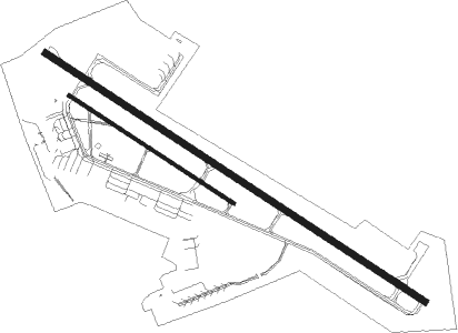
Runway info
Runway 11L / 29R  | ||
| length | 3122m (10243ft) | |
| bearing | 121° / 301° | |
| width | 46m (151ft) | |
| surface | asphalt | |
| displ threshold | 302m (991ft) / 184m (604ft) | |
| blast zone | 61m (200ft) / 0m (0ft) | |
| Runway 11R / 29L | ||
| length | 1355m (4446ft) | |
| bearing | 121° / 301° | |
| width | 22m (72ft) | |
| surface | asphalt | |
Nearby beacons
| code | identifier | dist | bearing | frequency |
|---|---|---|---|---|
| LIN | LINDEN VOR/DME | 15.6 | 51° | 114.80 |
| MOD | MODESTO VOR/DME | 20.4 | 133° | 114.60 |
| LV | REIGA (LIVERMORE) NDB | 24.3 | 246° | 374 |
| SAC | SACRAMENTO VORTAC | 36.5 | 330° | 115.20 |
| CCR | CONCORD VOR/DME | 39.4 | 281° | 117 |
| SUU | TRAVIS (FAIRFIELD) TACAN | 39.8 | 297° | 116.60 |
| SJC | SAN JOSE VOR/DME | 45.6 | 234° | 114.10 |
| MCC | MC CLELLAN (SACRAMENTO) VOR/DME | 47.5 | 348° | 109.20 |
| NUQ | MOFFETT (MOUNTAIN VIEW) TACAN | 47.6 | 241° | 117.60 |
| OAK | OAKLAND VOR/DME | 47.8 | 261° | 116.80 |
| HNW | HANGTOWN (PLACERVILLE) VOR/DME | 55.2 | 30° | 115.50 |
| HYP | EL NIDO (MERCED) VOR/DME | 56.4 | 129° | 114.20 |
Instrument approach procedures
| runway | airway (heading) | route (dist, bearing) |
|---|---|---|
| RW11L | ALTAM (82°) | ALTAM LITPE (9mi, 56°) 5000ft HAXEK (10mi, 57°) 2700ft |
| RW11L | LIN (231°) | LIN HAXEK (21mi, 262°) 2700ft HAXEK (turn) 2700ft |
| RW11L | OAKEY (111°) | OAKEY HAXEK (11mi, 100°) 2700ft |
| RW11L | VISTO (128°) | VISTO HAXEK (14mi, 133°) 2700ft |
| RNAV | HAXEK 2700ft GIKTE (6mi, 121°) 1800ft KSCK (6mi, 123°) 77ft (6856mi, 107°) 229ft OXJEF (6850mi, 287°) 2000ft OXJEF (turn) | |
| RW29R | AXING (273°) | AXING OXJEF (8mi, 224°) 2000ft |
| RW29R | FASIT (335°) | FASIT OXJEF (8mi, 44°) 2000ft |
| RW29R | OXJEF (300°) | OXJEF 6000ft OXJEF (turn) 2000ft |
| RNAV | OXJEF 2000ft IPDEW (6mi, 301°) 1800ft WIGBI (4mi, 301°) 520ft KSCK (2mi, 294°) 87ft (6856mi, 107°) 232ft HAXEK (6862mi, 287°) 2700ft HAXEK (turn) |
Disclaimer
The information on this website is not for real aviation. Use this data with the X-Plane flight simulator only! Data taken with kind consent from X-Plane 12 source code and data files. Content is subject to change without notice.