Oneida - Scott Muni
Airport details
| Country | United States of America |
| State | Tennessee |
| Region | K7 |
| Airspace | Indianapolis Ctr |
| Municipality | Scott County |
| Elevation | 1543ft (470m) |
| Timezone | GMT -5 |
| Coordinates | 36.45570, -84.58575 |
| Magnetic var | |
| Type | land |
| Available since | X-Plane v10.40 |
| ICAO code | KSCX |
| IATA code | n/a |
| FAA code | SCX |
Communication
| Scott Muni AWOS 3 | 135.025 |
| Scott Muni CTAF/UNICOM | 122.800 |
Nearby Points of Interest:
Black Creek Fire Lookout Tower
-Barton Chapel
-Pickett State Rustic Park Historic District
-Stearns Administrative and Commercial District
-A.E. Perkins House
-Forbus
-U.S. Post Office and Mine Rescue Station
-Fairchild House
-Old Wayne County High School
-Kincaid-Howard House
-Lane Theater
-Dr. Fred Stone, Sr., Hospital
-Colonial Hall
-Green McAdoo School
-Oak Ridge Historic District
-Daugherty Furniture Building
-Luther Brannon House
-Alpine Institute
-Cornstalk Heights
-American Temperance University
-Burnside Methodist Church
-Manhattan Project National Historical Park
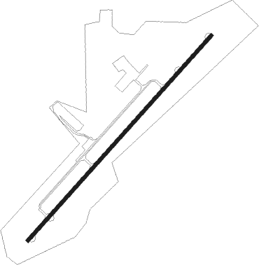
Runway info
| Runway 5 / 23 | ||
| length | 1677m (5502ft) | |
| bearing | 52° / 232° | |
| width | 23m (75ft) | |
| surface | asphalt | |
Nearby beacons
| code | identifier | dist | bearing | frequency |
|---|---|---|---|---|
| SCX | SCOTT (ONEIDA) NDB | 0 | 284° | 403 |
| LVT | LIVINGSTON VOR/DME | 29 | 283° | 108.40 |
| CDX | CUMBERLAND RIVER (SOMERSET) NDB | 32.7 | 350° | 388 |
| LOZ | LONDON VOR/DME | 41.5 | 39° | 116.55 |
| HCH | HINCH MTN (CROSSVILLE) VOR/DME | 44.7 | 210° | 117.60 |
| VXV | VOLUNTEER (KNOXVILLE) VORTAC | 47 | 129° | 116.40 |
| DTE | MARK ANTON (DAYTON) NDB | 60.8 | 200° | 394 |
Instrument approach procedures
| runway | airway (heading) | route (dist, bearing) |
|---|---|---|
| RW05 | ZITGO (52°) | ZITGO 3900ft |
| RNAV | ZITGO 3900ft JENAG (6mi, 52°) 3300ft TUKUW (2mi, 52°) 2340ft KSCX (2mi, 52°) 1605ft (5144mi, 113°) 1860ft COPEP (5135mi, 293°) 4800ft COPEP (turn) | |
| RW23 | COPEP (233°) | COPEP 4800ft |
| RNAV | COPEP 4800ft GATGE (6mi, 233°) 3700ft LUKYE (4mi, 233°) 2500ft KSCX (3mi, 232°) 1574ft (5144mi, 113°) 1772ft ZITGO (5151mi, 293°) 3900ft ZITGO (turn) |
Disclaimer
The information on this website is not for real aviation. Use this data with the X-Plane flight simulator only! Data taken with kind consent from X-Plane 12 source code and data files. Content is subject to change without notice.