Spokane - Felts Field
Airport details
| Country | United States of America |
| State | Washington |
| Region | K1 |
| Airspace | Seattle Ctr |
| Municipality | Spokane |
| Elevation | 1953ft (595m) |
| Timezone | GMT -8 |
| Coordinates | 47.67908, -117.32759 |
| Magnetic var | |
| Type | land |
| Available since | X-Plane v10.40 |
| ICAO code | KSFF |
| IATA code | SFF |
| FAA code | SFF |
Communication
| Felts Field ATIS | 120.550 |
| Felts Field UNICOM | 122.950 |
| Felts Field CTAF | 132.500 |
| Felts Field Ground Control | 121.700 |
| Felts Field Tower | 132.500 |
| Felts Field SPOKANE Approach/Departure | 133.350 |
Approach frequencies
| ILS-cat-I | RW22R | 111.7 | 18.00mi |
| 3.6° GS | RW22R | 111.7 | 18.00mi |
Nearby Points of Interest:
Rosebush House
-Spokane Public Library - East Side Branch
-Frequency Changing Station
-United States Post Office, Courthouse, and Custom House
-Mount Saint Michael
-Cambern Dutch Shop Windmill
-The Globe Hotel
-Kemp & Hebert Building
-Spokane Public Library - North Monroe Branch
-Breslin
-Spokane City Hall Building
-Spokane Fire Station No. 3
-Peyton Building and Peyton Annex
-Knickerbocker
-Review Building
-Riverside Avenue Historic District
-Grace Baptist Church
-Eldridge Building
-Amman
-Coolidge–Rising House
-Patsy Clark Mansion
-John A. Finch Memorial Nurses Home
-Fort George Wright
-Spokane River Centennial Trail
-Cheney Odd Fellows Hall
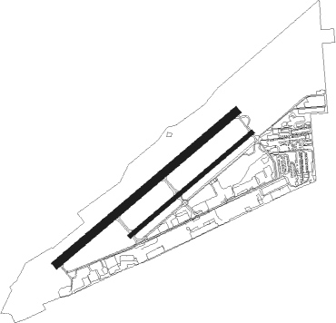
Runway info
Runway 4L / 22R  | ||
| length | 1370m (4495ft) | |
| bearing | 64° / 244° | |
| width | 46m (151ft) | |
| surface | concrete | |
| Runway 4R / 22L | ||
| length | 931m (3054ft) | |
| bearing | 64° / 244° | |
| width | 23m (75ft) | |
| surface | asphalt | |
| displ threshold | 126m (413ft) / 0m (0ft) | |
| Runway 03 / 21 | ||
| length | 950m (3117ft) | |
| bearing | 67° / 247° | |
| width | 30m (98ft) | |
Nearby beacons
| code | identifier | dist | bearing | frequency |
|---|---|---|---|---|
| GEG | SPOKANE VORTAC | 13.9 | 249° | 115.50 |
| SKA | FAIRCHILD (SPOKANE) TACAN | 14.1 | 258° | 111.40 |
| DPY | DEER PARK NDB | 17.7 | 341° | 365 |
| COE | COEUR D'ALENE VOR/DME | 21.2 | 79° | 108.80 |
| SZT | SANDPOE (SANDPOINT) NDB | 47.8 | 51° | 264 |
Departure and arrival routes
| Transition altitude | 18000ft |
| Transition level | 18000ft |
| SID end points | distance | outbound heading | |
|---|---|---|---|
| RW04 (ALL) | |||
| FELTS4, HAYDE4 | 73mi | 257° | |
| RW22 (ALL) | |||
| FELTS4 | 73mi | 257° | |
| STAR starting points | distance | inbound heading | |
|---|---|---|---|
| RW04L | |||
| ZOOMR1 | 42.6 | 76° | |
| HILIE2 | 27.5 | 284° | |
| RW04R | |||
| ZOOMR1 | 42.6 | 76° | |
| HILIE2 | 27.5 | 284° | |
| RW22L | |||
| ZOOMR1 | 42.6 | 76° | |
| HILIE2 | 27.5 | 284° | |
| RW22R | |||
| ZOOMR1 | 42.6 | 76° | |
| HILIE2 | 27.5 | 284° | |
Instrument approach procedures
| runway | airway (heading) | route (dist, bearing) |
|---|---|---|
| RW04L | DIANN (197°) | DIANN ZOPEL (37mi, 232°) 6000ft SOLJR (7mi, 133°) 5300ft CEBTA (5mi, 133°) 4100ft |
| RW04L | GRAPH (59°) | GRAPH ETFEM (18mi, 51°) 6000ft CEBTA (6mi, 67°) 4100ft |
| RW04L | ROPES (306°) | ROPES ODOCE (15mi, 245°) 7000ft CEBTA (11mi, 314°) 4100ft |
| RNAV | CEBTA 4100ft ALAYE (8mi, 64°) 3900ft KSFF (6mi, 65°) 2002ft (6486mi, 112°) 2850ft CEVOS (6476mi, 292°) KARPS (12mi, 80°) 8000ft KARPS (turn) |
Disclaimer
The information on this website is not for real aviation. Use this data with the X-Plane flight simulator only! Data taken with kind consent from X-Plane 12 source code and data files. Content is subject to change without notice.