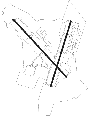
Springfield - Springfield-branson National
Airport details
| Country | United States of America |
| State | Missouri |
| Region | K3 |
| Airspace | Kansas City Ctr |
| Municipality | Springfield |
| Elevation | 1268ft (386m) |
| Timezone | GMT -6 |
| Coordinates | 37.24567, -93.38864 |
| Magnetic var | |
| Type | land |
| Available since | X-Plane v10.40 |
| ICAO code | KSGF |
| IATA code | SGF |
| FAA code | SGF |
Communication
| Springfield-Branson National ATIS | 119.050 |
| Springfield-Branson National UNICOM | 122.950 |
| Springfield-Branson National Clearance DEL | 123.675 |
| Springfield-Branson National Ground Control | 121.900 |
| Springfield-Branson National Tower | 119.900 |
| Springfield-Branson National Approach/Departure | 124.950 |
| Springfield-Branson National Approach/Departure | 121.100 |
Approach frequencies
| ILS-cat-I | RW14 | 109.7 | 18.00mi |
| ILS-cat-I | RW02 | 109.9 | 18.00mi |
| 3° GS | RW14 | 109.7 | 18.00mi |
| 3° GS | RW02 | 109.9 | 18.00mi |
Nearby Points of Interest:
Springfield Seed Co. Office and Warehouse
-Commercial Street Historic District
-Henry Schneider Building
-Finkbiner Building
-Greene County Courthouse
-D.M. Oberman Manufacturing Co. Building
-U.S. Customhouse and Post Office
-Springfield Public Square Historic District
-Fallin Brothers Building
-J.E. King Manufacturing Company
-Old Calaboose
-Woods-Evertz Stove Company Historic District
-Gottfried Furniture Company Building
-Heer's Department Store
-Franklin Springfield Motor Co. Building
-Benton Avenue AME Church
-Bentley House
-Holland Building
-Wise Feed Company Building
-E. M. Wilhoit Building
-College Apartments
-Robert B. and Vitae A. Kite Apartment Building
-Day House
-Keet-McElhany House
-Camp Manor Apartments

Nearby beacons
| code | identifier | dist | bearing | frequency |
|---|---|---|---|---|
| SGF | SPRINGFIELD VORTAC | 7.1 | 26° | 116.90 |
| DGD | DOGWOOD VORTAC | 27.8 | 113° | 109.40 |
| HRO | HARRISON VOR/DME | 56.3 | 169° | 112.50 |
| SHY | SUNSHINE (KAISER) VOR/DME | 60.6 | 45° | 108.40 |
| RZC | RAZORBACK (FAYETTEVILLE) VORTAC | 69.6 | 216° | 116.40 |
| FLP | DME | 72.3 | 135° | 116.05 |
Instrument approach procedures
| runway | airway (heading) | route (dist, bearing) |
|---|---|---|
| RW02 | AWAQE (25°) | AWAQE 3000ft |
| RW02 | EDDEV (52°) | EDDEV 3000ft AWAQE (5mi, 108°) 3000ft |
| RW02 | GUPUJ (355°) | GUPUJ 3000ft AWAQE (5mi, 288°) 3000ft |
| RNAV | AWAQE 3000ft TICOT (6mi, 26°) 2500ft KSGF (4mi, 23°) 1318ft INOYU (12mi, 28°) 3000ft INOYU (turn) | |
| RW14 | OZARK (111°) | OZARK JOGPU (10mi, 84°) 3000ft |
| RW14 | SGF (206°) | SGF JOGPU (11mi, 285°) 3000ft JOGPU (turn) 3000ft |
| RW14 | SHIRE (149°) | SHIRE JOGPU (8mi, 173°) 3000ft |
| RNAV | JOGPU 3000ft ZEDAK (7mi, 135°) 2900ft KSGF (6mi, 134°) 1310ft (5567mi, 112°) 1518ft RETHA (5560mi, 292°) 3000ft RETHA (turn) | |
| RW20 | BAYAT (235°) | BAYAT 3100ft INOYU (6mi, 288°) 3000ft |
| RW20 | CISNO (175°) | CISNO 3000ft INOYU (6mi, 108°) 3000ft |
| RW20 | INOYU (208°) | INOYU 3000ft |
| RNAV | INOYU 3000ft FANDR (6mi, 207°) 3000ft KSGF (6mi, 209°) 1309ft AWAQE (11mi, 205°) 3000ft AWAQE (turn) | |
| RW32 | RETHA (316°) | RETHA 3200ft |
| RNAV | RETHA 3200ft APELL (6mi, 316°) 2900ft KSGF (5mi, 316°) 1319ft (5567mi, 112°) 1468ft JOGPU (5575mi, 292°) 3000ft JOGPU (turn) |
Disclaimer
The information on this website is not for real aviation. Use this data with the X-Plane flight simulator only! Data taken with kind consent from X-Plane 12 source code and data files. Content is subject to change without notice.