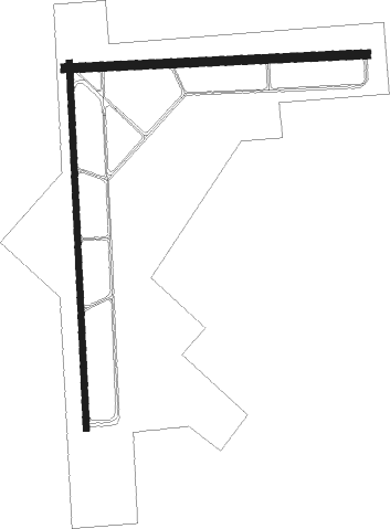
Stuttgart - Stuttgart Muni
Airport details
| Country | United States of America |
| State | Arkansas |
| Region | K4 |
| Airspace | Memphis Ctr |
| Municipality | Prairie County |
| Elevation | 224ft (68m) |
| Timezone | GMT -6 |
| Coordinates | 34.59948, -91.57500 |
| Magnetic var | |
| Type | land |
| Available since | X-Plane v10.40 |
| ICAO code | KSGT |
| IATA code | SGT |
| FAA code | SGT |
Communication
| Stuttgart Muni AWOS 3 | 119.025 |
| Stuttgart Muni CTAF/UNICOM | 122.800 |
| Stuttgart Muni LITTLE ROCK Approach/Departure | 135.400 |
Approach frequencies
| ILS-cat-I | RW36 | 110.55 | 18.00mi |
| 3° GS | RW36 | 110.55 | 18.00mi |
Nearby beacons
| code | identifier | dist | bearing | frequency |
|---|---|---|---|---|
| TT | STUTT (STUTTGART) NDB | 5.6 | 184° | 338 |
| PBF | PINE BLUFF VOR/DME | 27.4 | 225° | 116 |
| LIT | LITTLE ROCK VORTAC | 30.2 | 277° | 113.90 |
| DS | CERCY (SEARCY) NDB | 32.7 | 340° | 375 |
| LRF | JACKSONVILLE TACAN | 34.5 | 299° | 109.20 |
| LI | LASKY (LITTLE ROCK) NDB | 36.3 | 275° | 353 |
| UJM | MARVELL (HELENA) VOR/DME | 44.5 | 92° | 109.60 |
Instrument approach procedures
| runway | airway (heading) | route (dist, bearing) |
|---|---|---|
| RW09 | HINOX (93°) | HINOX 2000ft |
| RW09 | LIT (97°) | LIT HINOX (19mi, 100°) 2000ft |
| RW09 | PBF (45°) | PBF RIDOC (18mi, 23°) 2000ft HINOX (5mi, 2°) 2000ft |
| RW09 | TAFTE (150°) | TAFTE PIMAE (11mi, 203°) 2000ft HINOX (5mi, 182°) 2000ft |
| RNAV | HINOX 2000ft GEYSE (6mi, 91°) 1900ft KSGT (5mi, 94°) 264ft (5483mi, 111°) 600ft WEGAV (5471mi, 291°) 2000ft WEGAV (turn) | |
| RW18 | DRAST (259°) | DRAST WILUS (10mi, 346°) 2000ft ZEDUK (5mi, 272°) 2000ft |
| RW18 | HILLE (223°) | HILLE WILUS (26mi, 229°) 2000ft ZEDUK (5mi, 272°) 2000ft |
| RW18 | LIT (97°) | LIT NIBIC (26mi, 77°) 2000ft ZEDUK (5mi, 91°) 2000ft |
| RW18 | ZEDUK (181°) | ZEDUK 2000ft |
| RNAV | ZEDUK 2000ft TOCOK (6mi, 182°) 1900ft KSGT (5mi, 180°) 265ft (5483mi, 111°) 474ft HOGOM (5484mi, 291°) 2000ft HOGOM (turn) | |
| RW27 | AGOTE (239°) | AGOTE WEGAV (24mi, 222°) 2000ft |
| RW27 | PBF (45°) | PBF CISAX (33mi, 65°) 2000ft WEGAV (5mi, 2°) 2000ft |
| RW27 | UJM (272°) | UJM WEGAV (33mi, 272°) 2000ft |
| RW27 | WEGAV (271°) | WEGAV 2000ft |
| RNAV | WEGAV 2000ft HONAM (6mi, 272°) 1900ft KSGT (6mi, 269°) 264ft (5483mi, 111°) 580ft HINOX (5494mi, 291°) 2000ft HINOX (turn) | |
| RW36 | HOGOM (3°) | HOGOM 2000ft |
| RW36 | KIYEL (313°) | KIYEL HOGOM (11mi, 272°) 2000ft |
| RW36 | PBF (45°) | PBF OKIYO (15mi, 56°) 2000ft HOGOM (5mi, 92°) 2000ft |
| RNAV | HOGOM 2000ft LAYIS (6mi, 2°) 1900ft MAVRE (2mi, 2°) 1220ft KSGT (4mi, 6°) 273ft (5483mi, 111°) 474ft ZEDUK (5483mi, 291°) 2000ft ZEDUK (turn) |
Disclaimer
The information on this website is not for real aviation. Use this data with the X-Plane flight simulator only! Data taken with kind consent from X-Plane 12 source code and data files. Content is subject to change without notice.

