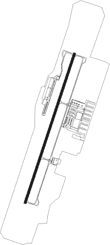
St George - St George Regl
Airport details
| Country | United States of America |
| State | Utah |
| Region | K2 |
| Airspace | Los Angeles Ctr |
| Municipality | St. George |
| Elevation | 2881ft (878m) |
| Timezone | GMT -7 |
| Coordinates | 37.03639, -113.51031 |
| Magnetic var | |
| Type | land |
| Available since | X-Plane v10.40 |
| ICAO code | KSGU |
| IATA code | SGU |
| FAA code | SGU |
Communication
| St George Regl WX AWOS-3 at SGU | 135.075 |
| St George Regl CTAF/Unicom | 122.800 |
| St George Regl LA Center Approach/Departure Con | 124.200 |
Approach frequencies
| ILS-cat-I | RW19 | 110.9 | 18.00mi |
| 3.1° GS | RW19 | 110.9 | 18.00mi |
Nearby Points of Interest:
Washington Cotton Factory
-Orson Pratt House
-Old Washington County Courthouse
-Washington Relief Society Hall
-Thomas Judd House
-St. George Opera House
-Brigham Young Winter Home and Office
-Robert D. Covington House
-Frederick and Anna Maria Reber House
-Hurricane Canal
-Wells Fargo and Company Express Building
-John Steele House
-Pine Valley Chapel and Tithing Office
-Deseret Telegraph and Post Office
-South Campground Comfort Station
-Oak Creek Historic District
-Zion Nature Center-Zion Inn
-Pine Creek Residential Historic District
-Canyon Overlook Trail
-Emerald Pools Trail
-Zion Lodge–Birch Creek Historic District
-Zion – Mount Carmel Highway
-Grotto Residence
-Mesquite High School Gymnasium
-Grotto Camping Ground North Comfort Station
Nearby beacons
| code | identifier | dist | bearing | frequency |
|---|---|---|---|---|
| UTI | ST GEORGE VOR/DME | 1.1 | 202° | 108.60 |
| AZC | COLORADO CITY NDB | 24.4 | 99° | 403 |
| MMM | MORMON MESA VORTAC | 40.1 | 251° | 114.30 |
| EHK | ENOCH VOR/DME | 49.7 | 30° | 117.30 |
Departure and arrival routes
| Transition altitude | 18000ft |
| Transition level | 18000ft |
| SID end points | distance | outbound heading | |
|---|---|---|---|
| RW01 | |||
| PHYLI2 | 18mi | 258° | |
| HIVKA2 | 29mi | 338° | |
| RW19 | |||
| PHYLI2 | 18mi | 258° | |
| HIVKA2 | 29mi | 338° | |
Instrument approach procedures
| runway | airway (heading) | route (dist, bearing) |
|---|---|---|
| RW01 | MATZO (229°) | MATZO HOLUK (33mi, 208°) 9000ft ARENT (5mi, 286°) 8600ft |
| RW01 | MMM (71°) | MMM CUTAP (26mi, 90°) 11000ft ARENT (5mi, 90°) 8600ft |
| RNAV | ARENT 8600ft JITEG (2mi, 24°) 7900ft WOMIM (2mi, 24°) 7300ft ZOGOV (2mi, 24°) 6800ft VEVUY (3mi, 24°) 5700ft UGEXY (4mi, 24°) 4340ft IRQEV (3mi, 24°) 3080ft (6521mi, 108°) 3151ft UYITA (6519mi, 288°) HUNKU (23mi, 312°) 9800ft HUNKU (turn) | |
| RW19 | EHK (210°) | EHK PIETZ (12mi, 202°) 16000ft HOPEB (8mi, 202°) 12400ft IPPOD (4mi, 216°) 10300ft |
| RNAV | IPPOD 10300ft JIGAV (10mi, 216°) 7900ft PAYLR (5mi, 216°) 6300ft OWTUJ (6mi, 216°) 4300ft YEYUY (4mi, 216°) 3105ft (6520mi, 108°) 3284ft HUNKU (6529mi, 288°) 9800ft HUNKU (turn) |
Disclaimer
The information on this website is not for real aviation. Use this data with the X-Plane flight simulator only! Data taken with kind consent from X-Plane 12 source code and data files. Content is subject to change without notice.
