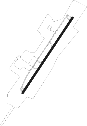
Staunton/waynesboro/harrisonburg - Shenandoah Valley Regl
Airport details
| Country | United States of America |
| State | Virginia |
| Region | K6 |
| Airspace | Washington Ctr |
| Municipality | Augusta County |
| Elevation | 1201ft (366m) |
| Timezone | GMT -5 |
| Coordinates | 38.26383, -78.89645 |
| Magnetic var | |
| Type | land |
| Available since | X-Plane v10.40 |
| ICAO code | KSHD |
| IATA code | SHD |
| FAA code | SHD |
Communication
| Shenandoah Valley Regl AWOS 3 | 124.925 |
| Shenandoah Valley Regl CTAF/UNICOM | 123.000 |
| Shenandoah Valley Regl POTOMAC Approach | 132.850 |
| Shenandoah Valley Regl POTOMAC Departure | 132.850 |
Approach frequencies
| ILS-cat-I | RW05 | 109.5 | 18.00mi |
| 3° GS | RW05 | 109.5 | 18.00mi |
Nearby beacons
| code | identifier | dist | bearing | frequency |
|---|---|---|---|---|
| SH | STAUT(STAUNTON-WAYNESBORO-HARR NDB | 4.7 | 224° | 375 |
| MOL | MONTEBELLO VOR/DME | 23.9 | 210° | 115.30 |
| LUA | CAVERNS (LURAY) NDB | 32.8 | 44° | 245 |
| GVE | GORDONSVILLE VORTAC | 38.1 | 109° | 115.60 |
| LDN | LINDEN VORTAC | 48 | 49° | 114.30 |
| MSQ | NAILR (CULPEPER) NDB | 48 | 79° | 351 |
| ESL | KESSEL VOR/DME | 57.9 | 354° | 110.80 |
| RQY | RANDOLPH CO. (ELKINS) NDB | 58.9 | 303° | 284 |
Instrument approach procedures
| runway | airway (heading) | route (dist, bearing) |
|---|---|---|
| RW05 | BOOME (57°) | BOOME GABEL (17mi, 68°) 5200ft |
| RW05 | CEROL (243°) | CEROL GABEL (22mi, 230°) 5200ft GABEL (turn) 5200ft |
| RW05 | MOL (30°) | MOL GABEL (9mi, 359°) 5200ft |
| RNAV | GABEL 5200ft CIBRO (11mi, 45°) 2800ft KSHD (5mi, 45°) 1230ft HAPED (6mi, 45°) JATIR (11mi, 291°) GABEL (23mi, 193°) 5200ft GABEL (turn) | |
| RW23 | ADIOS (225°) | ADIOS 4800ft ELOPY (3mi, 225°) 4300ft |
| RW23 | LURAY (225°) | LURAY ADIOS (11mi, 224°) 4800ft ELOPY (3mi, 225°) 4300ft |
| RW23 | MITER (278°) | MITER OLAJO (11mi, 349°) 5800ft ADIOS (5mi, 302°) 4800ft ELOPY (3mi, 225°) 4300ft |
| RW23 | TTUMS (153°) | TTUMS ASGOF (13mi, 103°) 5600ft ADIOS (5mi, 122°) 4800ft ELOPY (3mi, 225°) 4300ft |
| RNAV | ELOPY 4300ft FLLAT (3mi, 225°) 3900ft DORDE (5mi, 225°) 2200ft KSHD (3mi, 225°) 1246ft GABEL (16mi, 225°) 5300ft GABEL (turn) |
Disclaimer
The information on this website is not for real aviation. Use this data with the X-Plane flight simulator only! Data taken with kind consent from X-Plane 12 source code and data files. Content is subject to change without notice.
