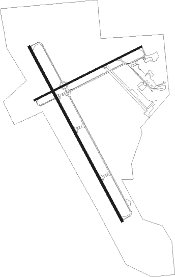
Sheridan - Sheridan County
Airport details
| Country | United States of America |
| State | Wyoming |
| Region | K1 |
| Airspace | Salt Lake City Ctr |
| Municipality | Sheridan County |
| Elevation | 4020ft (1225m) |
| Timezone | GMT -7 |
| Coordinates | 44.76920, -106.98028 |
| Magnetic var | |
| Type | land |
| Available since | X-Plane v10.40 |
| ICAO code | KSHR |
| IATA code | SHR |
| FAA code | SHR |
Communication
| Sheridan County ASOS | 135.175 |
| Sheridan County CTAF/UNICOM | 123.000 |
| Sheridan County SALT LAKE ApproachROACH | 127.750 |
| Sheridan County SALT LAKE DepartureARTURE | 127.750 |
Approach frequencies
| ILS-cat-I | RW33 | 108.7 | 18.00mi |
| 3° GS | RW33 | 108.7 | 18.00mi |
Nearby Points of Interest:
ECS Bridge over Big Goose Creek
-ECR Kooi Bridge
-Main Street Historic District
Nearby beacons
| code | identifier | dist | bearing | frequency |
|---|---|---|---|---|
| SHR | SHERIDAN VOR/DME | 5.5 | 312° | 115.30 |
| CZI | CRAZY WOMAN VOR/DME | 51.7 | 145° | 117.30 |
| RLY | WORLAND VOR/DME | 63.8 | 230° | 114.80 |
Instrument approach procedures
| runway | airway (heading) | route (dist, bearing) |
|---|---|---|
| RW15 | PARBE (125°) | PARBE RAMVE (10mi, 102°) 7000ft |
| RW15 | SHR (132°) | SHR RAMVE (7mi, 341°) 7000ft RAMVE (turn) 7000ft |
| RNAV | RAMVE 7000ft MONSE (6mi, 148°) 6000ft JIVOX (4mi, 148°) 4780ft KSHR (3mi, 146°) 4064ft (6124mi, 113°) 4500ft HERKA (6114mi, 293°) 7100ft HERKA (turn) 7100ft | |
| RW33 | SHERZ (326°) | SHERZ KEKNE (6mi, 315°) 9100ft |
| RW33 | SHR (132°) | SHR KEKNE (26mi, 145°) 9100ft KEKNE (turn) 9100ft |
| RNAV | KEKNE 9100ft FEKLI (10mi, 329°) 7200ft JULVI (4mi, 329°) 5840ft PIDSE (3mi, 328°) 4920ft KSHR (4mi, 330°) 4030ft (6124mi, 113°) 4205ft SHR (6126mi, 293°) 7300ft SHR (turn) 7300ft |
Disclaimer
The information on this website is not for real aviation. Use this data with the X-Plane flight simulator only! Data taken with kind consent from X-Plane 12 source code and data files. Content is subject to change without notice.

