San Angelo - San Angelo Regn Mathis Fld
Airport details
| Country | United States of America |
| State | Texas |
| Region | K4 |
| Airspace | Ft Worth Ctr |
| Municipality | San Angelo |
| Elevation | 1917ft (584m) |
| Timezone | GMT -6 |
| Coordinates | 31.35775, -100.49631 |
| Magnetic var | |
| Type | land |
| Available since | X-Plane v10.40 |
| ICAO code | KSJT |
| IATA code | SJT |
| FAA code | SJT |
Communication
| San Angelo Regn Mathis Fld ATIS | 128.450 |
| San Angelo Regn Mathis Fld UNICOM | 122.950 |
| San Angelo Regn Mathis Fld Ground Control | 121.900 |
| San Angelo Regn Mathis Fld Tower | 118.300 |
| San Angelo Regn Mathis Fld Approach/Departure | 125.350 |
Approach frequencies
| ILS-cat-I | RW03 | 109.7 | 18.00mi |
| 3° GS | RW03 | 109.7 | 18.00mi |
Nearby Points of Interest:
J. B. Blakeney House
-Municipal Swimming Pool
-Freeze Building
-Tom Green County Courthouse
-Montgomery Ward Building
-Masonic Lodge 570
-Concho County Courthouse
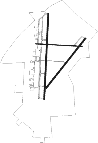
Runway info
Runway 18 / 36  | ||
| length | 2460m (8071ft) | |
| bearing | 189° / 9° | |
| width | 46m (150ft) | |
| surface | asphalt | |
| displ threshold | 275m (902ft) / 0m (0ft) | |
| blast zone | 65m (213ft) / 63m (207ft) | |
| Runway 3 / 21 | ||
| length | 1812m (5945ft) | |
| bearing | 48° / 228° | |
| width | 46m (150ft) | |
| surface | asphalt | |
| blast zone | 72m (236ft) / 0m (0ft) | |
| Runway 9 / 27 | ||
| length | 1343m (4406ft) | |
| bearing | 96° / 276° | |
| width | 23m (75ft) | |
| surface | asphalt | |
Nearby beacons
| code | identifier | dist | bearing | frequency |
|---|---|---|---|---|
| SJT | SAN ANGELO VORTAC | 2.3 | 67° | 115.10 |
| SJ | WOOLE (SAN ANGELO) NDB | 6.2 | 226° | 356 |
| SOA | SONORA NDB | 47.2 | 191° | 371 |
| JCT | JUNCTION VORTAC | 57.4 | 138° | 116 |
| TQA | TUSCOLA (ABILENE) VOR/DME | 63.1 | 38° | 111.60 |
| AB | TOMHI (ABILENE) NDB | 70.3 | 41° | 353 |
Instrument approach procedures
| runway | airway (heading) | route (dist, bearing) |
|---|---|---|
| RW03 | CHILD (353°) | CHILD ESOBY (6mi, 302°) 4400ft HEXPE (8mi, 309°) 4400ft |
| RW03 | SJT (247°) | SJT HEXPE (15mi, 230°) 4400ft HEXPE (turn) 4400ft |
| RW03 | TANKR (120°) | TANKR APDOW (11mi, 213°) 4400ft HEXPE (7mi, 129°) 4400ft |
| RNAV | HEXPE 4400ft ILIMY (6mi, 47°) 3900ft ANTHY (3mi, 47°) 3000ft KSJT (4mi, 44°) 1968ft (5943mi, 107°) 2117ft LITAZ (5935mi, 287°) 3800ft LITAZ (turn) | |
| RW18 | EVILE (285°) | EVILE CUGPA (24mi, 317°) 4100ft HONOB (6mi, 264°) 4100ft |
| RW18 | HONOB (188°) | HONOB 8000ft HONOB (turn) 4100ft |
| RW18 | STEEP (113°) | STEEP JIGEM (25mi, 97°) 4300ft HONOB (9mi, 96°) 4100ft |
| RNAV | HONOB 4100ft ZODEN (6mi, 189°) 3500ft ZUXUP (3mi, 189°) 2640ft KSJT (3mi, 185°) 1944ft (5943mi, 107°) 2158ft HUMUG (5944mi, 287°) HEXPE (9mi, 241°) 4400ft HEXPE (turn) | |
| RW21 | EVILE (285°) | EVILE RONFO (14mi, 306°) 4000ft LITAZ (7mi, 309°) 3800ft |
| RW21 | SJT (247°) | SJT LITAZ (7mi, 42°) 3800ft LITAZ (turn) 3800ft |
| RW21 | WATOR (142°) | WATOR MIXDI (13mi, 108°) 4100ft LITAZ (7mi, 129°) 3800ft |
| RNAV | LITAZ 3800ft JIPBI (6mi, 228°) 2900ft KSJT (4mi, 231°) 1945ft (5943mi, 107°) 2106ft HEXPE (5952mi, 287°) 4400ft HEXPE (turn) | |
| RW36 | CRALR (48°) | CRALR DBASE (11mi, 96°) 4100ft |
| RW36 | DBASE (9°) | DBASE 4100ft |
| RW36 | SANRE (327°) | SANRE DBASE (11mi, 276°) 4100ft |
| RNAV | DBASE 4100ft TIMPP (8mi, 8°) 4000ft VORYO (3mi, 8°) 2980ft KSJT (4mi, 11°) 1967ft (5943mi, 107°) 2319ft HONOB (5940mi, 287°) 4100ft HONOB (turn) |
Disclaimer
The information on this website is not for real aviation. Use this data with the X-Plane flight simulator only! Data taken with kind consent from X-Plane 12 source code and data files. Content is subject to change without notice.