Beaver Island
Airport details
| Country | United States of America |
| State | Michigan |
| Region | K5 |
| Airspace | Minneapolis Ctr |
| Municipality | Peaine Township |
| Elevation | 668ft (204m) |
| Timezone | GMT -5 |
| Coordinates | 45.69222, -85.56661 |
| Magnetic var | |
| Type | land |
| Available since | X-Plane v10.30 |
| ICAO code | KSJX |
| IATA code | n/a |
| FAA code | SJX |
Communication
| BEAVER ISLAND AWOS 3 | 118.075 |
| BEAVER ISLAND CTAF/UNICOM | 122.800 |
Nearby Points of Interest:
Feodar Protar Cabin
-Ekdahl–Goudreau Site
-Seul Choix Light
-Manitou Lodge
-Mt. McSauba Site
-Pine River Site
-Charlevoix City Park Site
-O'Neill Site
-Chicago and West Michigan Railroad Charlevoix Station
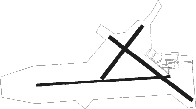
Runway info
Runway 9 / 27  | ||
| length | 1310m (4298ft) | |
| bearing | 91° / 271° | |
| width | 23m (75ft) | |
| surface | asphalt | |
| Runway 14 / 32 | ||
| length | 1006m (3301ft) | |
| bearing | 122° / 302° | |
| width | 37m (120ft) | |
| surface | grass | |
| displ threshold | 0m (0ft) / 183m (600ft) | |
| Runway 05 / 23 | ||
| length | 634m (2080ft) | |
| bearing | 52° / 232° | |
| width | 37m (120ft) | |
| surface | grass | |
Nearby beacons
| code | identifier | dist | bearing | frequency |
|---|---|---|---|---|
| ISQ | CO. (MANISTIQ DME | 30.5 | 295° | 114.85 |
| PLN | PELLSTON VORTAC | 38 | 94° | 111.80 |
| GL | BANGU (GAYLORD) NDB | 51.7 | 132° | 375 |
| GLR | GAYLORD VOR/DME | 54.6 | 128° | 109.20 |
| TV | GWENN (TRAVERSE CITY) NDB | 57.8 | 172° | 365 |
| GYG | GRAYLING NDB | 64.6 | 142° | 359 |
Instrument approach procedures
| runway | airway (heading) | route (dist, bearing) |
|---|---|---|
| RW27 | BODAY (270°) | BODAY 2600ft |
| RW27 | DIPLE (255°) | DIPLE BODAY (5mi, 177°) 2600ft |
| RW27 | PLN (274°) | PLN BODAY (26mi, 276°) 2600ft |
| RNAV | BODAY 2600ft AMILE (6mi, 270°) 2600ft KSJX (6mi, 270°) 707ft (5219mi, 118°) 1069ft BODAY (5207mi, 298°) 2600ft BODAY (turn) |
Disclaimer
The information on this website is not for real aviation. Use this data with the X-Plane flight simulator only! Data taken with kind consent from X-Plane 12 source code and data files. Content is subject to change without notice.