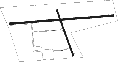
Cheboygan - Cheboygan Co
Airport details
| Country | United States of America |
| State | Michigan |
| Region | K5 |
| Airspace | Minneapolis Ctr |
| Municipality | Beaugrand Township |
| Elevation | 640ft (195m) |
| Timezone | GMT -5 |
| Coordinates | 45.65379, -84.51930 |
| Magnetic var | |
| Type | land |
| Available since | X-Plane v10.30 |
| ICAO code | KSLH |
| IATA code | n/a |
| FAA code | SLH |
Communication
| CHEBOYGAN CO AWOS 3 | 118.175 |
| CHEBOYGAN CO CTAF/UNICOM | 122.800 |
Nearby Points of Interest:
Newton–Allaire House
-Forrest J. Stimpson House
-Mission House
-Matthew Geary House
-Michigan Governor's Summer Residence
-Mackinac Island
-Faunce-McMichael Farm
-John Chambers House
-Marquette Street Archaeological District
-Gros Cap Archaeological District
-Sacred Heart-Gros Cap Church
-Hessel School
-Presque Isle County Courthouse
-Mackinac Trail – Carp River Bridge
-Bay View
-Shay Hexagon House
-Chief Andrew J. Blackbird House
-Grand Rapids and Indiana Railroad Harbor Springs Depot
-G. W. Olin House
-George and Eugene Markle House
-J. B. Allen House
-Petoskey Downtown Historic District
-Stout House
-Petoskey Public Works Utility Building
-Chesapeake and Ohio Depot

Nearby beacons
| code | identifier | dist | bearing | frequency |
|---|---|---|---|---|
| PLN | PELLSTON VORTAC | 6.2 | 261° | 111.80 |
| GLR | GAYLORD VOR/DME | 39.2 | 196° | 109.20 |
| GL | BANGU (GAYLORD) NDB | 40.2 | 204° | 375 |
| CI | KOLOE (SAULT STE MARIE) NDB | 40.7 | 358° | 400 |
| SSM | SAULT STE MARIE VOR/DME | 46.3 | 15° | 112.20 |
| APN | ALPENA VORTAC | 53.1 | 121° | 108.80 |
| GYG | GRAYLING NDB | 55.8 | 199° | 359 |
| AP | FELPS (ALPENA) NDB | 58 | 126° | 206 |
| CGG | GRAYLING VOR | 59 | 192° | 109.80 |
| TV | GWENN (TRAVERSE CITY) NDB | 67.3 | 225° | 365 |
Instrument approach procedures
| runway | airway (heading) | route (dist, bearing) |
|---|---|---|
| RW10 | PINES (185°) | PINES JATRA (26mi, 220°) 2600ft JATRA (turn) 2600ft |
| RW10 | PLN (81°) | PLN JATRA (6mi, 283°) 2600ft JATRA (turn) 2600ft |
| RNAV | JATRA 2600ft CATAP (6mi, 93°) 2400ft FELNO (2mi, 90°) 1620ft KSLH (3mi, 90°) 679ft (5175mi, 118°) 1040ft FIKAM (5164mi, 298°) 2600ft FIKAM (turn) | |
| RW28 | PLN (81°) | PLN FIKAM (17mi, 87°) 2600ft FIKAM (turn) 2600ft |
| RW28 | REEFY (256°) | REEFY FIKAM (15mi, 246°) 2600ft |
| RNAV | FIKAM 2600ft FIDOG (6mi, 270°) 2200ft KSLH (5mi, 270°) 667ft (5175mi, 118°) 877ft CATAP (5181mi, 298°) JATRA (6mi, 273°) 2600ft JATRA (turn) |
Disclaimer
The information on this website is not for real aviation. Use this data with the X-Plane flight simulator only! Data taken with kind consent from X-Plane 12 source code and data files. Content is subject to change without notice.