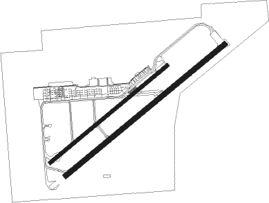
Los Alamitos - Los Alamitos Aaf
Airport details
| Country | United States of America |
| State | California |
| Region | K2 |
| Airspace | Los Angeles Ctr |
| Municipality | Los Alamitos |
| Elevation | 35ft (11m) |
| Timezone | GMT -8 |
| Coordinates | 33.79003, -118.05143 |
| Magnetic var | |
| Type | land |
| Available since | X-Plane v10.40 |
| ICAO code | KSLI |
| IATA code | n/a |
| FAA code | SLI |
Communication
| Los Alamitos AAF Ground Control | 126.950 |
| Los Alamitos AAF Tower | 123.850 |
| Los Alamitos AAF SOCAL Approach/Departure | 125.350 |
Nearby Points of Interest:
Puvunga
-Phillip Ackley Stanton House
-Villa Riviera
-Cooper Arms Apartments
-United States Post Office–Long Beach Main
-First National Bank of Long Beach
-Muckenthaler House
-Bembridge House
-Los Cerritos Ranch House
-Elephant Packing House
-Fullerton Odd Fellows Temple
-Masonic Temple
-Helme-Worthy Store and Residence
-Clarke Estate
-Santa Ana Fire Station Headquarters No. 1
-Old Orange County Courthouse
-Dominguez Rancho Adobe
-Santora Building
-Builders Exchange Building
-Howe-Waffle House and Carriage House
-Odd Fellows Hall
-Pacific Electric Sub-Station No. 14
-Oldest McDonald's restaurant
-First Baptist Church of Orange
-Cypress Street Schoolhouse

Nearby beacons
| code | identifier | dist | bearing | frequency |
|---|---|---|---|---|
| SLI | SEAL BEACH (LOS ALAMITOS) VORTAC | 0.4 | 206° | 115.70 |
| ELB | EL TORO (SANTA ANA) VOR/DME | 17.4 | 110° | 117.20 |
| LAX | LOS ANGELES VORTAC | 20.8 | 291° | 113.60 |
| POM | POMONA VORTAC | 21.7 | 43° | 110.40 |
| SMO | SANTA MONICA VOR/DME | 24.1 | 299° | 110.80 |
| PDZ | PARADISE (ONTARIO) VORTAC | 27.1 | 76° | 112.20 |
| SXC | SANTA CATALINA VORTAC | 31 | 222° | 111.40 |
| RAL | RIVERSIDE VOR | 31.5 | 75° | 112.40 |
| VNY | VAN NUYS VOR/DME | 34 | 315° | 113.10 |
| SB | PETIS (SAN BERNARDINO) NDB | 37.7 | 69° | 397 |
| RIV | MARCH (RIVERSIDE) TACAN | 39.3 | 81° | 113 |
| HDF | HOMELAND (RIVERSIDE) VOR | 43.2 | 91° | 113.40 |
| NFG | CAMP PENDLETON (OCEANSIDE TACAN | 45.4 | 128° | 111.80 |
| OCN | OCEANSIDE VORTAC | 45.7 | 131° | 115.30 |
| PMD | PALMDALE VORTAC | 50.5 | 359° | 114.50 |
| NUC | SAN CLEMENTE TACAN | 52.9 | 215° | 117.60 |
| VTU | VENTURA (OXNARD) VOR/DME | 53.4 | 288° | 108.20 |
| FIM | FILLMORE VORTAC | 53.5 | 304° | 112.50 |
| NSD | BEAVER (SAN DIEGO) TACAN | 58 | 203° | 113.90 |
| VCV | VICTORVILLE VOR/DME | 58.4 | 39° | 109.05 |
| LHS | LAKE HUGHES VORTAC | 59.6 | 330° | 114.35 |
| NKX | MIRAMAR (SAN DIEGO) TACAN | 71.2 | 136° | 109.60 |
Departure and arrival routes
| Transition altitude | 18000ft |
| Transition level | 18000ft |
| SID end points | distance | outbound heading | |
|---|---|---|---|
| RW04R | |||
| HAWWC3 | 52mi | 290° | |
| RW22L | |||
| HAWWC3 | 52mi | 290° | |
| STAR starting points | distance | inbound heading | |
|---|---|---|---|
| ALL | |||
| KAYOH7 | 23.0 | 271° | |
Instrument approach procedures
| runway | airway (heading) | route (dist, bearing) |
|---|---|---|
| RW22L | POM (223°) | POM FEBUG (12mi, 204°) 3000ft |
| RNAV | FEBUG 3000ft JIRPU (6mi, 240°) 1500ft SUDME (2mi, 240°) 720ft KSLI (3mi, 241°) 90ft (6787mi, 106°) 500ft ALBAS (6791mi, 286°) 2100ft ALBAS (turn) 4000ft |
Disclaimer
The information on this website is not for real aviation. Use this data with the X-Plane flight simulator only! Data taken with kind consent from X-Plane 12 source code and data files. Content is subject to change without notice.