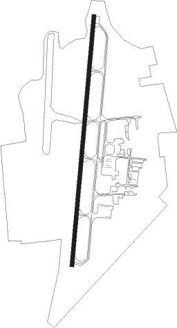
Sulphur Springs - Sulphur Springs Muni
Airport details
| Country | United States of America |
| State | Texas |
| Region | K4 |
| Airspace | Ft Worth Ctr |
| Municipality | Sulphur Springs |
| Elevation | 487ft (148m) |
| Timezone | GMT -6 |
| Coordinates | 33.15983, -95.62114 |
| Magnetic var | |
| Type | land |
| Available since | X-Plane v10.40 |
| ICAO code | KSLR |
| IATA code | SLR |
| FAA code | SLR |
Communication
| Sulphur Springs Muni AWOS 3 | 118.350 |
| Sulphur Springs Muni CTAF/UNICOM | 123.075 |
Nearby Points of Interest:
Hopkins County Courthouse
-Marcus DeWitt Carlock House
-Post Office Building
-Katy Depot
-Sam Bell Maxey House
-First Church of Christ, Scientist
-First Presbyterian Church
-First United Methodist Church
-Howard L. and Vivian W. Lott House
Nearby beacons
| code | identifier | dist | bearing | frequency |
|---|---|---|---|---|
| SLR | SULPHUR SPRINGS VOR/DME | 4.5 | 64° | 109 |
| UIM | DME | 21.1 | 138° | 114 |
| GV | MAJOR (GREENVILLE) NDB | 22.2 | 270° | 201 |
| MJF | ARVILLA (GREENVILLE) TACAN | 22.8 | 258° | 109.60 |
| PRX | PARIS VOR/DME | 24.5 | 24° | 113.60 |
| BYP | BONHAM VORTAC | 38.2 | 302° | 114.60 |
| ABG | AMBASSADOR (BIG SANDY) NDB | 42.9 | 139° | 404 |
| TYR | TYLER VOR/DME | 49.5 | 165° | 114.20 |
| PQF | MESQUITE NDB | 50.3 | 249° | 248 |
| GG | VEELS (LONGVIEW) NDB | 59.3 | 131° | 410 |
| URH | (DURANT) DME | 60.8 | 316° | 114.30 |
| GGG | GREGG CO. (LONGVIEW) VORTAC | 62.5 | 131° | 112.90 |
| CQY | CEDAR CREEK VORTAC | 65.8 | 212° | 114.80 |
Instrument approach procedures
| runway | airway (heading) | route (dist, bearing) |
|---|---|---|
| RW01 | CABUN (354°) | CABUN EDDGR (5mi, 320°) 2500ft |
| RW01 | CINOK (63°) | CINOK BILYA (18mi, 90°) 3000ft EDDGR (14mi, 59°) 2500ft |
| RW01 | EDDGR (11°) | EDDGR 2500ft |
| RNAV | EDDGR 2500ft SEVOC (5mi, 11°) 2000ft UXAHA (3mi, 11°) 1180ft KSLR (2mi, 11°) 545ft (5688mi, 109°) 803ft WEDAT (5685mi, 289°) 3000ft WEDAT (turn) | |
| RW19 | LENYI (237°) | LENYI WUSNU (23mi, 250°) 3000ft WEDAT (6mi, 250°) 2500ft |
| RW19 | MONTE (144°) | MONTE PIPIC (14mi, 122°) 3000ft WEDAT (6mi, 122°) 2500ft |
| RW19 | PRX (204°) | PRX WEDAT (14mi, 214°) 2500ft |
| RW19 | WEDAT (191°) | WEDAT 2500ft |
| RNAV | WEDAT 2500ft EVIJI (6mi, 191°) 2000ft ZILVA (3mi, 191°) 1060ft KSLR (2mi, 191°) 506ft (5688mi, 109°) 726ft EDDGR (5690mi, 289°) 3000ft EDDGR (turn) |
Disclaimer
The information on this website is not for real aviation. Use this data with the X-Plane flight simulator only! Data taken with kind consent from X-Plane 12 source code and data files. Content is subject to change without notice.