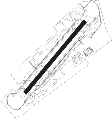
Santa Monica - Santa Monica Muni
Airport details
| Country | United States of America |
| State | California |
| Region | K2 |
| Airspace | Los Angeles Ctr |
| Municipality | Santa Monica |
| Elevation | 173ft (53m) |
| Timezone | GMT -8 |
| Coordinates | 34.01644, -118.44913 |
| Magnetic var | |
| Type | land |
| Available since | X-Plane v10.40 |
| ICAO code | KSMO |
| IATA code | SMO |
| FAA code | SMO |
Communication
| Santa Monica Muni ATIS | 119.150 |
| Santa Monica Muni CTAF | 120.100 |
| Santa Monica Muni UNICOM | 122.950 |
| Santa Monica Muni Ground Control | 121.900 |
| Santa Monica Muni Tower | 120.100 |
| Santa Monica Muni SOCAL Approach | 125.200 |
| Santa Monica Muni SOCAL Approach | 128.500 |
| Santa Monica Muni SOCAL Approach | 124.300 |
| Santa Monica Muni SOCAL Approach | 124.900 |
| Santa Monica Muni SOCAL Departure | 125.200 |
Nearby Points of Interest:
Lincoln Place Apartment Homes
-Venice of America House
-Parkhurst Building
-Venice Branch
-Horatio West Court
-Venice Canal Historic District
-Wadsworth Chapel
-Santa Monica Looff Hippodrome
-Warren Wilson Beach House
-Majestic Crest Theatre
-Streetcar Depot, West Los Angeles
-Charmont Apartments
-Ralphs Grocery Store
-Citizens Publishing Company Building
-Strathmore Apartments
-Henry Weaver House
-Chateau Colline
-Bradbury House
-Will Rogers State Historic Park
-Memorial Branch
-Beverly Hills Women's Club
-Harold Lloyd Estate
-Virginia Robinson Gardens
-Beverly Hills Main Post Office
-Saban Theatre
Nearby beacons
| code | identifier | dist | bearing | frequency |
|---|---|---|---|---|
| SMO | SANTA MONICA VOR/DME | 0.5 | 231° | 110.80 |
| LAX | LOS ANGELES VORTAC | 5 | 168° | 113.60 |
| VNY | VAN NUYS VOR/DME | 12.6 | 348° | 113.10 |
| SLI | SEAL BEACH (LOS ALAMITOS) VORTAC | 24.1 | 121° | 115.70 |
| FIM | FILLMORE VORTAC | 29.6 | 308° | 112.50 |
| VTU | VENTURA (OXNARD) VOR/DME | 30.4 | 279° | 108.20 |
| POM | POMONA VORTAC | 33.1 | 85° | 110.40 |
| NTD | POINT MUGU (OXNARD) TACAN | 34 | 279° | 110.60 |
| CMA | CAMARILLO VOR/DME | 34.1 | 287° | 115.80 |
| SXC | SANTA CATALINA VORTAC | 38.5 | 177° | 111.40 |
| LHS | LAKE HUGHES VORTAC | 40.5 | 349° | 114.35 |
| ELB | EL TORO (SANTA ANA) VOR/DME | 41.2 | 115° | 117.20 |
| PMD | PALMDALE VORTAC | 41.5 | 32° | 114.50 |
| PDZ | PARADISE (ONTARIO) VORTAC | 46.1 | 96° | 112.20 |
| RAL | RIVERSIDE VOR | 49.8 | 94° | 112.40 |
| GMN | GORMAN VORTAC | 51.5 | 332° | 116.10 |
| NUC | SAN CLEMENTE TACAN | 59.7 | 188° | 117.60 |
| EDW | EDWARDS VORTAC | 67.9 | 37° | 116.40 |
Departure and arrival routes
| Transition altitude | 18000ft |
| Transition level | 18000ft |
| SID end points | distance | outbound heading | |
|---|---|---|---|
| RW03 | |||
| CHOII3 | 120mi | 62° | |
| SMO3 | 109mi | 69° | |
| TPNGA2 | 16mi | 274° | |
| RW21 | |||
| SMO3 | 109mi | 69° | |
| PEVEE6 | 122mi | 122° | |
| TPNGA2 | 16mi | 274° | |
| CTRUS4 | 146mi | 302° | |
| STAR starting points | distance | inbound heading | |
|---|---|---|---|
| ALL | |||
| ZUUMA3 | 30.6 | 116° | |
| FERN7 | 29.6 | 128° | |
| BONJO2 | 44.2 | 130° | |
| WAYVE1 | 33.5 | 174° | |
| KIMMO3 | 23.6 | 185° | |
| BOGET2 | 31.4 | 202° | |
| THRNE3 | 67.3 | 272° | |
Instrument approach procedures
| runway | airway (heading) | route (dist, bearing) |
|---|---|---|
| RW03-Y | WAKER (92°) | WAKER NATHN (11mi, 120°) 3500ft |
| RNAV | NATHN 3500ft THACH (6mi, 67°) 2000ft MORVE (5mi, 67°) 388ft (6803mi, 106°) 600ft NATJU (6793mi, 286°) JAASK (12mi, 317°) SESPE (16mi, 276°) 5500ft SESPE (turn) | |
| RW03-Z | WAKER (92°) | WAKER OHWEN (6mi, 108°) 3500ft RNSTO (3mi, 108°) 3000ft |
| RNAV | RNSTO 3000ft RGBEE (7mi, 83°) 1400ft MORVE (3mi, 77°) 363ft (6803mi, 106°) 600ft DARTS (6791mi, 286°) 5000ft DARTS (turn) |
Holding patterns
| STAR name | hold at | type | turn | heading* | altitude | leg | speed limit |
|---|---|---|---|---|---|---|---|
| FERN7 | REYES | VHF | right | 310 (130)° | < 45000ft | 1.5min timed | ICAO rules |
| KIMMO3 | DARTS | VHF | left | 319 (139)° | DME 10.0mi | ICAO rules | |
| WAYVE1 | UPDOC | VHF | left | 323 (143)° | DME 8.0mi | ICAO rules | |
| WAYVE1 | WRING | VHF | left | 331 (151)° | DME 10.0mi | ICAO rules | |
| ZUUMA3 | ALMST | VHF | right | 313 (133)° | DME 10.0mi | ICAO rules | |
| *) magnetic outbound (inbound) holding course | |||||||
Disclaimer
The information on this website is not for real aviation. Use this data with the X-Plane flight simulator only! Data taken with kind consent from X-Plane 12 source code and data files. Content is subject to change without notice.