Somerville - Somerset
Airport details
| Country | United States of America |
| State | New Jersey |
| Region | K6 |
| Airspace | New York Ctr |
| Municipality | Bedminster Township |
| Elevation | 105ft (32m) |
| Timezone | GMT -5 |
| Coordinates | 40.62598, -74.67003 |
| Magnetic var | |
| Type | land |
| Available since | X-Plane v10.40 |
| ICAO code | KSMQ |
| IATA code | n/a |
| FAA code | SMQ |
Communication
| SOMERSET ASOS | 120.600 |
| SOMERSET CTAF/UNICOM | 123.000 |
| SOMERSET NEW YORK Approach/Departure | 132.800 |
Nearby Points of Interest:
North Branch Historic District
-Pluckemin Village Historic District
-Jacob Vosseller House
-Jacobus Vanderveer House
-Lamington Historic District
-Relief Home Company No. 2 Engine House
-Moggy Hollow Natural Area
-General John Frelinghuysen House
-Daniel Robert House
-Wallace House
-Old Dutch Parsonage
-Whitehouse-Mechanicsville Historic District
-Bartles House
-Somerset County Court House complex
-West End Hose Company Number 3
-Oldwick Historic District
-Readington Village Historic District
-South Branch Schoolhouse
-Taylor's Mill Historic District
-Charles Eversole House
-Van Veghten House
-Van Horne House
-Brick Academy
-Fairmount Historic District
-Olcott Avenue Historic District
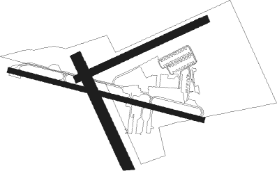
Runway info
Runway 12 / 30  | ||
| length | 831m (2726ft) | |
| bearing | 105° / 285° | |
| width | 20m (65ft) | |
| surface | asphalt | |
| displ threshold | 0m (0ft) / 61m (200ft) | |
| Runway 08 / 26 | ||
| length | 587m (1926ft) | |
| bearing | 74° / 254° | |
| width | 30m (100ft) | |
| surface | grass | |
| Runway 17 / 35 | ||
| length | 519m (1703ft) | |
| bearing | 154° / 334° | |
| width | 46m (150ft) | |
| surface | grass | |
Nearby beacons
| code | identifier | dist | bearing | frequency |
|---|---|---|---|---|
| SBJ | SOLBERG VOR/DME | 4.1 | 239° | 112.90 |
| BWZ | BROADWAY (SCHOOLEY'S MT) VOR/DME | 12.4 | 319° | 114.20 |
| CAT | CHATHAM NDB | 12.9 | 64° | 254 |
| MM | MOREE (MORRISTOWN) NDB | 21.5 | 53° | 392 |
| STW | STILLWATER VOR/DME | 23.9 | 332° | 109.60 |
| ARD | YARDLEY VOR/DME | 24.8 | 213° | 108.20 |
| RBV | ROBBINSVILLE VORTAC | 26.6 | 158° | 113.80 |
| TE | TORBY (TETERBORO) NDB | 26.7 | 72° | 214 |
| SAX | SPARTA VORTAC | 27.1 | 17° | 115.70 |
| COL | COLTS NECK VOR/DME | 30 | 122° | 115.40 |
| TEB | TETERBORO VOR/DME | 30.7 | 70° | 108.40 |
| CRI | CANARSIE VOR/DME | 35.3 | 91° | 112.30 |
| FJC | ALLENTOWN VORTAC | 36.2 | 277° | 117.50 |
| GXU | MC GUIRE (WRIGHTSTOWN) VORTAC | 37.1 | 173° | 110.60 |
| LGA | LA GUARDIA (NEW YORK) VOR/DME | 37.6 | 79° | 113.10 |
| NEL | LAKEHURST NDB | 38.1 | 150° | 396 |
| NEL | LAKEHURST TACAN | 38.2 | 152° | 111.80 |
| JFK | KENNEDY (NEW YORK) VOR/DME | 40.9 | 90° | 115.90 |
| ING | AMBLER NDB | 41.1 | 231° | 275 |
| HUO | HUGUENOT VOR/DME | 47.2 | 6° | 116.10 |
| PTW | POTTSTOWN VORTAC | 47.3 | 246° | 116.50 |
| CYN | COYLE VORTAC | 49.7 | 164° | 113.40 |
| SW | NEELY (NEWBURGH) NDB | 55.3 | 27° | 335 |
| SKU | STANWYCK (NEWBURGH) NDB | 61.1 | 35° | 261 |
| OOD | WOODSTOWN VORTAC | 66.1 | 213° | 112.80 |
| DQO | DUPONT (WILMINGTON) VORTAC | 71.3 | 225° | 114 |
Departure and arrival routes
| Transition altitude | 18000ft |
| Transition level | 18000ft |
| STAR starting points | distance | inbound heading | |
|---|---|---|---|
| ALL | |||
| JAIKE3 | 66.2 | 48° | |
| MAZIE3 | 27.1 | 55° | |
| LVZ4 | 60.3 | 122° | |
Instrument approach procedures
| runway | airway (heading) | route (dist, bearing) |
|---|---|---|
| RW12 | ARMMS (181°) | ARMMS BOMTE (16mi, 223°) 3000ft RATEE (5mi, 204°) 2800ft |
| RW12 | DIRPE (65°) | DIRPE AVETE (8mi, 24°) 3000ft RATEE (5mi, 24°) 2800ft |
| RW12 | METRO (360°) | METRO AVETE (16mi, 305°) 3000ft RATEE (5mi, 24°) 2800ft |
| RNAV | RATEE 2800ft NEMOE (5mi, 105°) 2100ft HEBAR (4mi, 105°) 900ft KSMQ (2mi, 104°) 124ft (4710mi, 119°) 506ft SBJ (4713mi, 299°) 2500ft SBJ (turn) 2500ft | |
| RW30 | AFOPY (267°) | AFOPY CARAK (6mi, 231°) 2000ft |
| RW30 | BONIE (306°) | BONIE CARAK (6mi, 356°) 2000ft |
| RNAV | CARAK 2000ft BUPDE (5mi, 285°) 1700ft AKEXE (1mi, 285°) 1680ft KSMQ (4mi, 285°) 143ft (4710mi, 119°) 506ft OFFER (4718mi, 299°) 2500ft OFFER (turn) |
Holding patterns
| STAR name | hold at | type | turn | heading* | altitude | leg | speed limit |
|---|---|---|---|---|---|---|---|
| JAIKE3 | MAZIE | VHF | left | 237 (57)° | < 17999ft | 1.0min timed | 210 |
| JAIKE3 | PALEO | VHF | left | 232 (52)° | < 45000ft | 1.5min timed | ICAO rules |
| JAIKE3 | SPNCR | VHF | right | 227 (47)° | 6001ft - 14000ft | DME 4.0mi | 210 |
| LVZ4 | HARTY | VHF | left | 305 (125)° | 18000ft - 45000ft | 1.5min timed | ICAO rules |
| LVZ4 | HOXIE | VHF | left | 295 (115)° | 18000ft - 45000ft | DME 6.0mi | ICAO rules |
| LVZ4 | MUGZY | VHF | left | 305 (125)° | 6001ft - 14000ft | 1.0min timed | 210 |
| MAZIE3 | BACKY | VHF | right | 216 (36)° | DME 7.0mi | ICAO rules | |
| MAZIE3 | MAZIE | VHF | left | 237 (57)° | < 17999ft | 1.0min timed | 210 |
| MAZIE3 | RAZER | VHF | right | 229 (49)° | < 60000ft | DME 6.0mi | 210 |
| *) magnetic outbound (inbound) holding course | |||||||
Disclaimer
The information on this website is not for real aviation. Use this data with the X-Plane flight simulator only! Data taken with kind consent from X-Plane 12 source code and data files. Content is subject to change without notice.