Shawnee
Airport details
| Country | United States of America |
| State | Oklahoma |
| Region | K4 |
| Airspace | Ft Worth Ctr |
| Municipality | Shawnee |
| Elevation | 1073ft (327m) |
| Timezone | GMT -6 |
| Coordinates | 35.35731, -96.94283 |
| Magnetic var | |
| Type | land |
| Available since | X-Plane v10.40 |
| ICAO code | KSNL |
| IATA code | SNL |
| FAA code | SNL |
Communication
| Shawnee AWOS 3 | 118.275 |
| Shawnee CTAF/UNICOM | 122.700 |
| Shawnee OKC Approach | 120.450 |
| Shawnee OKC Departure | 120.450 |
Approach frequencies
| ILS-cat-I | RW17 | 108.75 | 18.00mi |
| 3° GS | RW17 | 108.75 | 18.00mi |
Nearby Points of Interest:
Benedictine Hall
-Governor's Mansion
-Beard Cabin
-St. Paul Baptist Church and Cemetery
-Strother Memorial Chapel
-Seaba's Filling Station
-St. Cloud Hotel
-St. Stephen's Episcopal Church
-Conklin House
-First Presbyterian Church of Chandler
-Threatt Filling Station
-Mascho Building and Public Privy
-Chandler Armory
-Bavinger House
-Seminole County Courthouse
-Moore–Lindsay House
-Boyd House
-Ledbetter House
-Joseph Carpenter House
-Elks Victory Lodge-Ruby's Grill Building
-James C. Nance Memorial Bridge
-Oklahoma Publishing Company Building
-First National Center
-Cain's Coffee Building
-Braniff Building
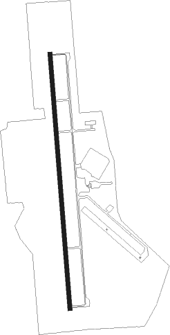
Runway info
| Runway 17 / 35 | ||
| length | 1834m (6017ft) | |
| bearing | 180° / 360° | |
| width | 30m (100ft) | |
| surface | asphalt | |
| displ threshold | 0m (0ft) / 123m (404ft) | |
| blast zone | 0m (0ft) / 46m (151ft) | |
Nearby beacons
| code | identifier | dist | bearing | frequency |
|---|---|---|---|---|
| SRE | SEMINOLE NDB | 14.1 | 108° | 278 |
| TIK | TINKER (OKLAHOMA CITY) TACAN | 21.9 | 280° | 115.80 |
| RG | GALLY (OKLAHOMA CITY) NDB | 31.8 | 264° | 350 |
| IRW | WILL ROGERS (OKLAHOMA CIT VORTAC | 32.6 | 270° | 114.10 |
| PWA | WILEY POST (OKLAHOMA CITY VOR/DME | 36 | 284° | 113.40 |
| HET | HENRYETTA NDB | 45.5 | 87° | 267 |
| SWO | STILLWATER VOR/DME | 52.5 | 351° | 108.40 |
| SW | BLAKI (STILLWATER) NDB | 53.2 | 351° | 255 |
| OK | PRESO (OKMULGEE) NDB | 54.1 | 68° | 388 |
| GNP | (TULSA) DME | 58.3 | 60° | 110.60 |
| EI | GARFY (ENID) NDB | 68.8 | 317° | 341 |
Departure and arrival routes
| Transition altitude | 18000ft |
| Transition level | 18000ft |
| STAR starting points | distance | inbound heading | |
|---|---|---|---|
| RW17 | |||
| GULLI2 | 40.5 | 163° | |
| RW35 | |||
| GULLI2 | 40.5 | 163° | |
Instrument approach procedures
| runway | airway (heading) | route (dist, bearing) |
|---|---|---|
| RW17 | FAVAN (180°) | FAVAN 3000ft |
| RW17 | HIKIT (208°) | HIKIT 3000ft FAVAN (5mi, 270°) 3000ft |
| RW17 | JEBNU (152°) | JEBNU 3000ft FAVAN (5mi, 90°) 3000ft |
| RNAV | FAVAN 3000ft NESIY (6mi, 180°) 2800ft OWNOJ (3mi, 180°) 1660ft KSNL (2mi, 180°) 1127ft HEDEK (7mi, 180°) MINGG (7mi, 186°) 4000ft MINGG (turn) | |
| RW35 | CARIJ (333°) | CARIJ 3000ft JISOD (5mi, 270°) 3000ft |
| RW35 | JISOD (360°) | JISOD 3000ft |
| RW35 | UYOPI (27°) | UYOPI 3100ft JISOD (5mi, 90°) 3000ft |
| RNAV | JISOD 3000ft BIGOH (6mi, 360°) 2800ft IVICE (3mi, 360°) 1780ft KSNL (3mi, 360°) 1113ft (5745mi, 110°) 1317ft FAVAN (5744mi, 290°) 3000ft FAVAN (turn) |
Holding patterns
| STAR name | hold at | type | turn | heading* | altitude | leg | speed limit |
|---|---|---|---|---|---|---|---|
| GULLI2 | GULLI | VHF | right | 23 (203)° | 1.0min timed | ICAO rules | |
| *) magnetic outbound (inbound) holding course | |||||||
Disclaimer
The information on this website is not for real aviation. Use this data with the X-Plane flight simulator only! Data taken with kind consent from X-Plane 12 source code and data files. Content is subject to change without notice.