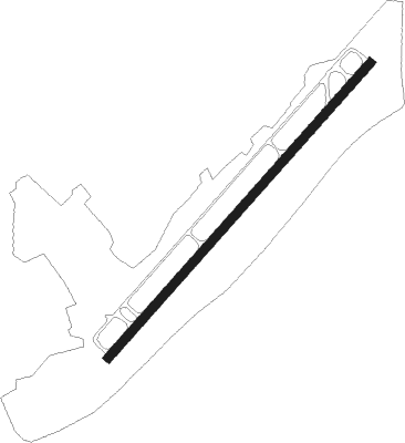
Pinehurst/southern Pines - Moore County
Airport details
| Country | United States of America |
| State | North Carolina |
| Region | K7 |
| Airspace | Washington Ctr |
| Municipality | Moore County |
| Elevation | 459ft (140m) |
| Timezone | GMT -5 |
| Coordinates | 35.23742, -79.38903 |
| Magnetic var | |
| Type | land |
| Available since | X-Plane v10.40 |
| ICAO code | KSOP |
| IATA code | SOP |
| FAA code | SOP |
Communication
| Moore County AWOS 3 | 127.575 |
| Moore County CTAF/UNICOM | 123.050 |
Approach frequencies
| ILS-cat-I | RW05 | 111.5 | 18.00mi |
| 3° GS | RW05 | 111.5 | 18.00mi |
Nearby Points of Interest:
James Boyd House
-Southern Pines Historic District
-Mystic Cottage
-Lloyd-Howe House
-Malcolm Blue Farm
-Aberdeen Historic District
-J.C. Black House
-Moore County Courthouse
-Carthage Historic District
-Alexander Kelly House
-Lee County Training School
-Lee Avenue Historic District
-Hoke County Courthouse
-Raeford Historic District
-Lee County Courthouse
-Rosemount-McIver Park Historic District
-John D. McIver Farm
-Downtown Sanford Historic District
-Temple Theater
-Railroad House
-Sanford High School, Former
-Hawkins Avenue Historic District
-East Sanford Historic District
-Puppy Creek Plantation
-Bostick School
Nearby beacons
| code | identifier | dist | bearing | frequency |
|---|---|---|---|---|
| SDZ | SANDHILLS (SOUTHERN PINES VORTAC | 9.8 | 264° | 111.80 |
| POB | POPE (FAYETTEVILLE) TACAN | 18.5 | 101° | 113.80 |
| POB | POPE (FAYETTEVILLE) NDB | 21.3 | 91° | 338 |
| FGP | FORT BRAGG NDB | 28.8 | 100° | 393 |
| FAY | FAYETTEVILLE VOR/DME | 29.4 | 116° | 108.80 |
| ME | MAXTN (MAXTON) NDB | 30.4 | 186° | 257 |
| LIB | LIBERTY VORTAC | 36.1 | 339° | 113 |
| HQT | HARNETT (ERWIN) NDB | 36.9 | 75° | 417 |
| VU | ALLER (ALBEMARLE) NDB | 37.2 | 290° | 346 |
| BES | BENNETTSVILLE NDB | 40.7 | 209° | 230 |
| JB | JIGEL (LUMBERTON) NDB | 43.3 | 160° | 384 |
| HB | ALAMM NDB | 45.5 | 345° | 361 |
| DLC | DILLON NDB | 47.2 | 179° | 274 |
| RDU | RALEIGH-DURHAM VORTAC | 48.2 | 44° | 117.20 |
| JN | JURLY (SMITHFIELD) NDB | 49.3 | 76° | 263 |
| LE | LEEVY (RALEIGH/DURHAM) NDB | 52.7 | 44° | 350 |
| UDG | DARLINGTON NDB | 53.6 | 212° | 245 |
| CTF | CHESTERFIELD VOR/DME | 56 | 236° | 108.20 |
| GSO | GREENSBORO VORTAC | 56.3 | 324° | 116.20 |
| HVS | HARTSVILLE NDB | 61.5 | 221° | 341 |
| HUR | PERSON (ROXBORO) NDB | 61.8 | 18° | 220 |
| IN | REENO (WINSTON SALEM) NDB | 62.8 | 317° | 317 |
| CPC | CAMP (WHITEVILLE) NDB | 66.8 | 145° | 227 |
Instrument approach procedures
| runway | airway (heading) | route (dist, bearing) |
|---|---|---|
| RW05 | HEBNO (52°) | HEBNO 2500ft |
| RNAV | HEBNO 2500ft ZIKDA (6mi, 52°) 2500ft WORBU (4mi, 52°) 1120ft KSOP (2mi, 52°) 494ft (4886mi, 114°) 655ft OWWEN (4879mi, 294°) 2500ft OWWEN (turn) | |
| RW23 | OWWEN (232°) | OWWEN 2500ft |
| RNAV | OWWEN 2500ft BUNEW (5mi, 232°) 2100ft MOKSE (3mi, 232°) 1240ft KSOP (3mi, 232°) 485ft (4886mi, 114°) 681ft HEBNO (4894mi, 294°) 2500ft HEBNO (turn) |
Disclaimer
The information on this website is not for real aviation. Use this data with the X-Plane flight simulator only! Data taken with kind consent from X-Plane 12 source code and data files. Content is subject to change without notice.