Spearfish - Black Hills Clyde Ice Fld
Airport details
| Country | United States of America |
| State | South Dakota |
| Region | K3 |
| Airspace | Denver Ctr |
| Municipality | Spearfish |
| Elevation | 3931ft (1198m) |
| Timezone | GMT -7 |
| Coordinates | 44.48114, -103.78593 |
| Magnetic var | |
| Type | land |
| Available since | X-Plane v10.40 |
| ICAO code | KSPF |
| IATA code | SPF |
| FAA code | SPF |
Communication
| Black Hills Clyde Ice Fld AWOS 3 | 118.325 |
| Black Hills Clyde Ice Fld CTAF/UNICOM | 122.800 |
| Black Hills Clyde Ice Fld ELLSWORTH Approach/Departure | 119.500 |
Nearby Points of Interest:
Webb S. Knight House
-James A. Corbin House
-Spearfish Filling Station
-Frawley Ranch
-Episcopal Church of All Angels
-Arthur Hewes House
-Mount Theodore Roosevelt Monument
-St. Lawrence O'Toole Catholic Church
-Old Finnish Lutheran Church
-Williams Middle School
-Tomahawk Lake Country Club
-Ranch A
-Bear Butte
-Belle Fourche Dam
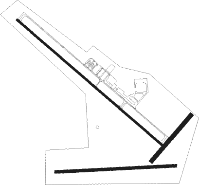
Runway info
Runway 13 / 31  | ||
| length | 1949m (6394ft) | |
| bearing | 126° / 306° | |
| width | 23m (75ft) | |
| surface | asphalt | |
| Runway 08 / 26 | ||
| length | 1217m (3993ft) | |
| bearing | 91° / 271° | |
| width | 30m (100ft) | |
| surface | grass | |
| Runway 04 / 22 | ||
| length | 607m (1991ft) | |
| bearing | 55° / 235° | |
| width | 46m (150ft) | |
| surface | grass | |
Nearby beacons
| code | identifier | dist | bearing | frequency |
|---|---|---|---|---|
| RCA | ELLSWORTH (RAPID CITY) TACAN | 35.8 | 117° | 108.80 |
| ECS | NEWCASTLE VOR | 42.4 | 221° | 108.20 |
| RAP | RAPID CITY VORTAC | 45 | 123° | 112.30 |
Departure and arrival routes
| Transition altitude | 18000ft |
| Transition level | 18000ft |
| SID end points | distance | outbound heading | |
|---|---|---|---|
| RW13 | |||
| SWUNG2 | 21mi | 359° | |
| RW31 | |||
| SWUNG2 | 21mi | 359° | |
Instrument approach procedures
| runway | airway (heading) | route (dist, bearing) |
|---|---|---|
| RW13 | BFFLO (254°) | BFFLO JUNSI (40mi, 271°) 7000ft DRACO (8mi, 235°) 7000ft |
| RW13 | DRACO (126°) | DRACO 14000ft DRACO (turn) 7000ft |
| RW13 | KARAS (68°) | KARAS ROBIT (18mi, 31°) 8300ft DRACO (8mi, 54°) 7000ft |
| RNAV | DRACO 7000ft SOPHI (8mi, 126°) 5600ft KSPF (6mi, 126°) 3934ft (5993mi, 113°) 4600ft ELRAP (5985mi, 293°) 7000ft ELRAP (turn) 7000ft | |
| RW31 | BFFLO (254°) | BFFLO WIMBO (28mi, 225°) 9000ft HURPO (8mi, 235°) 8200ft |
| RW31 | ECS (41°) | ECS LAGIY (32mi, 70°) 9300ft HURPO (11mi, 55°) 8200ft |
| RW31 | RAP (303°) | RAP HURPO (26mi, 301°) 8200ft |
| RNAV | HURPO 8200ft AVENS (10mi, 306°) 6500ft NOSIE (3mi, 306°) 6300ft ZODMA (3mi, 306°) 5260ft KSPF (4mi, 305°) 3945ft (5993mi, 113°) 4281ft DRACO (6001mi, 293°) 7000ft DRACO (turn) |
Disclaimer
The information on this website is not for real aviation. Use this data with the X-Plane flight simulator only! Data taken with kind consent from X-Plane 12 source code and data files. Content is subject to change without notice.