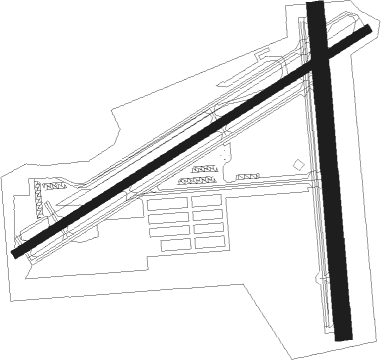
St Petersburg - Albert Whitted
Airport details
| Country | United States of America |
| State | Florida |
| Region | K7 |
| Airspace | Miami Oceanic Ctr |
| Municipality | Saint Petersburg |
| Elevation | 4ft (1m) |
| Timezone | GMT -5 |
| Coordinates | 27.76511, -82.62698 |
| Magnetic var | |
| Type | land |
| Available since | X-Plane v10.30 |
| ICAO code | KSPG |
| IATA code | SPG |
| FAA code | SPG |
Communication
| Albert Whitted CTAF | 127.400 |
| Albert Whitted UNICOM | 122.950 |
| Albert Whitted Ground Control | 121.800 |
| Albert Whitted Tower | 127.400 |
| Albert Whitted TAMPA Approach/Departure | 119.650 |
| Albert Whitted TAMPA Approach/Departure | 125.300 |
Nearby Points of Interest:
Potter House
-John C. Williams House
-Downtown St. Petersburg Historic District
-Mirror Lake Library
-Veillard House
-St. Petersburg Lawn Bowling Club
-Boone House
-North Shore Historic District
-Huggins-Stengel Field
-St. Petersburg Woman's Club
-Kenwood Historic District
-Casa Coe da Sol
-Casa De Muchas Flores
-Pass-a-Grille Historic District
-Johnson-Wolff House
-Bay Pines Veterans Administration Home and Hospital Historic District
-House at 200 Corsica Avenue
-A. M. Lamb House
-A. P. Dickman House
-George McA. Miller House
-Stovall House
-LeClaire Apartments
-Madira Bickel Mound State Archeological Site
-Louis Johnson Building
-Tampania House

Nearby beacons
| code | identifier | dist | bearing | frequency |
|---|---|---|---|---|
| MCF | MACDILL (TAMPA) TACAN | 8.3 | 50° | 111 |
| PIE | SAINT PETERSBURG VORTAC | 9 | 338° | 116.40 |
| PI | CAPOK(ST PETERSBURG-CLEARWATER NDB | 14.4 | 342° | 360 |
| TP | COSME (TAMPA) NDB | 19.9 | 18° | 368 |
| SRQ | SARASOTA VOR/DME | 21.7 | 170° | 117 |
| LAL | LAKELAND VORTAC | 35.1 | 70° | 116 |
| PGD | PUNTA GORDA VOR | 61.2 | 143° | 110.20 |
Departure and arrival routes
| Transition altitude | 18000ft |
| Transition level | 18000ft |
| STAR starting points | distance | inbound heading | |
|---|---|---|---|
| ALL | |||
| DARBS3 | 29.0 | 151° | |
| LZARD6 | 36.2 | 210° | |
| BRDGE8 | 32.2 | 302° | |
Instrument approach procedures
| runway | airway (heading) | route (dist, bearing) |
|---|---|---|
| RW07 | PHIEL (65°) | PHIEL 2000ft |
| RW07 | PIE (158°) | PIE LOYIL (12mi, 231°) 2000ft PHIEL (6mi, 149°) 2000ft |
| RW07 | SRQ (350°) | SRQ CWBIL (15mi, 314°) 2000ft PHIEL (6mi, 335°) 2000ft |
| RNAV | PHIEL 2000ft TONYJ (6mi, 65°) 1500ft YOPUN (4mi, 65°) 660ft (5015mi, 109°) 1000ft PHIEL (5023mi, 288°) 2000ft PHIEL (turn) | |
| RW18 | PIE (158°) | PIE 6000ft PIE (turn) 2000ft |
| RNAV | PIE 2000ft KENVE (5mi, 150°) 1200ft PICOL (3mi, 165°) 215ft (5014mi, 109°) 407ft PIE (5017mi, 289°) 2000ft PIE (turn) | |
| RW36 | JRGAL (354°) | JRGAL 6000ft JRGAL (turn) 2000ft |
| RNAV | JRGAL 2000ft WHITD (6mi, 349°) 1600ft BENWA (4mi, 360°) 322ft (5013mi, 109°) 500ft JRGAL (5012mi, 288°) 2000ft JRGAL (turn) |
Holding patterns
| STAR name | hold at | type | turn | heading* | altitude | leg | speed limit |
|---|---|---|---|---|---|---|---|
| BRDGE8 | BRDGE | VHF | right | 138 (318)° | < 17999ft | 1.0min timed | ICAO rules |
| DARBS3 | TABIR | VHF | right | 336 (156)° | < 17999ft | 1.0min timed | ICAO rules |
| LZARD6 | LZARD | VHF | right | 45 (225)° | < 17999ft | 1.0min timed | ICAO rules |
| LZARD6 | OLENE | VHF | left | 3 (183)° | < 17999ft | 1.0min timed | ICAO rules |
| *) magnetic outbound (inbound) holding course | |||||||
Disclaimer
The information on this website is not for real aviation. Use this data with the X-Plane flight simulator only! Data taken with kind consent from X-Plane 12 source code and data files. Content is subject to change without notice.