Wichita Falls - Sheppard Afb
Airport details
| Country | United States of America |
| State | Texas |
| Region | K4 |
| Airspace | Ft Worth Ctr |
| Municipality | Wichita County |
| Elevation | 1019ft (311m) |
| Timezone | GMT -6 |
| Coordinates | 33.98880, -98.49191 |
| Magnetic var | |
| Type | land |
| Available since | X-Plane v10.40 |
| ICAO code | KSPS |
| IATA code | SPS |
| FAA code | SPS |
Communication
| Sheppard AFB ATIS | 132.050 |
| Sheppard AFB CTAF | 119.750 |
| Sheppard AFB UNICOM | 122.950 |
| Sheppard AFB Clearance DEL | 121.200 |
| Sheppard AFB Ground Control | 125.500 |
| Sheppard AFB Tower | 119.750 |
| Sheppard AFB Approach | 118.200 |
| Sheppard AFB Departure | 120.400 |
Approach frequencies
| ILS-cat-I | RW15C | 110.5 | 18.00mi |
| ILS-cat-I | RW33L | 109.7 | 18.00mi |
| 3° GS | RW15C | 110.5 | 18.00mi |
| 3° GS | RW33L | 109.7 | 18.00mi |
Nearby Points of Interest:
State Highway 79 Bridge at the Red River
-Irving Baptist Church
-Archer County Courthouse and Jail
-First Presbyterian Church
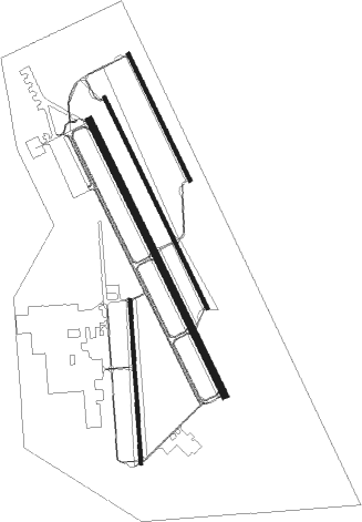
Runway info
Runway 15R / 33L  | ||
| length | 3997m (13114ft) | |
| bearing | 154° / 334° | |
| width | 91m (300ft) | |
| surface | concrete | |
| blast zone | 255m (837ft) / 255m (837ft) | |
| Runway 15C / 33C | ||
| length | 3051m (10010ft) | |
| bearing | 154° / 334° | |
| width | 46m (150ft) | |
| surface | asphalt | |
| blast zone | 255m (837ft) / 255m (837ft) | |
| Runway 15L / 33R | ||
| length | 1831m (6007ft) | |
| bearing | 154° / 334° | |
| width | 46m (150ft) | |
| surface | asphalt | |
| blast zone | 255m (837ft) / 255m (837ft) | |
| Runway 17 / 35 | ||
| length | 2142m (7028ft) | |
| bearing | 181° / 1° | |
| width | 46m (150ft) | |
| surface | asphalt | |
Nearby beacons
| code | identifier | dist | bearing | frequency |
|---|---|---|---|---|
| SHP | SHEPPARD (WICHITA FALLS) TACAN | 0.4 | 145° | 110.80 |
| SPS | WICHITA FALLS VORTAC | 5 | 269° | 112.70 |
| SKB | SCOTLAND (WICHITA FALLS) NDB | 12.4 | 179° | 344 |
| LAW | LAWTON VOR/DME | 30.7 | 9° | 109.40 |
| DUC | DME | 37.1 | 55° | 111 |
| UKW | BOWIE VORTAC | 43.1 | 124° | 117.15 |
| GHX | GRAHAM NDB | 49.4 | 180° | 371 |
| LTS | ALTUS VORTAC | 55.9 | 311° | 109.80 |
| HBR | HOBART VORTAC | 59.8 | 327° | 111.80 |
Instrument approach procedures
| runway | airway (heading) | route (dist, bearing) |
|---|---|---|
| RW15C | CEROV (155°) | CEROV 3300ft |
| RNAV | CEROV 3300ft HIPKI (4mi, 154°) 2300ft JONKA (4mi, 154°) 2300ft KSPS (5mi, 156°) 1054ft (5828mi, 109°) 1419ft DILGR (5823mi, 289°) 3100ft DILGR (turn) 6000ft | |
| RW15L | CALPO (143°) | CALPO 8000ft IKACE (14mi, 123°) 4000ft |
| RW15L | GONTE (220°) | GONTE 8000ft IKACE (18mi, 252°) 4000ft |
| RW15L | IKACE (165°) | IKACE 4000ft |
| RNAV | IKACE 4000ft JUGIR (8mi, 169°) 2400ft KSPS (5mi, 160°) 1059ft DUKLE (7mi, 150°) 3100ft DUKLE (turn) 7000ft | |
| RW15R | CEKAP (154°) | CEKAP 2700ft |
| RW15R | WALTO (200°) | WALTO 5000ft LUCIR (9mi, 229°) 3700ft CEKAP (7mi, 229°) 2700ft |
| RNAV | CEKAP 2700ft KEYEV (7mi, 154°) 2300ft KSPS (5mi, 154°) 1053ft (5828mi, 109°) 1419ft AYIVO (5827mi, 289°) RERUE (10mi, 154°) 3500ft RERUE (turn) 6000ft | |
| RW33C | DILGR (334°) | DILGR 3000ft |
| RNAV | DILGR 3000ft LEXAG (5mi, 335°) 2300ft HIBKI (5mi, 334°) 2300ft KSPS (5mi, 332°) 1037ft (5828mi, 109°) 1360ft CEROV (5831mi, 289°) 3300ft CEROV (turn) 6000ft | |
| RW33L | KARYN (348°) | KARYN 6000ft RERUE (11mi, 4°) 3500ft |
| RW33L | RERUE (335°) | RERUE 3500ft |
| RNAV | RERUE 3500ft ZEGUM (8mi, 334°) 2300ft KSPS (5mi, 335°) 1048ft (5828mi, 109°) 1360ft BAILE (5828mi, 289°) CEKAP (8mi, 334°) 3300ft CEKAP (turn) 6000ft |
Disclaimer
The information on this website is not for real aviation. Use this data with the X-Plane flight simulator only! Data taken with kind consent from X-Plane 12 source code and data files. Content is subject to change without notice.