Spencer - Spencer Muni
Airport details
| Country | United States of America |
| State | Iowa |
| Region | K3 |
| Airspace | Minneapolis Ctr |
| Municipality | Clay County |
| Elevation | 1337ft (408m) |
| Timezone | GMT -6 |
| Coordinates | 43.16564, -95.20280 |
| Magnetic var | |
| Type | land |
| Available since | X-Plane v10.40 |
| ICAO code | KSPW |
| IATA code | SPW |
| FAA code | SPW |
Communication
| Spencer Muni ASOS | 126.625 |
| Spencer Muni CTAF/UNICOM | 123.000 |
Approach frequencies
| ILS-cat-I | RW12 | 110.9 | 18.00mi |
| 3° GS | RW12 | 110.9 | 18.00mi |
Nearby Points of Interest:
Clay County Courthouse
-Gerome Clark House
-Spirit Lake Massacre Log Cabin
-Logan Center School No.5
-Dickinson County Courthouse
-Spirit Lake Public Library
-O'Brien County Courthouse
-Emmetsburg Public Library
-Laurens Carnegie Free Library
-Osceola County Courthouse
-Carnegie Library
-Jackson County Courthouse
-Cherokee Commercial Historic District
-Cherokee Public Library
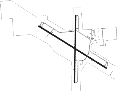
Runway info
Runway 12 / 30  | ||
| length | 1827m (5994ft) | |
| bearing | 118° / 298° | |
| width | 30m (100ft) | |
| surface | concrete | |
| displ threshold | 0m (0ft) / 152m (499ft) | |
| Runway 18 / 36 | ||
| length | 1556m (5105ft) | |
| bearing | 188° / 8° | |
| width | 23m (75ft) | |
| surface | concrete | |
Nearby beacons
| code | identifier | dist | bearing | frequency |
|---|---|---|---|---|
| SPW | SPENCER VOR/DME | 0.2 | 152° | 110 |
| SP | SNORE (SPENCER) NDB | 6.8 | 299° | 394 |
| EGQ | EMMETSBURG NDB | 22 | 97° | 410 |
| OT | WONDD (WORTHINGTON) NDB | 29.4 | 330° | 277 |
| OTG | WORTHINGTON VOR/DME | 33.3 | 322° | 110.60 |
| FNX | DME | 44.6 | 59° | 114.25 |
| FRM | DME | 44.6 | 58° | 110.20 |
| FQ | MONTZ (FAIRMONT) NDB | 45.7 | 65° | 420 |
| FOD | FORT DODGE VORTAC | 52 | 121° | 113.50 |
| FO | BARRO (FORT DODGE) NDB | 55.5 | 126° | 341 |
Instrument approach procedures
| runway | airway (heading) | route (dist, bearing) |
|---|---|---|
| RW12 | COPYE (76°) | COPYE OKKIH (25mi, 60°) 4000ft YAYDU (5mi, 45°) 4000ft |
| RW12 | OTG (142°) | OTG KOMDE (19mi, 145°) 4000ft YAYDU (5mi, 225°) 4000ft |
| RW12 | YAYDU (118°) | YAYDU 4000ft |
| RNAV | YAYDU 4000ft HEPON (7mi, 118°) 3500ft CISOS (5mi, 118°) 2000ft KSPW (2mi, 118°) 1392ft (5633mi, 114°) 1539ft ONUWA (5623mi, 294°) 4000ft ONUWA (turn) | |
| RW18 | EJFIF (188°) | EJFIF 4000ft |
| RNAV | EJFIF 4000ft HINLO (6mi, 188°) 3000ft JAPDO (3mi, 188°) 2120ft KSPW (3mi, 188°) 1388ft (5633mi, 114°) 1585ft ICOSU (5635mi, 294°) 4000ft ICOSU (turn) | |
| RW30 | ONUWA (298°) | ONUWA 4000ft |
| RNAV | ONUWA 4000ft MESVE (8mi, 298°) 3000ft UMANY (3mi, 298°) 1940ft KSPW (2mi, 298°) 1385ft (5633mi, 114°) 1585ft YAYDU (5644mi, 294°) 4000ft YAYDU (turn) | |
| RW36 | ICOSU (7°) | ICOSU 4000ft |
| RNAV | ICOSU 4000ft JOPDA (6mi, 8°) 3000ft HOFFN (3mi, 8°) 2180ft KSPW (3mi, 7°) 1390ft (5633mi, 114°) 1587ft EJFIF (5631mi, 294°) 4000ft EJFIF (turn) |
Disclaimer
The information on this website is not for real aviation. Use this data with the X-Plane flight simulator only! Data taken with kind consent from X-Plane 12 source code and data files. Content is subject to change without notice.