Sterling/rockfalls - Whiteside Co - Bittorf
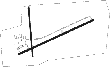
Airport details
| Country | United States of America |
| State | Illinois |
| Region | K5 |
| Airspace | Chicago Ctr |
| Municipality | Whiteside County |
| Elevation | 645ft (197m) |
| Timezone | GMT -6 |
| Coordinates | 41.74283, -89.67628 |
| Magnetic var | |
| Type | land |
| Available since | X-Plane v10.40 |
| ICAO code | KSQI |
| IATA code | SQI |
| FAA code | SQI |
Communication
| Whiteside Co - Bittorf AWOS 3 | 119.175 |
| Whiteside Co - Bittorf CTAF/UNICOM | 123.000 |
| Whiteside Co - Bittorf ROCKFORD Approach/Departure | 126.000 |
Approach frequencies
| ILS-cat-I | RW25 | 111.5 | 18.00mi |
| 3° GS | RW25 | 111.5 | 18.00mi |
Nearby Points of Interest:
Sterling Masonic Temple
-Fulton Commercial Historic District
-H. C. Pitney Variety Store Building
-Main Street Historic District
-Illinois Central Stone Arch Railroad Bridges
-Dixon Downtown Historic District
-John Deere House and Shop
-William H. Van Epps House
-Christopher Brookner House
-Malvern Roller Mill
-Joseph Steffens House
-Morrison Main Street Historic District
-David and Julia Watson House
-Henry D. Barber House
-John McGrath House
-Buffalo Grove Lime Kiln
-Polo Independent Order of Odd Fellows Lodge No. 197
-Buffalo Township Public Library
-Bryant H. and Lucie Barber House
-Zenas Aplington House
-Dr. William Burns House
-Amboy Illinois Central Depot
-First State Bank of Manlius
-Col. Nathan Whitney House
-Charles Franks House

Nearby beacons
| code | identifier | dist | bearing | frequency |
|---|---|---|---|---|
| PLL | POLO VOR/DME | 15 | 34° | 111.20 |
| FN | HILLZ (CLINTON) NDB | 32 | 271° | 517 |
| BDF | BRADFORD VORTAC | 35.2 | 171° | 114.70 |
| RFD | DME | 35.9 | 45° | 110.80 |
| CVA | DAVENPORT VORTAC | 36.2 | 268° | 113.80 |
| MZV | MOLINE VOR/DME | 50.1 | 246° | 114.40 |
| DB | ZILOM (DUBUQUE) NDB | 53.9 | 302° | 341 |
| JVL | JANESVILLE VOR/DME | 55.1 | 35° | 114.30 |
| GBG | DME | 59.2 | 223° | 109.80 |
| PNT | PONTIAC VOR/DME | 69.8 | 134° | 109.60 |
Instrument approach procedures
| runway | airway (heading) | route (dist, bearing) |
|---|---|---|
| RW07 | CVA (88°) | CVA KEBEY (25mi, 93°) 2700ft |
| RW07 | GENSO (56°) | GENSO KEBEY (24mi, 46°) 2700ft |
| RNAV | KEBEY 2700ft JIGRO (6mi, 75°) 2400ft IROCI (3mi, 75°) 1300ft KSQI (2mi, 73°) 697ft (5391mi, 115°) 1020ft HELEG (5379mi, 295°) 2700ft HELEG (turn) | |
| RW25 | HELEG (255°) | HELEG 2500ft |
| RW25 | PLL (214°) | PLL VOSUY (3mi, 122°) 2500ft HELEG (8mi, 154°) 2500ft |
| RW25 | TRIDE (300°) | TRIDE TEVUE (15mi, 324°) 2500ft HELEG (8mi, 334°) 2500ft |
| RNAV | HELEG 2500ft FOVON (6mi, 255°) 2500ft COVKA (4mi, 255°) 1360ft KSQI (3mi, 256°) 701ft (5391mi, 115°) 847ft KEBEY (5402mi, 295°) 2700ft KEBEY (turn) |
Disclaimer
The information on this website is not for real aviation. Use this data with the X-Plane flight simulator only! Data taken with kind consent from X-Plane 12 source code and data files. Content is subject to change without notice.