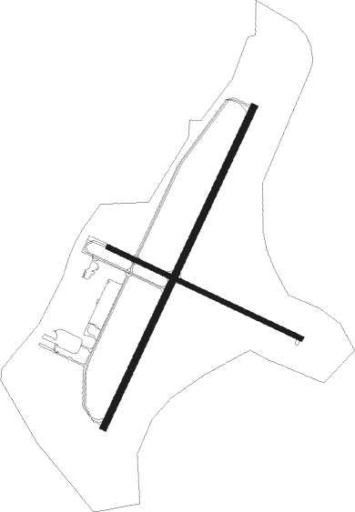
Stevens Point - Stevens Point Muni
Airport details
| Country | United States of America |
| State | Wisconsin |
| Region | K5 |
| Airspace | Minneapolis Ctr |
| Municipality | Stevens Point |
| Elevation | 1108ft (338m) |
| Timezone | GMT -6 |
| Coordinates | 44.54514, -89.53028 |
| Magnetic var | |
| Type | land |
| Available since | X-Plane v10.40 |
| ICAO code | KSTE |
| IATA code | STE |
| FAA code | STE |
Communication
| Stevens Point Muni AWOS 3 | 119.275 |
| Stevens Point Muni CTAF/UNICOM | 122.700 |
Approach frequencies
| ILS-cat-I | RW21 | 111.35 | 18.00mi |
| 3° GS | RW21 | 111.35 | 18.00mi |
Nearby Points of Interest:
Old Plover Methodist Church
-L. A. Pomeroy House
-Pipe School
-Karl Mathie House
-Joseph Dessert Library
-Veterans Cottages Historic District
-Commandant's Residence Home
-Veterans Home Chapel
-Danes Hall
-Waupaca Post Office
-Louis Marchetti House
-Duey and Julia Wright House
-Marathon County Fairgrounds
-Granville D. Jones House
-C. H. Wegner House
-Hiram C. Stewart House
-E.K. Schuetz House
-C. F. Dunbar House
-Ely Wright House
-D. C. Everest House
-C. B. Bird House
-Willard D. Purdy Junior High and Vocational School

Nearby beacons
| code | identifier | dist | bearing | frequency |
|---|---|---|---|---|
| AUW | WAUSAU VOR/DME | 18.2 | 349° | 111.60 |
| DAF | NECEDAH NDB | 38.8 | 227° | 233 |
| VOK | VOLK (CAMP DOUGLAS) TACAN | 47.8 | 230° | 110.40 |
| OSH | OSHKOSH VORTAC | 53.5 | 120° | 116.75 |
| OS | POBER (OSHKOSH) NDB | 58.1 | 125° | 395 |
| DLL | DELLS (BARABOO) VORTAC | 60.5 | 193° | 117 |
Instrument approach procedures
| runway | airway (heading) | route (dist, bearing) |
|---|---|---|
| RW03 | BLUNN (9°) | BLUNN FAYYE (5mi, 292°) 2800ft |
| RW03 | DOLDY (61°) | DOLDY FAYYE (5mi, 112°) 2800ft |
| RW03 | FAYYE (39°) | FAYYE 6000ft FAYYE (turn) 2800ft |
| RNAV | FAYYE 2800ft ESCAF (6mi, 38°) 2800ft KSTE (6mi, 39°) 1141ft (5385mi, 116°) 1409ft JUVOP (5379mi, 297°) 2900ft JUVOP (turn) | |
| RW12 | CODKI (134°) | CODKI 3000ft ILICA (5mi, 218°) 3000ft |
| RW12 | EMIBY (94°) | EMIBY 3000ft ILICA (5mi, 38°) 3000ft |
| RW12 | ILICA (112°) | ILICA 3000ft |
| RNAV | ILICA 3000ft WLCHS (6mi, 112°) 2800ft HIRDA (3mi, 112°) 1880ft KSTE (3mi, 112°) 1145ft SAJSI (12mi, 112°) 3000ft SAJSI (turn) | |
| RW21 | ACEBE (246°) | ACEBE JUVOP (6mi, 292°) 2900ft |
| RW21 | CLIDE (182°) | CLIDE JUVOP (6mi, 112°) 2900ft |
| RW21 | JUVOP (218°) | JUVOP 2900ft |
| RNAV | JUVOP 2900ft ODUYA (6mi, 219°) 2800ft KSTE (6mi, 218°) 1154ft (5385mi, 116°) 1360ft FAYYE (5391mi, 296°) 2800ft FAYYE (turn) | |
| RW30 | REKTE (275°) | REKTE 3000ft SAJSI (5mi, 219°) 3000ft |
| RW30 | SAJSI (292°) | SAJSI 3000ft |
| RW30 | TIVDE (314°) | TIVDE 3000ft SAJSI (5mi, 39°) 3000ft |
| RNAV | SAJSI 3000ft WEDNE (6mi, 292°) 2800ft JIBSU (3mi, 292°) 1780ft KSTE (2mi, 293°) 1143ft (5385mi, 116°) 1510ft SAJSI (5375mi, 296°) 3000ft SAJSI (turn) |
Disclaimer
The information on this website is not for real aviation. Use this data with the X-Plane flight simulator only! Data taken with kind consent from X-Plane 12 source code and data files. Content is subject to change without notice.