Sterling - Sterling Muni
Airport details
| Country | United States of America |
| State | Colorado |
| Region | K2 |
| Airspace | Denver Ctr |
| Municipality | Logan County |
| Elevation | 4038ft (1231m) |
| Timezone | GMT -7 |
| Coordinates | 40.61430, -103.26426 |
| Magnetic var | |
| Type | land |
| Available since | X-Plane v10.40 |
| ICAO code | KSTK |
| IATA code | STK |
| FAA code | STK |
Communication
| Sterling Muni AWOS 3 | 118.525 |
| Sterling Muni CTAF/UNICOM | 122.800 |
| Sterling Muni DENVER CNTR | 118.475 |
Nearby Points of Interest:
St. Anthony's Roman Catholic Church (Sterling, Colorado)
-Downtown Sterling Historic District
-Logan County Courthouse
-Akron Gymnasium
-All Saints Church of Eben Ezer
-First National Bank of Haxtun
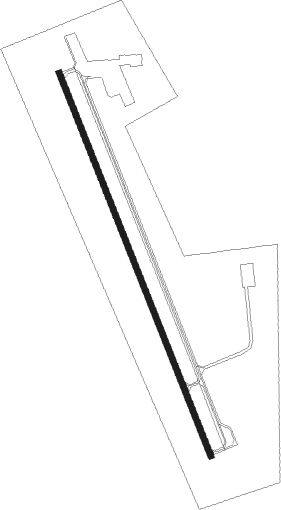
Runway info
| Runway 15 / 33 | ||
| length | 1586m (5203ft) | |
| bearing | 158° / 338° | |
| width | 23m (75ft) | |
| surface | asphalt | |
Nearby beacons
| code | identifier | dist | bearing | frequency |
|---|---|---|---|---|
| AKO | AKRON VOR/DME | 27.8 | 170° | 114.40 |
| SNY | SIDNEY VOR/DME | 31.6 | 30° | 115.90 |
| CNP | CHAPPELL NDB | 45.9 | 60° | 383 |
| TXC | THURMAN VORTAC | 55 | 177° | 112.90 |
| OKS | OSHKOSH NDB | 62.8 | 49° | 233 |
Instrument approach procedures
| runway | airway (heading) | route (dist, bearing) |
|---|---|---|
| RW15 | SNY (210°) | SNY KUBRE (16mi, 222°) 8000ft ZETAX (8mi, 253°) 7500ft |
| RW15 | TUMBL (60°) | TUMBL ZETAX (26mi, 31°) 7500ft ZETAX (turn) 7500ft |
| RNAV | ZETAX 7500ft JUDNI (8mi, 158°) 5800ft JORAL (3mi, 158°) 4900ft KSTK (3mi, 158°) 4082ft (6008mi, 111°) 4288ft ANUCE (6006mi, 291°) 6400ft ANUCE (turn) | |
| RW33 | AKO (350°) | AKO ANUCE (16mi, 359°) 6400ft |
| RW33 | HINGA (234°) | HINGA ANUCE (22mi, 200°) 6400ft ANUCE (turn) 6400ft |
| RNAV | ANUCE 6400ft DENCO (7mi, 338°) 5800ft WOSIK (3mi, 338°) 4700ft KSTK (2mi, 338°) 4070ft (6008mi, 111°) 4278ft ZETAX (6010mi, 292°) 7500ft ZETAX (turn) 7500ft |
Disclaimer
The information on this website is not for real aviation. Use this data with the X-Plane flight simulator only! Data taken with kind consent from X-Plane 12 source code and data files. Content is subject to change without notice.