Stuart - Witham Fld
Airport details
| Country | United States of America |
| State | Florida |
| Region | K7 |
| Airspace | Miami Oceanic Ctr |
| Municipality | Martin County |
| Elevation | 18ft (5m) |
| Timezone | GMT -5 |
| Coordinates | 27.18571, -80.22213 |
| Magnetic var | |
| Type | land |
| Available since | X-Plane v10.40 |
| ICAO code | KSUA |
| IATA code | SUA |
| FAA code | SUA |
Communication
| Witham Fld ATIS | 134.475 |
| Witham Fld CTAF | 126.600 |
| Witham Fld Ground Control | 121.700 |
| Witham Fld STUART Tower | 126.600 |
| Witham Fld PALM BEACH Approach | 128.300 |
| Witham Fld PALM BEACH Departure | 128.300 |
Nearby Points of Interest:
Krueger House
-Golden Gate Building
-Old Martin County Courthouse
-Lyric Theatre
-Tuckahoe
-Olympia School
-Hobe Sound National Wildlife Refuge
-Gate House
-Captain Hammond House
-Trapper Nelson Zoo Historic District
-Jules Frere House
-Boston House
-St. Lucie High School
-Arcade Building
-Old Fort Pierce Post Office
-Old Fort Pierce City Hall
-Old St. Anastasia Catholic School
-Zora Neale Hurston House
-Jupiter Inlet Historic and Archeological Site
-St. Lucie Village Historic District
-Casa Caprona
-Immokolee
-Cypress Lodge
-Kelsey City City Hall
-Northboro Park Historic District
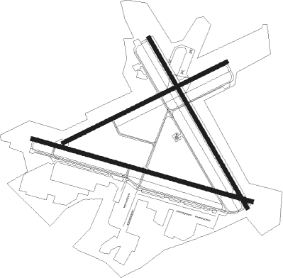
Runway info
Runway 12 / 30  | ||
| length | 1775m (5823ft) | |
| bearing | 108° / 288° | |
| width | 30m (100ft) | |
| surface | asphalt | |
| displ threshold | 143m (469ft) / 0m (0ft) | |
| blast zone | 137m (449ft) / 183m (600ft) | |
| Runway 16 / 34 | ||
| length | 1528m (5013ft) | |
| bearing | 152° / 332° | |
| width | 30m (100ft) | |
| surface | asphalt | |
| displ threshold | 102m (335ft) / 268m (879ft) | |
| blast zone | 55m (180ft) / 46m (151ft) | |
| Runway 7 / 25 | ||
| length | 1417m (4649ft) | |
| bearing | 70° / 250° | |
| width | 30m (100ft) | |
| surface | asphalt | |
| blast zone | 0m (0ft) / 46m (151ft) | |
Nearby beacons
| code | identifier | dist | bearing | frequency |
|---|---|---|---|---|
| UTX | UNITED NDB | 17.7 | 202° | 405 |
| FPR | FORT PIERCE NDB | 19.7 | 333° | 275 |
| PBI | PALM BEACH VORTAC | 31.2 | 165° | 115.70 |
| TRV | TREASURE (VERO BEACH) VORTAC | 32.8 | 331° | 117.30 |
| PHK | PAHOKEE VOR/DME | 34.8 | 229° | 115.40 |
| MLB | MELBOURNE VOR/DME | 59.4 | 336° | 115.85 |
Departure and arrival routes
| Transition altitude | 18000ft |
| Transition level | 18000ft |
| SID end points | distance | outbound heading | |
|---|---|---|---|
| RW07 | |||
| SNDLR2 | 21mi | 288° | |
| RW12 | |||
| SNDLR2 | 21mi | 288° | |
| RW16 | |||
| SNDLR2 | 21mi | 288° | |
| RW25 | |||
| SNDLR2 | 21mi | 288° | |
| RW30 | |||
| SNDLR2 | 21mi | 288° | |
| RW34 | |||
| SNDLR2 | 21mi | 288° | |
| STAR starting points | distance | inbound heading | |
|---|---|---|---|
| ALL | |||
| FEBAD1 | 32.9 | 61° | |
| SHRVY1 | 48.3 | 63° | |
| TTYLR1 | 42.9 | 71° | |
Instrument approach procedures
| runway | airway (heading) | route (dist, bearing) |
|---|---|---|
| RW12 | ANGEE (195°) | ANGEE HADAT (13mi, 246°) 2000ft PETNE (8mi, 202°) 2000ft |
| RW12 | FFAIR (138°) | FFAIR HADAT (7mi, 132°) 2000ft PETNE (8mi, 202°) 2000ft |
| RW12 | IVETY (75°) | IVETY PETNE (8mi, 22°) 2000ft |
| RW12 | PETNE (106°) | PETNE 6000ft PETNE (turn) 2000ft |
| RW12 | SHEDS (108°) | SHEDS PETNE (10mi, 109°) 2000ft |
| RNAV | PETNE 2000ft MAINR (6mi, 108°) 1600ft ZEVPU (3mi, 108°) 660ft KSUA (2mi, 99°) 75ft (4883mi, 109°) 268ft LEBAN (4872mi, 289°) 2000ft LEBAN (turn) | |
| RW30 | PBI (345°) | PBI MONAD (21mi, 4°) 3000ft LEBAN (6mi, 22°) 2000ft |
| RW30 | STOOP (233°) | STOOP BERBE (8mi, 109°) 3000ft LEBAN (6mi, 203°) 2000ft |
| RNAV | LEBAN 2000ft AROSS (6mi, 288°) 1600ft WOLOB (3mi, 288°) 560ft KSUA (2mi, 297°) 51ft (4883mi, 109°) 262ft PETNE (4894mi, 289°) 2000ft PETNE (turn) |
Holding patterns
| STAR name | hold at | type | turn | heading* | altitude | leg | speed limit |
|---|---|---|---|---|---|---|---|
| SHRVY1 | GAWKS | VHF | left | 287 (107)° | DME 15.0mi | ICAO rules | |
| SHRVY1 | HORUT | VHF | right | 349 (169)° | DME 10.0mi | ICAO rules | |
| SHRVY1 | MOLIE | VHF | right | 349 (169)° | DME 10.0mi | ICAO rules | |
| SHRVY1 | RACNO | VHF | right | 316 (136)° | DME 10.0mi | ICAO rules | |
| SHRVY1 | ROKSY | VHF | left | 273 (93)° | DME 10.0mi | ICAO rules | |
| *) magnetic outbound (inbound) holding course | |||||||
Disclaimer
The information on this website is not for real aviation. Use this data with the X-Plane flight simulator only! Data taken with kind consent from X-Plane 12 source code and data files. Content is subject to change without notice.