Stroud - Stroud Muni
Airport details
| Country | United States of America |
| State | Oklahoma |
| Region | K4 |
| Airspace | Kansas City Ctr |
| Municipality | Stroud |
| Elevation | 898ft (274m) |
| Timezone | GMT -6 |
| Coordinates | 35.78959, -96.65567 |
| Magnetic var | |
| Type | land |
| Available since | X-Plane v10.40 |
| ICAO code | KSUD |
| IATA code | SUD |
| FAA code | SUD |
Communication
| STROUD MUNI CTAF | 122.900 |
Nearby Points of Interest:
Joseph Carpenter House
-Chandler Armory
-Mascho Building and Public Privy
-St. Cloud Hotel
-Conklin House
-First Presbyterian Church of Chandler
-St. Stephen's Episcopal Church
-Texaco Service Station
-Seaba's Filling Station
-St. Paul Baptist Church and Cemetery
-Jim Thorpe House
-Threatt Filling Station
-Stillwater Santa Fe Depot
-William Frick House
-Walker Building
-Hoke Building
-Selph Building
-Payne County Courthouse
-James E. Berry House
-Campus Fire Station
-Old Central
-Magruder Plots
-Josephine Reifsnyder Lustron House
-Oklahoma A & M College Agronomy Barn and Seed House
-Benedictine Hall
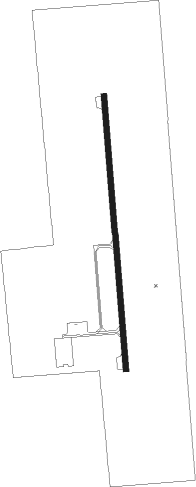
Runway info
| Runway 18 / 36 | ||
| length | 917m (3009ft) | |
| bearing | 180° / 0° | |
| width | 18m (60ft) | |
| surface | asphalt | |
Nearby beacons
| code | identifier | dist | bearing | frequency |
|---|---|---|---|---|
| SRE | SEMINOLE NDB | 31.1 | 182° | 278 |
| SWO | STILLWATER VOR/DME | 33.3 | 316° | 108.40 |
| SW | BLAKI (STILLWATER) NDB | 34 | 316° | 255 |
| GNP | (TULSA) DME | 34.3 | 79° | 110.60 |
| OK | PRESO (OKMULGEE) NDB | 34.5 | 93° | 388 |
| HET | HENRYETTA NDB | 38.9 | 121° | 267 |
| OKM | OKMULGEE VOR/DME | 38.9 | 97° | 114.90 |
| TIK | TINKER (OKLAHOMA CITY) TACAN | 41.2 | 244° | 115.80 |
| TU | OILLR (TULSA) NDB | 41.6 | 68° | 338 |
| TUL | TULSA VORTAC | 48.7 | 65° | 114.40 |
| PWA | WILEY POST (OKLAHOMA CITY VOR/DME | 50.7 | 255° | 113.40 |
| IRW | WILL ROGERS (OKLAHOMA CIT VORTAC | 53.2 | 246° | 114.10 |
| RG | GALLY (OKLAHOMA CITY) NDB | 54.4 | 242° | 350 |
| PER | PIONEER (PONCA CITY) VORTAC | 62.4 | 332° | 113.20 |
| MLC | MCALESTER TACAN | 70.8 | 137° | 112 |
Disclaimer
The information on this website is not for real aviation. Use this data with the X-Plane flight simulator only! Data taken with kind consent from X-Plane 12 source code and data files. Content is subject to change without notice.