Sturgeon Bay - Door County Cherryland
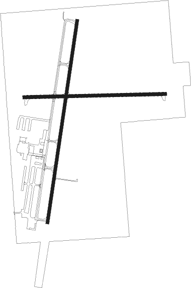
Airport details
| Country | United States of America |
| State | Wisconsin |
| Region | K5 |
| Airspace | Minneapolis Ctr |
| Municipality | Town of Nasewaupee |
| Elevation | 724ft (221m) |
| Timezone | GMT -6 |
| Coordinates | 44.84367, -87.42152 |
| Magnetic var | |
| Type | land |
| Available since | X-Plane v10.30 |
| ICAO code | KSUE |
| IATA code | SUE |
| FAA code | SUE |
Communication
| Door County Cherryland AWOS 3PT | 128.325 |
| Door County Cherryland CTAF/UNICOM | 122.700 |
| Door County Cherryland GREEN BAY Approach/Departure | 119.250 |
Approach frequencies
| SDF | RW02 | 111.9 | 18.00mi |
Nearby Points of Interest:
Potawatomi State Park Observation Tower
-Sturgeon Bay Post Office
-Carnegie Free Library
-L. A. Larson & Co. Store
-Door Peninsula
-Louis Vangindertahlen House
-Joseph Monfils Farmstead
-SS Lakeland
-J.B. Bouche House
-Daniel Lyons
-August Draize Farmstead
-Cupola House
-Art Dettman Fishing Shanty
-Ahnapee Brewery
-Melvin W. and Mary Perry House
-Chicago, Milwaukee, St. Paul and Pacific Railroad Station
-Independent Order of Odd Fellows-Lodge No. 189 Building
-First Street Historic District
-Bijou Theatre
-Lauerman Brothers Department Store
-Charles G. Janson Garage
-Dunlap Square Building
-Milwaukee Road Depot
-Globe Hotel
-Baileys Harbor Town Hall-McArdle Library

Nearby beacons
| code | identifier | dist | bearing | frequency |
|---|---|---|---|---|
| II | FICHY (STURGEON BAY) NDB | 5.3 | 198° | 224 |
| TN | TRIBE (MENOMINEE) NDB | 17.5 | 308° | 239 |
| MNM | MENOMINEE VOR/DME | 22.3 | 326° | 109.60 |
| GRB | GREEN BAY VORTAC | 37.2 | 250° | 115.50 |
| SG | DEPRE (GREEN BAY) NDB | 40.4 | 238° | 332 |
| MT | MAWOC (MANITOWOC) NDB | 40.5 | 204° | 362 |
| GR | FAMIS (GREEN BAY) NDB | 42.5 | 244° | 356 |
| MTW | DME | 44.3 | 200° | 111 |
| ES | PIKLE (ESCANABA) NDB | 53.4 | 13° | 344 |
| ESC | ESCANABA VOR/DME | 54.6 | 21° | 110.80 |
| AQ | KOOKY (APPLETON) NDB | 56.3 | 237° | 407 |
| IMT | IRON MOUNTAIN VOR/DME | 65.2 | 325° | 111.20 |
Instrument approach procedures
| runway | airway (heading) | route (dist, bearing) |
|---|---|---|
| RW10 | AGOMA (35°) | AGOMA SAWRY (12mi, 334°) 2600ft FOLGO (5mi, 4°) 2600ft |
| RW10 | FOLGO (92°) | FOLGO 2600ft |
| RW10 | WARWF (101°) | WARWF FOLGO (9mi, 113°) 2600ft |
| RNAV | FOLGO 2600ft NURKE (6mi, 92°) 2400ft KSUE (5mi, 93°) 753ft (5295mi, 117°) 1120ft TOTUE (5284mi, 297°) 2600ft TOTUE (turn) | |
| RW20 | MNM (146°) | MNM VOBUY (15mi, 118°) 2600ft |
| RW20 | VOBUY (198°) | VOBUY 2600ft |
| RW20 | ZUXIN (313°) | ZUXIN CENEB (25mi, 349°) 2600ft VOBUY (5mi, 279°) 2600ft |
| RNAV | VOBUY 2600ft LOSSI (6mi, 198°) 2400ft YUKTU (2mi, 198°) 1640ft KSUE (3mi, 197°) 750ft (5295mi, 117°) 974ft NENSE (5298mi, 297°) 3500ft NENSE (turn) | |
| RW28 | MNM (146°) | MNM WABOT (27mi, 118°) 2600ft TOTUE (5mi, 185°) 2600ft |
| RW28 | TOTUE (272°) | TOTUE 2600ft |
| RW28 | ZUXIN (313°) | ZUXIN TOTUE (14mi, 5°) 2600ft |
| RNAV | TOTUE 2600ft FELET (6mi, 272°) 2400ft KSUE (5mi, 272°) 766ft (5295mi, 117°) 1124ft FOLGO (5307mi, 297°) 2600ft FOLGO (turn) |
Disclaimer
The information on this website is not for real aviation. Use this data with the X-Plane flight simulator only! Data taken with kind consent from X-Plane 12 source code and data files. Content is subject to change without notice.