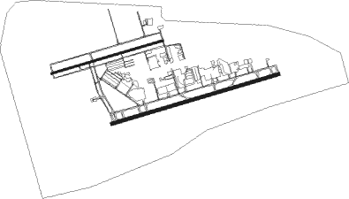
St Louis - Spirit Of St Louis
Airport details
| Country | United States of America |
| State | Missouri |
| Region | K3 |
| Airspace | Kansas City Ctr |
| Municipality | Chesterfield |
| Elevation | 462ft (141m) |
| Timezone | GMT -6 |
| Coordinates | 38.66211, -90.65205 |
| Magnetic var | |
| Type | land |
| Available since | X-Plane v10.40 |
| ICAO code | KSUS |
| IATA code | SUS |
| FAA code | SUS |
Communication
| Spirit of St Louis ATIS | 134.800 |
| Spirit of St Louis CTAF | 124.750 |
| Spirit of St Louis UNICOM | 122.950 |
| Spirit of St Louis Clearance DEL | 133.100 |
| Spirit of St Louis Ground Control | 121.700 |
| Spirit of St Louis Tower | 124.750 |
| Spirit of St Louis Tower | 122.600 |
| Spirit of St Louis ST LOUIS Approach/Departure | 126.500 |
Approach frequencies
| ILS-cat-I | RW26L | 111.1 | 18.00mi |
| ILS-cat-I | RW08R | 110.55 | 18.00mi |
| 3° GS | RW26L | 111.1 | 18.00mi |
| 3° GS | RW08R | 110.55 | 18.00mi |
Nearby Points of Interest:
Burkhardt Historic District
-Big Chief Restaurant
-Old Stone Church
-St. Albans Farms Stone Barn
-Isaac McCormick House
-St. Albans General Store
-Theodore A. Pappas House
-Daniel Boone Home
-Lindenwood Hall
-Barretts Tunnels
-Marten-Becker House
-Newbill-McElhiney House
-Oliver L. and Catherine Link House
-Samuel Stewart Watson House
-African Church
-Stone Row
-St. Charles Historic District
-Dr. John H. Stumberg House
-First Missouri State Capitol State Historic Site
-Old City Hall
-Midtown Neighborhood Historic District
-Frenchtown Historic District
-Meier General Store
-Des Peres Presbyterian Church
-St. Paul's Church
Nearby beacons
| code | identifier | dist | bearing | frequency |
|---|---|---|---|---|
| FZ | EAVES (ST LOUIS) NDB | 4.9 | 82° | 227 |
| SU | SNOOP (ST LOUIS) NDB | 5.5 | 259° | 326 |
| STL | SAINT LOUIS VORTAC | 14.3 | 41° | 117.40 |
| CSX | DME | 14.6 | 73° | 116.45 |
| FTZ | FORISTELL VORTAC | 15 | 276° | 110.80 |
| CP | ACORE (CAHOKIA/ST LOUIS) NDB | 29.1 | 103° | 350 |
| CVM | CIVIC MEMORIAL (ALTON) NDB | 31.1 | 69° | 263 |
| TOY | TROY VORTAC | 34.6 | 84° | 116 |
| SKE | SCOTT (BELLEVILLE) TACAN | 38.2 | 98° | 112.20 |
| JD | GOOEY (BELLEVILLE) NDB | 44.3 | 101° | 385 |
| FAM | FARMINGTON VORTAC | 62.5 | 157° | 115.70 |
Departure and arrival routes
| Transition altitude | 18000ft |
| Transition level | 18000ft |
| SID end points | distance | outbound heading | |
|---|---|---|---|
| ALL | |||
| GATWY1 | 211mi | 75° | |
| PLESS5 | 111mi | 118° | |
| LINDY8 | 58mi | 244° | |
| OZARK8 | 74mi | 287° | |
| STAR starting points | distance | inbound heading | |
|---|---|---|---|
| RW08 (ALL) | |||
| DELMA4 | 22.8 | 24° | |
| DIRTT2 | 20.2 | 117° | |
| BUUDD3 | 45.0 | 236° | |
| JHAUN1 | 28.1 | 304° | |
| SLVER1 | 35.5 | 329° | |
| RW26 (ALL) | |||
| DELMA4 | 22.8 | 24° | |
| DIRTT2 | 20.2 | 117° | |
| BUUDD3 | 45.0 | 236° | |
| JHAUN1 | 28.1 | 304° | |
| SLVER1 | 35.5 | 329° | |
Instrument approach procedures
| runway | airway (heading) | route (dist, bearing) |
|---|---|---|
| RW08L | DERDF (63°) | DERDF EXESS (5mi, 355°) 3000ft |
| RW08L | EXESS (82°) | EXESS 3000ft |
| RW08L | FTZ (96°) | FTZ EXESS (5mi, 132°) 3000ft |
| RNAV | EXESS 3000ft WIDNR (6mi, 81°) 2100ft KSUS (6mi, 83°) 504ft (5436mi, 113°) 855ft DBLEE (5431mi, 293°) BNANA (9mi, 167°) DERDF (18mi, 270°) 3000ft DERDF (turn) | |
| RW08R | DERDF (63°) | DERDF JOBRK (5mi, 345°) 3000ft |
| RW08R | FTZ (96°) | FTZ JOBRK (6mi, 142°) 3000ft |
| RW08R | JOBRK (80°) | JOBRK 3000ft |
| RNAV | JOBRK 3000ft DTOWN (6mi, 80°) 2400ft RAPCO (3mi, 81°) 1540ft KSUS (4mi, 78°) 516ft (5436mi, 113°) 662ft HUGGE (5430mi, 293°) BNANA (9mi, 172°) DERDF (18mi, 270°) 3000ft DERDF (turn) | |
| RW26L | CHADD (261°) | CHADD 6000ft CHADD (turn) 4000ft |
| RW26L | EMKAA (284°) | EMKAA CHADD (7mi, 345°) 4000ft |
| RW26L | FASHE (220°) | FASHE CSX (23mi, 195°) 4000ft CHADD (4mi, 221°) 4000ft |
| RNAV | CHADD 4000ft FAVOG (6mi, 261°) 2100ft SHEGZ (2mi, 261°) 1540ft KSUS (4mi, 263°) 517ft (5436mi, 113°) 662ft JOBRK (5448mi, 293°) 3000ft JOBRK (turn) | |
| RW26R | EMKAA (284°) | EMKAA KORNN (7mi, 339°) 4000ft |
| RW26R | FASHE (220°) | FASHE CSX (23mi, 195°) 4000ft KORNN (4mi, 232°) 4000ft |
| RW26R | KORNN (260°) | KORNN 6000ft KORNN (turn) 4000ft |
| RNAV | KORNN 4000ft PAMUW (7mi, 261°) 2100ft KSUS (4mi, 258°) 510ft (5436mi, 113°) 713ft EXESS (5447mi, 293°) 3000ft EXESS (turn) |
Disclaimer
The information on this website is not for real aviation. Use this data with the X-Plane flight simulator only! Data taken with kind consent from X-Plane 12 source code and data files. Content is subject to change without notice.

