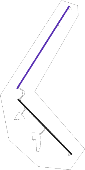
Superior - Richard I Bong
Airport details
| Country | United States of America |
| State | Wisconsin |
| Region | K5 |
| Airspace | Minneapolis Ctr |
| Municipality | City of Superior |
| Elevation | 673ft (205m) |
| Timezone | GMT -6 |
| Coordinates | 46.68968, -92.09464 |
| Magnetic var | |
| Type | land |
| Available since | X-Plane v10.40 |
| ICAO code | KSUW |
| IATA code | SUW |
| FAA code | SUW |
Communication
| Richard I Bong AWOS 3 | 118.875 |
| Richard I Bong CTAF/UNICOM | 122.700 |
| Richard I Bong Clearance DEL | 124.800 |
| Richard I Bong DULUTH Approach/Departure | 125.450 |
Nearby Points of Interest:
Douglas County Courthouse
-Empire Block
-USS Essex
-Irving School
-Lincoln Branch Library
-U.S. Army Corps of Engineers Vessel Yard
-Duluth Depot
-DeWitt-Seitz Building
-Munger Terrace
-YWCA of Duluth
-Duluth Missabe and Iron Range Depot
-Wirth Building
-Duluth Public Library
-Duluth Masonic Center
-Sacred Heart Cathedral, Sacred Heart School and Christian Brothers Home
-Historic Central High School
-Fire Station No. 1
-Fitger Brewing Company
-Bergetta Moe Bakery
-St. Mark's African Methodist Episcopal Church
-Chester Terrace
-Oliver G. Traphagen House
-Bridge L6113
-Bridge L8515
-Lester River Fish Hatchery
Nearby beacons
| code | identifier | dist | bearing | frequency |
|---|---|---|---|---|
| DLH | DULUTH VORTAC | 8 | 316° | 112.60 |
| LKI | LAKESIDE (DULUTH) TACAN | 9.9 | 329° | 135.40 |
| DL | PYKLA (DULUTH) NDB | 14.2 | 301° | 379 |
| HIB | HIBBING VOR/DME | 44.4 | 315° | 110.80 |
| HYR | DME | 48.4 | 136° | 113.40 |
| BXR | BIG DOCTOR (SIREN) NDB | 53.3 | 197° | 203 |
| RZN | DME | 53.4 | 198° | 109.40 |
| ROS | RUSH CITY NDB | 69.5 | 221° | 282 |
Instrument approach procedures
| runway | airway (heading) | route (dist, bearing) |
|---|---|---|
| RW04 | DLH (136°) | DLH BARUM (17mi, 190°) 4000ft BARUM (turn) 4000ft |
| RNAV | BARUM 4000ft HUROX (6mi, 39°) 2600ft DUYAR (4mi, 47°) 1340ft KSUW (2mi, 52°) 720ft (5491mi, 117°) 1500ft BARUM (5498mi, 297°) 4000ft BARUM (turn) 4000ft | |
| RW14 | BARUM (44°) | BARUM JIBEG (19mi, 354°) 3100ft JIBEG (turn) 3100ft |
| RW14 | FOSUP (177°) | FOSUP JIBEG (14mi, 220°) 3100ft |
| RW14 | HIB (135°) | HIB JIBEG (33mi, 138°) 3100ft |
| RNAV | JIBEG 3100ft PROCT (6mi, 129°) 2600ft ZINUP (2mi, 129°) 1860ft KSUW (4mi, 125°) 717ft (5491mi, 117°) 1000ft BNATT (5484mi, 297°) 3000ft BNATT (turn) | |
| RW22 | DLH (136°) | DLH NETIE (12mi, 79°) 3100ft NETIE (turn) 3100ft |
| RW22 | NOYIC (270°) | NOYIC NETIE (28mi, 285°) 3100ft |
| RW22 | WEMAN (230°) | WEMAN NETIE (25mi, 231°) 3100ft |
| RNAV | NETIE 3100ft HUVES (6mi, 228°) 2600ft KSUW (7mi, 226°) 710ft (5491mi, 117°) 1060ft DUYAR (5493mi, 297°) BARUM (9mi, 222°) 4000ft BARUM (turn) | |
| RW32 | CEKDA (288°) | CEKDA BNATT (27mi, 279°) 3000ft |
| RW32 | DLH (136°) | DLH BNATT (21mi, 133°) 3000ft BNATT (turn) 3000ft |
| RW32 | KINGZ (24°) | KINGZ BNATT (25mi, 53°) 3000ft |
| RNAV | BNATT 3000ft NISIC (6mi, 310°) 2600ft CUROR (4mi, 310°) 1220ft KSUW (2mi, 317°) 718ft (5491mi, 117°) 1000ft JIBEG (5499mi, 297°) 3100ft JIBEG (turn) |
Disclaimer
The information on this website is not for real aviation. Use this data with the X-Plane flight simulator only! Data taken with kind consent from X-Plane 12 source code and data files. Content is subject to change without notice.

