Sioux City - Sioux Gateway Col Bud Day Fld
Airport details
| Country | United States of America |
| State | Iowa |
| Region | K3 |
| Airspace | Minneapolis Ctr |
| Municipality | Sioux City |
| Elevation | 1098ft (335m) |
| Timezone | GMT -6 |
| Coordinates | 42.38921, -96.37517 |
| Magnetic var | |
| Type | land |
| Available since | X-Plane v10.40 |
| ICAO code | KSUX |
| IATA code | SUX |
| FAA code | SUX |
Communication
| SIOUX GATEWAY COL BUD DAY FLD ATIS | 119.450 |
| SIOUX GATEWAY COL BUD DAY FLD CTAF | 118.700 |
| SIOUX GATEWAY COL BUD DAY FLD UNICOM | 122.950 |
| SIOUX GATEWAY COL BUD DAY FLD Ground Control | 121.900 |
| SIOUX GATEWAY COL BUD DAY FLD SIOUX CITY Tower | 118.700 |
| SIOUX GATEWAY COL BUD DAY FLD SIOUX CITY Approach/Departure | 124.600 |
Approach frequencies
| ILS-cat-I | RW13 | 111.3 | 18.00mi |
| ILS-cat-I | RW31 | 109.3 | 18.00mi |
| 3° GS | RW13 | 111.3 | 18.00mi |
| 3° GS | RW31 | 109.3 | 18.00mi |
Nearby Points of Interest:
Julius and Anine Oversen House
-Charles City College Hall
-Meisch House
-KD Station
-Cornelius O'Connor House
-Sioux City Linseed Oil Works
-Evans Block
-Fourth Street Historic District
-Badgerow Building
-Boston Block
-Sioux City Fire Station Number 3
-T.S. Martin and Company
-Motor Mart Building
-Sioux City Free Public Library
-Federal Building and United States Courthouse
-Davidson Building
-Williges Building
-Alhambra Apartments
-Sioux City Masonic Temple
-Sioux City Central High School and Central Annex
-First Congregational Church, Former
-Mount Sinai Temple (Sioux City, Iowa)
-Elzy G. Burkam House
-Rose Hill Historic District
-Atchison A. Ashby House
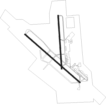
Runway info
Runway 17 / 35  | ||
| length | 2014m (6608ft) | |
| bearing | 181° / 1° | |
| width | 46m (150ft) | |
| surface | asphalt | |
| blast zone | 46m (151ft) / 0m (0ft) | |
| Runway 13 / 31 | ||
| length | 2746m (9009ft) | |
| bearing | 127° / 307° | |
| width | 46m (150ft) | |
| surface | concrete | |
| blast zone | 255m (837ft) / 255m (837ft) | |
Nearby beacons
| code | identifier | dist | bearing | frequency |
|---|---|---|---|---|
| SUX | SIOUX CITY TACAN | 3.5 | 131° | 116.50 |
| SU | SALIX (SOUIX CITY) NDB | 5.2 | 126° | 414 |
| OI | TOMMI (SIOUX CITY) NDB | 5.7 | 309° | 305 |
| SCB | SCRIBNER VOR/DME | 48.4 | 198° | 111 |
| YK | CAGUR (YANKTON) NDB | 49.2 | 296° | 347 |
| OLU | COLUMBUS VOR/DME | 71 | 226° | 111.80 |
Instrument approach procedures
| runway | airway (heading) | route (dist, bearing) |
|---|---|---|
| RW13 | ATLES (89°) | ATLES JOVDU (12mi, 66°) 3500ft VOGYU (5mi, 54°) 3500ft |
| RW13 | OYENS (218°) | OYENS WAGUX (19mi, 249°) 3500ft VOGYU (5mi, 234°) 3500ft |
| RW13 | VOGYU (128°) | VOGYU 3500ft |
| RNAV | VOGYU 3500ft YABUR (7mi, 127°) 2500ft KSUX (6mi, 128°) 1147ft (5688mi, 114°) 1295ft WAVUK (5680mi, 294°) 3900ft WAVUK (turn) | |
| RW18 | JMBON (179°) | JMBON 4400ft |
| RW18 | RIITA (219°) | RIITA JMBON (8mi, 271°) 4400ft |
| RW18 | TIGGO (140°) | TIGGO JMBON (8mi, 90°) 4400ft |
| RNAV | JMBON 4400ft AKJAW (6mi, 181°) 3000ft WEPDA (3mi, 181°) 2040ft KSUX (4mi, 175°) 1152ft (5688mi, 114°) 1352ft POGAE (5689mi, 294°) 3200ft POGAE (turn) | |
| RW31 | CUSHO (267°) | CUSHO USOSE (16mi, 251°) 3900ft WAVUK (5mi, 234°) 3900ft |
| RW31 | DECKA (346°) | DECKA ZAGTA (15mi, 360°) 3900ft WAVUK (5mi, 54°) 3900ft |
| RW31 | WAVUK (307°) | WAVUK 3900ft |
| RNAV | WAVUK 3900ft TOVUY (7mi, 307°) 2900ft KSUX (5mi, 306°) 1136ft (5688mi, 114°) 1296ft VOGYU (5696mi, 294°) 3500ft VOGYU (turn) | |
| RW36 | HASPO (320°) | HASPO POGAE (8mi, 271°) 3200ft |
| RW36 | POGAE (3°) | POGAE 3200ft |
| RW36 | RETEE (44°) | RETEE POGAE (8mi, 90°) 3200ft |
| RNAV | POGAE 3200ft CURNS (6mi, 1°) 3000ft MITTN (4mi, 1°) 1860ft KSUX (2mi, 13°) 1149ft (5688mi, 114°) 1297ft JMBON (5687mi, 294°) 4400ft JMBON (turn) 4400ft |
Disclaimer
The information on this website is not for real aviation. Use this data with the X-Plane flight simulator only! Data taken with kind consent from X-Plane 12 source code and data files. Content is subject to change without notice.