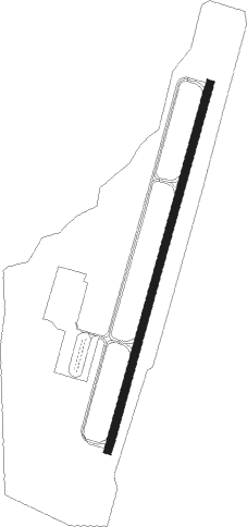
Benton - Saline County Regional
Airport details
| Country | United States of America |
| State | Arkansas |
| Region | K4 |
| Airspace | Memphis Ctr |
| Municipality | Bryant |
| Elevation | 389ft (119m) |
| Timezone | GMT -6 |
| Coordinates | 34.59040, -92.47944 |
| Magnetic var | |
| Type | land |
| Available since | X-Plane v10.40 |
| ICAO code | KSUZ |
| IATA code | n/a |
| FAA code | SUZ |
Communication
| Saline County Regional KSUZ CTAF | 122.800 |
| Saline County Regional AI Tower | 118.125 |
| Saline County Regional WX AWOS | 132.125 |
Approach frequencies
| ILS-cat-I | RW02 | 111.95 | 18.00mi |
| 3° GS | RW02 | 111.95 | 18.00mi |
Runway info
| Runway 2 / 20 | ||
| length | 1528m (5013ft) | |
| bearing | 24° / 204° | |
| width | 30m (100ft) | |
| surface | asphalt | |
Nearby beacons
| code | identifier | dist | bearing | frequency |
|---|---|---|---|---|
| LI | LASKY (LITTLE ROCK) NDB | 9.8 | 66° | 353 |
| LIT | LITTLE ROCK VORTAC | 15.6 | 74° | 113.90 |
| LRF | JACKSONVILLE TACAN | 25.2 | 44° | 109.20 |
| HOT | HOT SPRINGS VOR/DME | 30.9 | 260° | 110 |
| PBF | PINE BLUFF VOR/DME | 34.3 | 122° | 116 |
| HO | HOSSY (HOT SPRINGS) NDB | 36.5 | 257° | 385 |
| TT | STUTT (STUTTGART) NDB | 44.6 | 95° | 338 |
| DS | CERCY (SEARCY) NDB | 47.6 | 53° | 375 |
| RUE | RUSSELLVILLE NDB | 50.2 | 317° | 379 |
Instrument approach procedures
| runway | airway (heading) | route (dist, bearing) |
|---|---|---|
| RW02 | HERID (331°) | HERID WEKUK (8mi, 295°) 2000ft ZANIX (5mi, 287°) 2000ft |
| RW02 | HOT (80°) | HOT FONIR (22mi, 95°) 2800ft ZANIX (5mi, 107°) 2000ft |
| RW02 | ZANIX (24°) | ZANIX 2000ft |
| RNAV | ZANIX 2000ft UPENE (6mi, 24°) 2000ft COXES (3mi, 24°) 1100ft KSUZ (3mi, 24°) 428ft NIKIC (4mi, 24°) PARON (11mi, 293°) 2600ft PARON (turn) | |
| RW20 | ROLAN (187°) | ROLAN ZITPU (5mi, 141°) 3300ft |
| RNAV | ZITPU 3300ft PUYIS (6mi, 204°) 2300ft HUSAL (4mi, 204°) 1060ft KSUZ (2mi, 204°) 421ft UCICE (2mi, 204°) MALVE (14mi, 229°) 2000ft MALVE (turn) |
Disclaimer
The information on this website is not for real aviation. Use this data with the X-Plane flight simulator only! Data taken with kind consent from X-Plane 12 source code and data files. Content is subject to change without notice.
