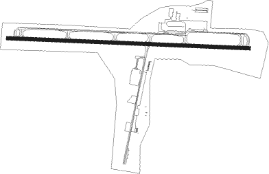
Statesville - Statesville Rgnl
Airport details
| Country | United States of America |
| State | North Carolina |
| Region | K7 |
| Airspace | Atlanta Ctr |
| Municipality | Statesville |
| Elevation | 963ft (294m) |
| Timezone | GMT -5 |
| Coordinates | 35.76500, -80.95389 |
| Magnetic var | |
| Type | land |
| Available since | X-Plane v10.40 |
| ICAO code | KSVH |
| IATA code | SVH |
| FAA code | SVH |
Communication
| Statesville Rgnl AWOS 3 | 119.225 |
| Statesville Rgnl CTAF | 123.075 |
Approach frequencies
| ILS-cat-I | RW28 | 111.75 | 18.00mi |
| 3° GS | RW28 | 111.75 | 18.00mi |
Nearby Points of Interest:
Statesville Commercial Historic District
-South Race Street Historic District
-St. Philip's Roman Catholic Church
-Academy Hill Historic District
-Iredell County Courthouse
-Col. Silas Alexander Sharpe House
-United States Post Office and County Courthouse
-Morrison-Mott House
-Center Street A.M.E. Zion Church
-McElwee Houses
-East Broad Street-Davie Avenue Historic District
-Murray's Mill Historic District
-Allison Woods
-Johnson-Neel House
-Balls Creek Campground
-Lucas Mansion
-Espy Watts Brawley House
-Rankin-Sherrill House
-Mooresville Historic District
-South Broad Street Row
-Hightower Hall
-Mooresville Mill Village Historic District
-Hargrave House
-Mount Mourne Plantation
-Christ Episcopal Church
Nearby beacons
| code | identifier | dist | bearing | frequency |
|---|---|---|---|---|
| BZM | BARRETTS MOUNTAIN (HICKOR VOR/DME | 15.2 | 290° | 113.75 |
| HK | TAWBA (HICKORY) NDB | 17.1 | 274° | 332 |
| RU | ROVDY (SALISBURY) NDB | 22.7 | 94° | 275 |
| CLT | CHARLOTTE VOR/DME | 34.5 | 180° | 115 |
| FIQ | FIDDLERS (MORGANTON) NDB | 35.1 | 266° | 391 |
| GHJ | STONIA (GASTONIA) NDB | 35.8 | 200° | 260 |
| IN | REENO (WINSTON SALEM) NDB | 42.4 | 69° | 317 |
| JUH | ASHEE (JEFFERSON) NDB | 43.9 | 331° | 410 |
| SLP | FIRST RIVER (SHELBY) NDB | 44 | 232° | 417 |
| VU | ALLER (ALBEMARLE) NDB | 45.6 | 108° | 346 |
| GSO | GREENSBORO VORTAC | 50.4 | 74° | 116.20 |
| BAR | HEMLOCK (BANNER ELK) NDB | 50.6 | 293° | 320 |
| UZ | RALLY (ROCK HILL) NDB | 52.9 | 188° | 227 |
| JJC | MOUNTAIN CITY NDB | 57.5 | 307° | 396 |
| DCM | CHESTER NDB | 60 | 194° | 220 |
| SPA | SPARTANBURG VORTAC | 64.7 | 233° | 115.70 |
Departure and arrival routes
| Transition altitude | 18000ft |
| Transition level | 18000ft |
| STAR starting points | distance | inbound heading | |
|---|---|---|---|
| ALL | |||
| KABEE3 | 76.8 | 324° | |
Instrument approach procedures
| runway | airway (heading) | route (dist, bearing) |
|---|---|---|
| RW10 | ALDOH (81°) | ALDOH UVAXE (7mi, 56°) 3500ft |
| RW10 | BZM (110°) | BZM UVAXE (6mi, 146°) 3500ft |
| RNAV | UVAXE 3500ft TEMKY (6mi, 95°) 2600ft USCOB (3mi, 96°) 1760ft KSVH (3mi, 96°) 1015ft (4965mi, 114°) 1440ft SANFI (4968mi, 294°) 3400ft SANFI (turn) | |
| RW28 | JOTTA (203°) | JOTTA DUNRE (13mi, 137°) 3500ft PEGTE (6mi, 189°) 3400ft |
| RW28 | MOPED (346°) | MOPED OSOGE (10mi, 70°) 3400ft PEGTE (6mi, 9°) 3400ft |
| RW28 | PEGTE (276°) | PEGTE 3400ft |
| RNAV | PEGTE 3400ft HESAB (7mi, 276°) 2600ft ICENU (3mi, 276°) 1760ft KSVH (3mi, 276°) 1010ft (4965mi, 114°) 1380ft SANFI (4968mi, 294°) 3400ft SANFI (turn) |
Holding patterns
| STAR name | hold at | type | turn | heading* | altitude | leg | speed limit |
|---|---|---|---|---|---|---|---|
| KABEE3 | FLO | NDB | left | 140 (320)° | 1.0min timed | ICAO rules | |
| KABEE3 | KABEE | VHF | left | 145 (325)° | DME 10.0mi | ICAO rules | |
| *) magnetic outbound (inbound) holding course | |||||||
Disclaimer
The information on this website is not for real aviation. Use this data with the X-Plane flight simulator only! Data taken with kind consent from X-Plane 12 source code and data files. Content is subject to change without notice.