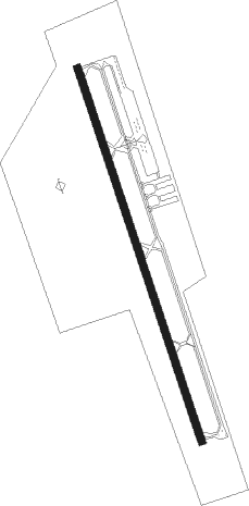
Sherman - Sherman Muni
Airport details
| Country | United States of America |
| State | Texas |
| Region | K4 |
| Airspace | Ft Worth Ctr |
| Municipality | Sherman |
| Elevation | 746ft (227m) |
| Timezone | GMT -6 |
| Coordinates | 33.62414, -96.58614 |
| Magnetic var | |
| Type | land |
| Available since | X-Plane v10.40 |
| ICAO code | KSWI |
| IATA code | n/a |
| FAA code | SWI |
Communication
| Sherman Muni CTAF/UNICOM | 122.800 |
Nearby Points of Interest:
Paul Brown Federal Building and United States Courthouse
-Sam Rayburn House Museum
-State Highway No. 78 Bridge at the Red River
-Robert E. Lee School
-Durant Downtown Historic District
-Bryan County Courthouse
-Oklahoma Presbyterian College
-Heard-Craig House
-Marshall County Courthouse
-Farmersville Masonic Lodge No. 214, A.F. and A.M.
-Allen Water Station
-Love County Jail and Sheriff's Residence
-Love County Courthouse
Nearby beacons
| code | identifier | dist | bearing | frequency |
|---|---|---|---|---|
| DNI | DENISON (SHERMAN-DENISON) NDB | 12.8 | 338° | 341 |
| BYP | BONHAM VORTAC | 18.3 | 104° | 114.60 |
| URH | (DURANT) DME | 21.5 | 31° | 114.30 |
| DT | PINCK (DENTON) NDB | 36.7 | 241° | 257 |
| GV | MAJOR (GREENVILLE) NDB | 38.4 | 132° | 201 |
| AI | ADDMO (ARDMORE) NDB | 40.4 | 330° | 400 |
| MJF | ARVILLA (GREENVILLE) TACAN | 42.6 | 137° | 109.60 |
| ADM | ARDMORE VORTAC | 45.6 | 315° | 116.70 |
| CVE | COWBOY (DALLAS) VOR/DME | 46.8 | 203° | 116.20 |
| PQF | MESQUITE NDB | 49 | 176° | 248 |
| TTT | MAVERICK VOR/DME | 50.7 | 211° | 113.10 |
| FUZ | RANGER (DALLAS-FORT WORTH VORTAC | 53.2 | 219° | 115.70 |
| FT | MUFIN (FORT WORTH) NDB | 59 | 227° | 365 |
| NFW | NAS JRB FORT WORTH (FT WO TACAN | 66.7 | 225° | 108.70 |
Instrument approach procedures
| runway | airway (heading) | route (dist, bearing) |
|---|---|---|
| RW16 | ADM (135°) | ADM EMWUK (29mi, 129°) 3000ft CEYAR (7mi, 121°) 3000ft |
| RW16 | BYP (284°) | BYP CEYAR (26mi, 304°) 3000ft CEYAR (turn) 3000ft |
| RW16 | URH (211°) | URH WIVBI (10mi, 261°) 3000ft CEYAR (7mi, 210°) 3000ft |
| RNAV | CEYAR 3000ft ZOKTO (6mi, 163°) 2400ft KSWI (5mi, 163°) 791ft (5734mi, 109°) 1146ft URH (5723mi, 289°) 3000ft URH (turn) | |
| RW34 | BYP (284°) | BYP YAYUN (16mi, 251°) 3000ft YAYUN (turn) 3000ft |
| RW34 | WILBR (304°) | WILBR YAYUN (12mi, 273°) 3000ft |
| RNAV | YAYUN 3000ft WAMGE (6mi, 344°) 2400ft OMOGY (3mi, 344°) 1420ft KSWI (2mi, 343°) 757ft (5734mi, 109°) 1060ft CEYAR (5736mi, 289°) 3000ft CEYAR (turn) |
Disclaimer
The information on this website is not for real aviation. Use this data with the X-Plane flight simulator only! Data taken with kind consent from X-Plane 12 source code and data files. Content is subject to change without notice.