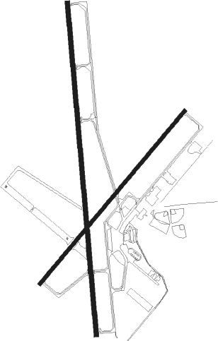
Stillwater - Stillwater Rgnl
Airport details
| Country | United States of America |
| State | Oklahoma |
| Region | K4 |
| Airspace | Kansas City Ctr |
| Municipality | Stillwater |
| Elevation | 1000ft (305m) |
| Timezone | GMT -6 |
| Coordinates | 36.16139, -97.08589 |
| Magnetic var | |
| Type | land |
| Available since | X-Plane v10.40 |
| ICAO code | KSWO |
| IATA code | SWO |
| FAA code | SWO |
Communication
| STILLWATER RGNL ASOS | 135.725 |
| STILLWATER RGNL CTAF/UNICOM | 122.700 |
| STILLWATER RGNL CTAF/UNICOM | 125.350 |
| STILLWATER RGNL Ground Control | 121.600 |
| STILLWATER RGNL Tower | 125.350 |
Approach frequencies
| ILS-cat-I | RW17 | 109.15 | 18.00mi |
| 3° GS | RW17 | 109.15 | 18.00mi |
Nearby Points of Interest:
Cottonwood Community Center
-Josephine Reifsnyder Lustron House
-Old Central
-Magruder Plots
-Oklahoma A & M College Agronomy Barn and Seed House
-Campus Fire Station
-James E. Berry House
-Payne County Courthouse
-Selph Building
-Hoke Building
-Walker Building
-William Frick House
-Stillwater Santa Fe Depot
-Morrison Baptist Church
-First National Bank and Trust Company Building
-Noble County Courthouse
-Perry Courthouse Square Historic District
-Wolleson–Nicewander Building
-Perry Armory
-Jim Thorpe House
-Pawnee Bill Ranch
-Arkansas Valley National Bank
-Pawnee County Courthouse
-Pawnee Armory
-Pawnee Agency and Boarding School Historic District

Nearby beacons
| code | identifier | dist | bearing | frequency |
|---|---|---|---|---|
| SWO | STILLWATER VOR/DME | 3.7 | 4° | 108.40 |
| SW | BLAKI (STILLWATER) NDB | 4.4 | 359° | 255 |
| EI | GARFY (ENID) NDB | 34.8 | 279° | 341 |
| PER | PIONEER (PONCA CITY) VORTAC | 35.3 | 353° | 113.20 |
| ODG | WOODRING (ENID) VOR/DME | 36.3 | 287° | 109 |
| PN | PONCA (PONCA CITY) NDB | 39.8 | 359° | 515 |
| END | VANCE (ENID) VORTAC | 41.7 | 282° | 115.40 |
| TIK | TINKER (OKLAHOMA CITY) TACAN | 45.8 | 202° | 115.80 |
| PWA | WILEY POST (OKLAHOMA CITY VOR/DME | 46.5 | 222° | 113.40 |
| IFI | KINGFISHER VORTAC | 49.4 | 249° | 114.70 |
| IRW | WILL ROGERS (OKLAHOMA CIT VORTAC | 54.5 | 213° | 114.10 |
| SRE | SEMINOLE NDB | 57 | 155° | 278 |
| RG | GALLY (OKLAHOMA CITY) NDB | 57.5 | 210° | 350 |
Instrument approach procedures
| runway | airway (heading) | route (dist, bearing) |
|---|---|---|
| RW17 | ACOKO (179°) | ACOKO 3000ft |
| RW17 | ALCOR (134°) | ALCOR ACOKO (12mi, 102°) 3000ft |
| RW17 | CALVA (212°) | CALVA ACOKO (15mi, 232°) 3000ft |
| RNAV | ACOKO 3000ft OSUYU (6mi, 179°) 2300ft KSWO (5mi, 179°) 1048ft (5748mi, 110°) 1200ft ESCOM (5749mi, 290°) 3000ft ESCOM (turn) | |
| RW35 | ESCOM (360°) | ESCOM 3000ft |
| RW35 | TOTES (345°) | TOTES ESCOM (14mi, 333°) 3000ft |
| RW35 | TRUMP (29°) | TRUMP ESCOM (11mi, 55°) 3000ft |
| RNAV | ESCOM 3000ft BADIC (6mi, 359°) 2600ft CUGAC (3mi, 359°) 1640ft KSWO (3mi, 1°) 1006ft (5748mi, 110°) 1166ft ACOKO (5748mi, 291°) 3000ft ACOKO (turn) |
Disclaimer
The information on this website is not for real aviation. Use this data with the X-Plane flight simulator only! Data taken with kind consent from X-Plane 12 source code and data files. Content is subject to change without notice.