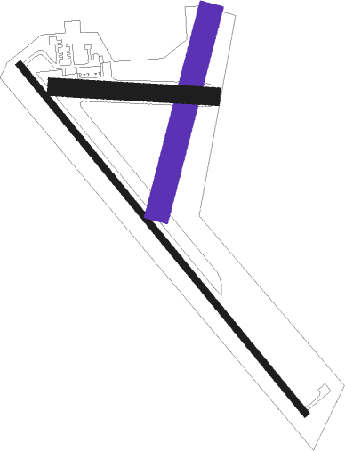
St Francis - Cheyenne Co Muni
Airport details
| Country | United States of America |
| State | Kansas |
| Region | K3 |
| Airspace | Denver Ctr |
| Municipality | Cheyenne County |
| Elevation | 3411ft (1040m) |
| Timezone | GMT -6 |
| Coordinates | 39.75985, -101.79488 |
| Magnetic var | |
| Type | land |
| Available since | X-Plane v10.40 |
| ICAO code | KSYF |
| IATA code | n/a |
| FAA code | SYF |
Communication
| Cheyenne Co Muni AWOS 3 | 118.925 |
| Cheyenne Co Muni CTAF/UNICOM | 122.800 |
Nearby Points of Interest:
Cheyenne County Courthouse
-Howard T. Sawhill City Park
-Henry Hickert Building
-Beecher Island
-Minor Sod House
-Dundy County Courthouse
-Goodland City Library
-Mary Seaman Ennis House
-Ruleton School
Nearby beacons
| code | identifier | dist | bearing | frequency |
|---|---|---|---|---|
| SYF | SAINT FRANCIS NDB | 2.3 | 138° | 386 |
| GLD | GOODLAND VORTAC | 22.8 | 165° | 115.10 |
| GL | SHUGR (GOODLAND) NDB | 29.4 | 157° | 414 |
| JDM | WHEATFIELD (COLBY) NDB | 37.6 | 108° | 408 |
| ITR | KIT CARSON (BURLINGTON) NDB | 38.2 | 224° | 209 |
| HCT | HAYES CENTER VORTAC | 57.7 | 51° | 117.70 |
| OEL | OAKLEY NDB | 59.7 | 123° | 380 |
Instrument approach procedures
| runway | airway (heading) | route (dist, bearing) |
|---|---|---|
| RW14 | WITVO (137°) | WITVO 6800ft |
| RNAV | WITVO 6800ft ZAKEL (7mi, 138°) 5200ft ZUDIN (3mi, 138°) 4240ft KSYF (3mi, 136°) 3441ft (5948mi, 111°) 3662ft DIPME (5942mi, 291°) 6800ft DIPME (turn) 6800ft | |
| RW32 | DIPME (318°) | DIPME 6800ft |
| RW32 | RAZED (346°) | RAZED DIPME (7mi, 42°) 6800ft |
| RW32 | ZIRPO (295°) | ZIRPO DIPME (7mi, 258°) 6800ft |
| RNAV | DIPME 6800ft CATAX (8mi, 318°) 5200ft HUDGO (3mi, 318°) 4300ft KSYF (3mi, 319°) 3480ft (5948mi, 111°) 3680ft WITVO (5954mi, 291°) 6800ft WITVO (turn) |
Disclaimer
The information on this website is not for real aviation. Use this data with the X-Plane flight simulator only! Data taken with kind consent from X-Plane 12 source code and data files. Content is subject to change without notice.

