Sylvester
Airport details
| Country | United States of America |
| State | Georgia |
| Region | K7 |
| Airspace | Jacksonville Ctr |
| Municipality | Worth County |
| Elevation | 401ft (122m) |
| Timezone | GMT -5 |
| Coordinates | 31.55639, -83.89417 |
| Magnetic var | |
| Type | land |
| Available since | X-Plane v10.40 |
| ICAO code | KSYV |
| IATA code | SYV |
| FAA code | SYV |
Communication
| Sylvester CTAF/UNICOM | 122.800 |
Nearby Points of Interest:
Sylvester Local News
-Worth County Courthouse
-U.S. Post Office
-Poulan Library
-Possum Poke
-Sumner High School and auditorium
-Bridge House
-Heritage Plaza
-Rosenberg Brothers Department Store
-Nelson Tift Building
-Albany Theatre
-Albany Municipal Auditorium
-Samuel Farkas House
-United States Post Office and Courthouse
-John A. Davis House
-Turner County Courthouse
-Turner County Jail
-George W. Jackson House
-Lee County Courthouse
-Leesburg Depot
-South Railroad Historic District
-James W. Coleman House
-Tifton Commercial Historic District
-Tifton Residential Historic District
-Tift County Courthouse
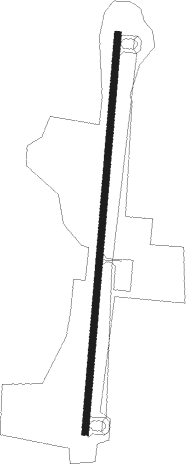
Runway info
| Runway 1 / 19 | ||
| length | 1381m (4531ft) | |
| bearing | 11° / 191° | |
| width | 23m (75ft) | |
| surface | asphalt | |
| blast zone | 54m (177ft) / 46m (151ft) | |
Nearby beacons
| code | identifier | dist | bearing | frequency |
|---|---|---|---|---|
| PZD | PECAN (ALBANY) VOR/DME | 21.2 | 284° | 116.10 |
| IFM | TIFT MYERS (TIFTON) VOR | 22.1 | 107° | 112.50 |
| OHY | CONEY (CORDELE) NDB | 26.5 | 4° | 400 |
| MGR | DME | 28.8 | 169° | 108.80 |
| SUR | FITZGERALD NDB | 31 | 85° | 362 |
| GTP | PATON (THOMASVILLE) NDB | 36.1 | 174° | 245 |
| ACJ | SOUTHER (AMERICUS) NDB | 36.5 | 332° | 242 |
| LKG | LINDBERGH (AMERICUS) NDB | 38.6 | 341° | 242 |
| CYR | CAIDY (CAIRO) NDB | 42.3 | 202° | 338 |
| VNA | VIENNA VORTAC | 44.3 | 31° | 116.50 |
| LYZ | WILLIS (BAINBRIDGE) NDB | 47.7 | 227° | 359 |
| IZS | MONTEZUMA NDB | 49 | 352° | 426 |
| OWC | COFFEE COUNTY (DOUGLAS) NDB | 50.5 | 99° | 390 |
| VAD | MOODY (VALDOSTA) TACAN | 50.7 | 130° | 113.30 |
| EZM | EASTMAN NDB | 51.1 | 52° | 366 |
| OTK | VALDOSTA VOR/DME | 56.2 | 142° | 114.80 |
| DB | CREKE (DUBLIN) NDB | 71.5 | 44° | 251 |
Disclaimer
The information on this website is not for real aviation. Use this data with the X-Plane flight simulator only! Data taken with kind consent from X-Plane 12 source code and data files. Content is subject to change without notice.