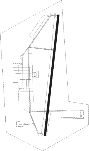
Knob Noster - Whiteman Afb
Airport details
| Country | United States of America |
| State | Missouri |
| Region | K3 |
| Airspace | Kansas City Ctr |
| Municipality | Johnson County |
| Elevation | 870ft (265m) |
| Timezone | GMT -6 |
| Coordinates | 38.73030, -93.54787 |
| Magnetic var | |
| Type | land |
| Available since | X-Plane v10.40 |
| ICAO code | KSZL |
| IATA code | SZL |
| FAA code | SZL |
Communication
| Whiteman AFB Clearance DEL | 121.750 |
| Whiteman AFB Ground Control | 128.275 |
| Whiteman AFB Tower | 132.400 |
| Whiteman AFB Approach | 127.450 |
| Whiteman AFB Departure | 125.925 |
Approach frequencies
| ILS-cat-I | RW19 | 108.5 | 18.00mi |
| ILS-cat-I | RW01 | 110.3 | 18.00mi |
| 2.8° GS | RW01 | 110.3 | 18.00mi |
| 2.5° GS | RW19 | 108.5 | 18.00mi |
Nearby beacons
| code | identifier | dist | bearing | frequency |
|---|---|---|---|---|
| SZL | WHITEMAN (KNOB NOSTER) TACAN | 0.3 | 335° | 109.80 |
| ANX | NAPOLEON VORTAC | 34.8 | 302° | 114 |
| BUM | BUTLER VORTAC | 52 | 244° | 115.90 |
| BQS | BRAYMER VOR/DME | 56.1 | 340° | 115.35 |
| SHY | SUNSHINE (KAISER) VOR/DME | 60.7 | 126° | 108.40 |
Instrument approach procedures
| runway | airway (heading) | route (dist, bearing) |
|---|---|---|
| RW01 | BEEAN (14°) | BEEAN 3000ft |
| RNAV | BEEAN 3000ft CAARP (7mi, 14°) 2500ft KSZL (6mi, 14°) 888ft (5571mi, 112°) 1271ft SKIDD (5568mi, 293°) 3000ft SKIDD (turn) 9000ft | |
| RW19 | SKIDD (194°) | SKIDD 3000ft |
| RNAV | SKIDD 3000ft CHOSE (6mi, 194°) 2500ft KSZL (7mi, 194°) 918ft (5571mi, 112°) 1260ft BEEAN (5574mi, 292°) 3000ft BEEAN (turn) 9000ft |
Disclaimer
The information on this website is not for real aviation. Use this data with the X-Plane flight simulator only! Data taken with kind consent from X-Plane 12 source code and data files. Content is subject to change without notice.
