Sandpoint
Airport details
| Country | United States of America |
| State | Idaho |
| Region | K1 |
| Airspace | Seattle Ctr |
| Municipality | Sandpoint |
| Elevation | 2129ft (649m) |
| Timezone | GMT -8 |
| Coordinates | 48.29953, -116.56014 |
| Magnetic var | |
| Type | land |
| Available since | X-Plane v10.40 |
| ICAO code | KSZT |
| IATA code | n/a |
| FAA code | SZT |
Communication
| Sandpoint AWOS 3 | 135.425 |
| Sandpoint CTAF/UNICOM | 122.700 |
Approach frequencies
| LOC | RW02 | 109.1 | 18.00mi |
Nearby Points of Interest:
Amanda Nesbitt House
-Sandpoint Historic District
-Dover Church
-Priest River Commercial Core Historic District
-Dr. John and Viola Phillips House and Office
-Russell and Pearl Soderling House
-Boundary County Courthouse
-Bonners Ferry Main Post Office
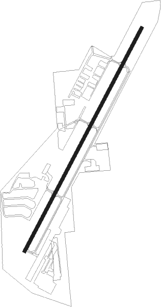
Runway info
| Runway 2 / 20 | ||
| length | 1679m (5509ft) | |
| bearing | 43° / 223° | |
| width | 23m (75ft) | |
| surface | asphalt | |
Nearby beacons
| code | identifier | dist | bearing | frequency |
|---|---|---|---|---|
| SZT | SANDPOE (SANDPOINT) NDB | 0.5 | 199° | 264 |
| COE | COEUR D'ALENE VOR/DME | 33.2 | 206° | 108.80 |
| DPY | DEER PARK NDB | 40 | 249° | 365 |
| ION | IONE NDB | 41.9 | 296° | 379 |
| MLP | MULLAN PASS VOR/DME | 62.5 | 133° | 117.80 |
Instrument approach procedures
| runway | airway (heading) | route (dist, bearing) |
|---|---|---|
| RW20-Y | AGUMY (109°) | AGUMY BILOE (21mi, 143°) 8000ft CAPGO (13mi, 82°) 8000ft DOATS (13mi, 23°) 6700ft ELLRA (6mi, 289°) 5100ft |
| RW20-Y | CESIG (349°) | CESIG CAPGO (13mi, 23°) 8000ft DOATS (13mi, 23°) 6700ft ELLRA (6mi, 289°) 5100ft |
| RW20-Y | DIANN (78°) | DIANN BILOE (18mi, 95°) 8000ft CAPGO (13mi, 82°) 8000ft DOATS (13mi, 23°) 6700ft ELLRA (6mi, 289°) 5100ft |
| RNAV | ELLRA 5100ft FAPIK (4mi, 223°) 3800ft KSZT (4mi, 223°) 2184ft (6444mi, 113°) 2531ft BILOE (6454mi, 292°) 6600ft BILOE (turn) 6600ft | |
| RW20-Z | AGUMY (109°) | AGUMY BILOE (21mi, 143°) 8000ft CAPGO (13mi, 82°) 8000ft DOATS (13mi, 23°) 6700ft ELLRA (6mi, 289°) 5100ft |
| RW20-Z | CESIG (349°) | CESIG CAPGO (13mi, 23°) 8000ft DOATS (13mi, 23°) 6700ft ELLRA (6mi, 289°) 5100ft |
| RW20-Z | DIANN (78°) | DIANN BILOE (18mi, 95°) 8000ft CAPGO (13mi, 82°) 8000ft DOATS (13mi, 23°) 6700ft ELLRA (6mi, 289°) 5100ft |
| RNAV | ELLRA 5100ft FAPIK (4mi, 223°) 3800ft GARRT (turn) 3380ft HAKUP (1mi, 223°) 2820ft KSZT (2mi, 223°) 2184ft (6444mi, 113°) 2520ft BILOE (6454mi, 292°) 6600ft BILOE (turn) 6600ft | |
| RWNVB | CLASS (317°) | CLASS CESIG (15mi, 285°) 8400ft CELUS (13mi, 294°) 6900ft |
| RWNVB | DIANN (78°) | DIANN CELUS (17mi, 102°) 6900ft |
| RWNVB | KARPS (19°) | KARPS CELUS (20mi, 357°) 6900ft |
| RNAV | CELUS 6900ft FEPMI (5mi, 43°) 6000ft FINTA (5mi, 43°) 4900ft KSZT (6mi, 43°) 2183ft (6444mi, 113°) 5800ft CESIG (6449mi, 292°) 7900ft CESIG (turn) |
Disclaimer
The information on this website is not for real aviation. Use this data with the X-Plane flight simulator only! Data taken with kind consent from X-Plane 12 source code and data files. Content is subject to change without notice.