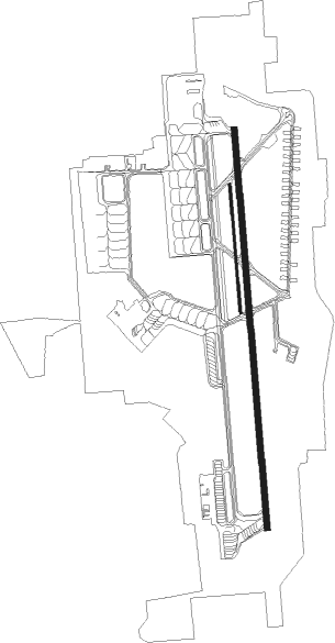
Tacoma - Mcchord Afb
Airport details
| Country | United States of America |
| State | Washington |
| Region | K1 |
| Airspace | Seattle Ctr |
| Municipality | Pierce County |
| Elevation | 317ft (97m) |
| Timezone | GMT -8 |
| Coordinates | 47.13768, -122.47648 |
| Magnetic var | |
| Type | land |
| Available since | X-Plane v10.40 |
| ICAO code | KTCM |
| IATA code | TCM |
| FAA code | TCM |
Communication
| McChord AFB Ground Control | 125.150 |
| McChord AFB Tower | 124.800 |
| McChord AFB SEATTLE Approach/Departure | 126.500 |
Approach frequencies
| ILS-cat-II | RW34 | 108.5 | 18.00mi |
| ILS-cat-I | RW16 | 109.9 | 18.00mi |
| 3° GS | RW16 | 109.9 | 18.00mi |
| 3° GS | RW34 | 108.5 | 18.00mi |
Nearby Points of Interest:
Rhodesleigh
-Thornewood
-Tacoma Mausoleum
-Fort Steilacoom
-Engine House No. 8
-Engine House No. 11
-Lewis Army Museum
-Engine House No. 4
-Albers Brothers Mill
-Union Station
-Nihon Go Gakko
-DuPont Village Historic District
-Luzon Building
-National Bank of Tacoma
-Pythian Temple
-Old City Hall Historic District
-Fireboat Station
-Old City Hall
-Northern Pacific Office Building
-North Slope
-Stadium District
-Rhodes House
-William Ross Rust House
-Engine House No. 13
-Tacoma Narrows Bridge

Nearby beacons
| code | identifier | dist | bearing | frequency |
|---|---|---|---|---|
| TCM | MC CHORD (TACOMA) TACAN | 0.6 | 8° | 109.60 |
| SEA | SEATTLE VORTAC | 19.1 | 29° | 116.80 |
| OLM | OLYMPIA VORTAC | 20 | 249° | 113.40 |
| PAE | PAINE (EVERETT) VOR/DME | 47.6 | 14° | 110.60 |
| AW | WATON (ARLINGTON) NDB | 57.8 | 19° | 382 |
Departure and arrival routes
| Transition altitude | 18000ft |
| Transition level | 18000ft |
| SID end points | distance | outbound heading | |
|---|---|---|---|
| RW16 | |||
| MOCAA3 | 48mi | 155° | |
| ALDER2 | 19mi | 169° | |
| RW34 | |||
| MOCAA3 | 48mi | 155° | |
| ALDER2 | 19mi | 169° | |
| STAR starting points | distance | inbound heading | |
|---|---|---|---|
| ALL | |||
| ARRIE7 | 60.2 | 127° | |
| RW16 | |||
| JAWBN6 | 55.7 | 158° | |
| GLASR1 | 54.8 | 226° | |
| ELN3 | 14.5 | 301° | |
| WHYTE6 | 28.2 | 319° | |
| ADYMS2 | 24.5 | 327° | |
| RW34 | |||
| JAWBN6 | 55.7 | 158° | |
| GLASR1 | 54.8 | 226° | |
| ELN3 | 14.5 | 301° | |
| WHYTE6 | 28.2 | 319° | |
| ADYMS2 | 24.5 | 327° | |
Instrument approach procedures
| runway | airway (heading) | route (dist, bearing) |
|---|---|---|
| RW34 | ALDER (349°) | ALDER 4000ft RIMOE (7mi, 331°) 4000ft |
| RW34 | MCKEN (18°) | MCKEN 4000ft RIMOE (5mi, 54°) 4000ft |
| RNAV | RIMOE 4000ft SPAAN (7mi, 360°) 1800ft KTCM (5mi, 360°) 380ft ZOSAV (4mi, 360°) 4000ft ZOSAV (turn) 6000ft |
Holding patterns
| STAR name | hold at | type | turn | heading* | altitude | leg | speed limit |
|---|---|---|---|---|---|---|---|
| GLASR1 | JAKSN | VHF | right | 75 (255)° | < 17999ft | 1.0min timed | ICAO rules |
| GLASR1 | LOSTT | VHF | right | 42 (222)° | < 17999ft | 1.0min timed | ICAO rules |
| GLASR1 | TEMPL | VHF | right | 77 (257)° | 18000ft - 45000ft | 1.5min timed | ICAO rules |
| JAWBN6 | JAWBN | VHF | right | 310 (130)° | < 17999ft | 1.0min timed | ICAO rules |
| *) magnetic outbound (inbound) holding course | |||||||
Disclaimer
The information on this website is not for real aviation. Use this data with the X-Plane flight simulator only! Data taken with kind consent from X-Plane 12 source code and data files. Content is subject to change without notice.