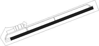
Toledo - South Lewis Co
Airport details
| Country | United States of America |
| State | Washington |
| Region | K1 |
| Airspace | Seattle Ctr |
| Municipality | Lewis County |
| Elevation | 354ft (108m) |
| Timezone | GMT -8 |
| Coordinates | 46.47717, -122.80648 |
| Magnetic var | |
| Type | land |
| Available since | X-Plane v10.40 |
| ICAO code | KTDO |
| IATA code | TDO |
| FAA code | TDO |
Communication
| South Lewis Co CTAF | 122.900 |
Nearby Points of Interest:
Claquato Church
-Centralia Downtown Historic District
-Holy Cross Polish National Catholic Church
-Longview Community Church-Saint Helen's Addition
-Miller–Brewer House
-Tenino Stone Company Quarry
-Tenino Downtown Historic District
-Gate School
-Millersylvania State Park
-Mima Mounds
Nearby beacons
| code | identifier | dist | bearing | frequency |
|---|---|---|---|---|
| OLM | OLYMPIA VORTAC | 29.9 | 349° | 113.40 |
| TCM | MC CHORD (TACOMA) TACAN | 42.5 | 26° | 109.60 |
| BTG | BATTLE GROUND VORTAC | 44.7 | 164° | 116.60 |
| PND | BANKS (PORTLAND) NDB | 51.8 | 196° | 356 |
| CBU | COLUMBIA (PORTLAND) TACAN | 53.9 | 168° | 109.20 |
| SEA | SEATTLE VORTAC | 61 | 27° | 116.80 |
Departure and arrival routes
| Transition altitude | 18000ft |
| Transition level | 18000ft |
| SID end points | distance | outbound heading | |
|---|---|---|---|
| RW06 | |||
| ATASY2 | 13mi | 260° | |
| RW24 | |||
| ATASY2 | 13mi | 260° | |
Instrument approach procedures
| runway | airway (heading) | route (dist, bearing) |
|---|---|---|
| RW06 | AST (74°) | AST HEMZO (34mi, 71°) 4700ft EYNAM (3mi, 78°) 3900ft |
| RW06 | CETUV (103°) | CETUV HEMZO (14mi, 132°) 4700ft EYNAM (3mi, 78°) 3900ft |
| RW06 | LOATH (29°) | LOATH HEMZO (24mi, 348°) 4700ft EYNAM (3mi, 78°) 3900ft |
| RW06 | WINLO (86°) | WINLO HEMZO (3mi, 222°) 4700ft HEMZO (turn) 4700ft EYNAM (3mi, 78°) 3900ft |
| RNAV | EYNAM 3900ft ASAXE (3mi, 78°) 3100ft FIFDE (5mi, 79°) 1360ft KTDO (3mi, 79°) 406ft COKAM (4mi, 79°) TONNO (13mi, 327°) 5000ft TONNO (turn) | |
| RW24 | ALDER (229°) | ALDER FISUS (16mi, 172°) 6300ft |
| RW24 | COUGA (341°) | COUGA FISUS (31mi, 33°) 6300ft FISUS (turn) 6300ft |
| RW24 | TOUTL (330°) | TOUTL FISUS (33mi, 17°) 6800ft FISUS (turn) 6300ft |
| RNAV | FISUS 6300ft HEGMU (3mi, 259°) 5300ft COXER (4mi, 259°) 4200ft KTDO (12mi, 259°) 427ft (6721mi, 111°) 685ft HEMZO (6735mi, 291°) HEVOL (18mi, 270°) 5000ft HEVOL (turn) |
Disclaimer
The information on this website is not for real aviation. Use this data with the X-Plane flight simulator only! Data taken with kind consent from X-Plane 12 source code and data files. Content is subject to change without notice.
