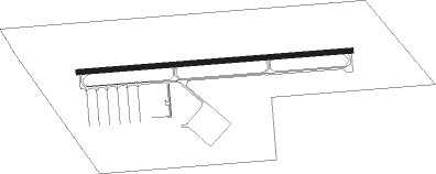
Mason - Mason Jewett Fld
Airport details
| Country | United States of America |
| State | Michigan |
| Region | K5 |
| Airspace | Cleveland Ctr |
| Municipality | Vevay Township |
| Elevation | 917ft (280m) |
| Timezone | GMT -5 |
| Coordinates | 42.56578, -84.42319 |
| Magnetic var | |
| Type | land |
| Available since | X-Plane v10.40 |
| ICAO code | KTEW |
| IATA code | n/a |
| FAA code | TEW |
Communication
| Mason Jewett Fld AWOS 3 | 119.425 |
| Mason Jewett Fld CTAF/UNICOM | 122.700 |
| Mason Jewett Fld LANSING Approach/Departure | 118.650 |
Nearby Points of Interest:
John Raynor House
-Ingham County Courthouse
-Ash Street-Sycamore Creek Bridge
-Merrylees-Post House
-Philip Nice House
-Michigan Central Railroad Mason Depot
-Somerville Barn
-Eustace Hall
-Toumey Woods
-Goetsch-Winckler House
-St. Katherine's Chapel
-Masonic Temple Building
-Isaac N. Reynolds House
-Central School
-Michigan State Medical Society Building
-Union Depot
-J.W. Knapp Company Building
-Strand Theatre and Arcade
-Elliott-Larsen Building
-Boji Tower
-Charles E. Chamberlain Federal Building & Post Office
-Ottawa Street Power Station
-Lansing Woman's Club Building
-Michigan Millers Mutual Fire Insurance Company Building
Nearby beacons
| code | identifier | dist | bearing | frequency |
|---|---|---|---|---|
| JXN | DME | 18.4 | 187° | 115.45 |
| LFD | LITCHFIELD VOR/DME | 33.8 | 214° | 111.20 |
| BT | BATOL (BATTLE CREEK) NDB | 35.8 | 255° | 272 |
| SVM | SALEM VORTAC | 37.9 | 101° | 114.30 |
| FNT | FLINT VORTAC | 38.3 | 59° | 116.90 |
| TCU | TECUMSEH NDB | 39.8 | 135° | 239 |
| PSI | DME | 40.1 | 81° | 111 |
| ADG | ADRIAN NDB | 44.5 | 154° | 278 |
| GR | KNOBS (GRAND RAPIDS) NDB | 46.5 | 289° | 263 |
| DT | REVUP (DETROIT) NDB | 51.5 | 114° | 388 |
| CRL | CARLETON VOR/DME | 52.9 | 118° | 115.70 |
| MB | OLSTE (SAGINAW) NDB | 54.8 | 15° | 257 |
| MBS | SAGINAW VOR/DME | 59.9 | 20° | 112.90 |
| TOL | TOLEDO TACAN | 64.6 | 147° | 112.50 |
Instrument approach procedures
| runway | airway (heading) | route (dist, bearing) |
|---|---|---|
| RW10 | WULOM (90°) | WULOM 3000ft |
| RNAV | WULOM 3000ft YIPUY (5mi, 90°) 2400ft EYUZU (2mi, 90°) 1660ft KTEW (3mi, 90°) 959ft (5159mi, 117°) 1300ft UJEXY (5149mi, 297°) 3000ft UJEXY (turn) | |
| RW28 | UJEXY (270°) | UJEXY 3000ft |
| RNAV | UJEXY 3000ft WEXUS (5mi, 270°) 2500ft ZEGUG (3mi, 270°) 1580ft KTEW (2mi, 270°) 955ft (5159mi, 117°) 1300ft YIPUY (5163mi, 297°) LESSY (8mi, 188°) 3000ft LESSY (turn) |
Disclaimer
The information on this website is not for real aviation. Use this data with the X-Plane flight simulator only! Data taken with kind consent from X-Plane 12 source code and data files. Content is subject to change without notice.