Tullahoma - Tullahoma Regl Wm Northern Fld
Airport details
| Country | United States of America |
| State | Tennessee |
| Region | K7 |
| Airspace | Memphis Ctr |
| Municipality | Tullahoma |
| Elevation | 1082ft (330m) |
| Timezone | GMT -6 |
| Coordinates | 35.38003, -86.24635 |
| Magnetic var | |
| Type | land |
| Available since | X-Plane v10.40 |
| ICAO code | KTHA |
| IATA code | THA |
| FAA code | THA |
Communication
| Tullahoma Regl Wm Northern Fld AWOS 3 | 128.325 |
| Tullahoma Regl Wm Northern Fld CTAF/UNICOM | 123.000 |
Approach frequencies
| SDF | RW18 | 110.9 | 18.00mi |
Nearby Points of Interest:
Absalom Lowe Landis House
-Green-Evans House
-Arnold Air Force Base
-Bobo Hotel
-Lynchburg Historic District
-Coffee County Courthouse
-Asia School
-Gov. Prentice Cooper House
-Winston Evans House
-Frierson-Coble House
-Fly Manufacturing Company Building
-Old Bedford County Jail
-Whitaker-Motlow House
-Martin House
-Grassland Farm
-Estill-Fite House
-Haynes House
-Franklin County Courthouse
-Cowan Tunnel
-Sewanee Fire Lookout Tower
-McDonald-Bolner House
-Borden Milk Plant
-Hugh Bright Douglas House
-Northcutt Plantation
-Logan Henderson Farm
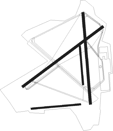
Runway info
Runway 18 / 36  | ||
| length | 1528m (5013ft) | |
| bearing | 180° / 360° | |
| width | 46m (150ft) | |
| surface | concrete | |
| displ threshold | 0m (0ft) / 245m (804ft) | |
| Runway 6 / 24 | ||
| length | 1679m (5509ft) | |
| bearing | 63° / 243° | |
| width | 46m (150ft) | |
| surface | asphalt | |
| displ threshold | 0m (0ft) / 152m (499ft) | |
| Runway 09 / 27 | ||
| length | 825m (2707ft) | |
| bearing | 90° / 270° | |
| width | 30m (100ft) | |
| surface | grass | |
| blast zone | 0m (0ft) / 22m (72ft) | |
| Runway 18R / 36L | ||
| length | 642m (2106ft) | |
| bearing | 180° / 360° | |
| width | 30m (98ft) | |
| surface | grass | |
Nearby beacons
| code | identifier | dist | bearing | frequency |
|---|---|---|---|---|
| SYI | SHELBYVILLE VOR/DME | 14.4 | 313° | 113.55 |
| FQW | WALTER HILL (MURFREESBORO) NDB | 35.4 | 348° | 371 |
| RQZ | ROCKET (HUNTSVILLE) VORTAC | 39.8 | 214° | 112.20 |
| HEM | HUCHN NDB | 48.6 | 47° | 233 |
| BNA | NASHVILLE VORTAC | 50.2 | 330° | 114.10 |
| DCU | DME | 55.6 | 223° | 112.80 |
Instrument approach procedures
| runway | airway (heading) | route (dist, bearing) |
|---|---|---|
| RW06 | ATWUS (62°) | ATWUS EXEGE (5mi, 60°) 3000ft |
| RW06 | EXEGE (63°) | EXEGE 6000ft EXEGE (turn) 3000ft |
| RW06 | SYI (133°) | SYI FOVEK (13mi, 212°) 3000ft EXEGE (8mi, 127°) 3000ft |
| RNAV | EXEGE 3000ft DACNA (6mi, 63°) 2700ft JAROL (3mi, 63°) 1820ft KTHA (3mi, 65°) 1125ft (5221mi, 112°) 1334ft IDEYA (5212mi, 292°) 3500ft IDEYA (turn) | |
| RW18 | LOYSI (181°) | LOYSI 3000ft |
| RW18 | NOGIC (281°) | NOGIC WAKEE (20mi, 330°) 4200ft LOYSI (9mi, 251°) 3000ft |
| RW18 | PECON (148°) | PECON LOYSI (7mi, 106°) 3000ft |
| RNAV | LOYSI 3000ft TETCO (6mi, 180°) 2500ft ALORE (2mi, 180°) 1780ft KTHA (3mi, 184°) 1124ft (5221mi, 112°) 1433ft KOJAK (5221mi, 292°) 3400ft KOJAK (turn) | |
| RW24 | FOSUL (210°) | FOSUL IDEYA (8mi, 154°) 3500ft |
| RW24 | IDEYA (242°) | IDEYA 3500ft |
| RW24 | NOGIC (281°) | NOGIC KELPY (7mi, 335°) 3600ft IDEYA (6mi, 303°) 3500ft |
| RNAV | IDEYA 3500ft HUSKU (6mi, 243°) 2700ft WASUP (3mi, 243°) 1760ft KTHA (2mi, 240°) 1126ft (5221mi, 112°) 1331ft EXEGE (5231mi, 292°) 3000ft EXEGE (turn) | |
| RW36 | ATWUS (62°) | ATWUS RACSO (9mi, 119°) 3400ft KOJAK (7mi, 73°) 3400ft |
| RW36 | SYI (133°) | SYI KOJAK (24mi, 152°) 3500ft KOJAK (turn) 3400ft |
| RW36 | TOBAY (287°) | TOBAY NONCI (23mi, 265°) 4300ft KOJAK (7mi, 287°) 3400ft |
| RNAV | KOJAK 3400ft WEKSI (6mi, 360°) 2700ft ENIME (3mi, 360°) 1780ft KTHA (2mi, 356°) 1128ft (5221mi, 112°) 1460ft LOYSI (5222mi, 292°) 3000ft LOYSI (turn) |
Disclaimer
The information on this website is not for real aviation. Use this data with the X-Plane flight simulator only! Data taken with kind consent from X-Plane 12 source code and data files. Content is subject to change without notice.