York
Airport details
| Country | United States of America |
| State | Pennsylvania |
| Region | K6 |
| Airspace | New York Ctr |
| Municipality | Jackson Township |
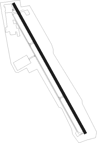
| Elevation | 494ft (151m) |
| Timezone | GMT -5 |
| Coordinates | 39.91700, -76.87302 |
| Magnetic var | |
| Type | land |
| Available since | X-Plane v10.40 |
| ICAO code | KTHV |
| IATA code | THV |
| FAA code | THV |
Communication
| York ASOS | 119.275 |
| York CTAF/UNICOM | 123.000 |
| York HARRISBURG Approach | 124.100 |
| York HARRISBURG Departure | 124.100 |
Nearby Points of Interest:
Spring Grove Borough Historic District
-Swigart's Mill
-Pettit's Ford
-Samuel Stoner Homestead
-Englehart Melchinger House
-East Berlin Historic District
-John Abbott House
-York Iron Company Mine
-West Side Sanitarium
-Howard Tunnel
-Bridge 5+92, Northern Central Railway
-Ashley and Bailey Company Silk Mill
-Hanover Junction Railroad Station
-Stevens School
-Cookes House
-Farmers Market
-United Cigar Manufacturing Company building
-York Meetinghouse
-Bridge in Washington Township
-Forry House
-Barnett Bobb House
-Willis House
-The Nook
-Fairmount Historic District
-Golden Plough Tavern
Nearby beacons
| code | identifier | dist | bearing | frequency |
|---|---|---|---|---|
| CX | LATLE (HARRISBURG) NDB | 16.8 | 333° | 219 |
| MD | ENOLA (HARRISBURG) NDB | 19.8 | 355° | 204 |
| HAR | HARRISBURG VORTAC | 24.8 | 333° | 112.50 |
| EMI | WESTMINSTER VORTAC | 25.8 | 194° | 117.90 |
| LRP | LANCASTER VOR/DME | 29.4 | 71° | 117.30 |
| BZJ | BELLGROVE (INDIANTOWN GAP) NDB | 34.4 | 32° | 328 |
| FND | ELLICOTT (BALTIMORE) NDB | 38 | 171° | 371 |
| FDK | FREDERICK VOR | 38.1 | 225° | 109 |
| RAV | RAVINE VORTAC | 40.2 | 23° | 114.60 |
| MTN | MARTIN (BALTIMORE) TACAN | 41.1 | 142° | 134.10 |
| BAL | BALTIMORE VORTAC | 45.8 | 164° | 115.10 |
| HGR | HAGERSTOWN VOR | 47.2 | 257° | 109.80 |
| BUH | ANNE ARUNDEL (FT MEADE) NDB | 50.2 | 172° | 260 |
| SEG | SELINSGROVE VOR/DME | 52.4 | 359° | 110.40 |
| MRB | MARTINSBURG VORTAC | 55.2 | 241° | 112.10 |
| GTN | GEORGETOWN (WASH., D.C.) NDB | 60.4 | 194° | 323 |
| AML | ARMEL (WASH.,D.C.) VOR/DME | 65.1 | 211° | 113.50 |
| UN | PENUE (STATE COLLEGE) NDB | 71.6 | 319° | 388 |
Instrument approach procedures
| runway | airway (heading) | route (dist, bearing) |
|---|---|---|
| RW17 | ETUVY (184°) | ETUVY WABEP (9mi, 233°) 3300ft |
| RW17 | JEKBI (120°) | JEKBI WABEP (9mi, 86°) 3300ft |
| RW17 | WABEP (149°) | WABEP 3300ft |
| RNAV | WABEP 3300ft AZBIC (6mi, 149°) 2400ft JAYSO (4mi, 149°) 1120ft KTHV (2mi, 149°) 520ft (4803mi, 117°) 895ft WABEP (4809mi, 298°) 3300ft WABEP (turn) | |
| RW35 | LACES (5°) | LACES XOPPA (9mi, 53°) 2800ft |
| RW35 | PAYCO (300°) | PAYCO XOPPA (9mi, 266°) 2800ft |
| RW35 | XOPPA (329°) | XOPPA 2800ft |
| RNAV | XOPPA 2800ft EZUMO (4mi, 329°) 2500ft YOKRI (3mi, 329°) 2000ft HODET (2mi, 329°) 1440ft KTHV (3mi, 329°) 535ft (4803mi, 117°) 895ft WABEP (4809mi, 298°) 3300ft WABEP (turn) |
Disclaimer
The information on this website is not for real aviation. Use this data with the X-Plane flight simulator only! Data taken with kind consent from X-Plane 12 source code and data files. Content is subject to change without notice.