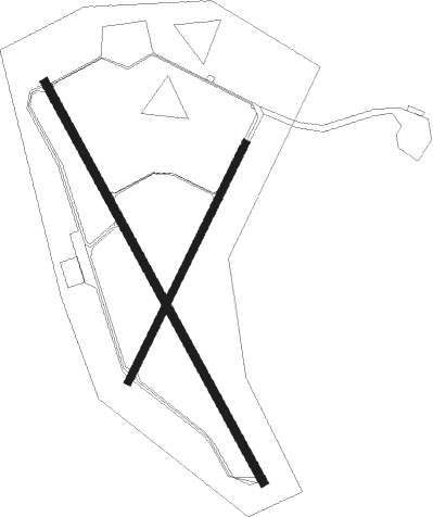
Tillamook
Airport details
| Country | United States of America |
| State | Oregon |
| Region | K1 |
| Airspace | Seattle Ctr |
| Municipality | Tillamook County |
| Elevation | 36ft (11m) |
| Timezone | GMT -8 |
| Coordinates | 45.41825, -123.81439 |
| Magnetic var | |
| Type | land |
| Available since | X-Plane v10.40 |
| ICAO code | KTMK |
| IATA code | OTK |
| FAA code | TMK |
Communication
| TILLAMOOK AWOS 3 | 120.000 |
| TILLAMOOK CTAF/UNICOM | 122.800 |
| TILLAMOOK SEATTLE Approach/Departure | 124.200 |
Nearby Points of Interest:
Mary Frances Isom Cottage
-A. E. Doyle Cottage
-Harry F. Wentz Studio
-Drift Creek Bridge
-Dundee Lodge
Nearby beacons
| code | identifier | dist | bearing | frequency |
|---|---|---|---|---|
| PND | BANKS (PORTLAND) NDB | 34.7 | 75° | 356 |
| UBG | NEWBERG VOR/DME | 35.4 | 94° | 117.40 |
| AST | ASTORIA VOR/DME | 44.7 | 355° | 114 |
| SL | TURNO (SALEM) NDB | 50.1 | 123° | 266 |
| ONP | NEWPORT VORTAC | 51.6 | 196° | 117.10 |
| LWG | LEWISBURG (CORVALLIS) NDB | 53.5 | 146° | 225 |
| CVO | CORVALLIS VOR/DME | 59.4 | 150° | 115.40 |
Departure and arrival routes
| Transition altitude | 18000ft |
| Transition level | 18000ft |
| SID end points | distance | outbound heading | |
|---|---|---|---|
| RW31 | |||
| FETUJ3 | 13mi | 327° | |
Instrument approach procedures
| runway | airway (heading) | route (dist, bearing) |
|---|---|---|
| RW13 | EYCEH (118°) | EYCEH FETUJ (7mi, 72°) 4500ft |
| RW13 | FETUJ (147°) | FETUJ 4500ft |
| RW13 | JEQEF (185°) | JEQEF FETUJ (7mi, 252°) 4500ft |
| RNAV | FETUJ 4500ft INSAJ (6mi, 147°) 2800ft QUCYO (7mi, 147°) 266ft (6786mi, 110°) 439ft ULKAW (6801mi, 290°) 5000ft ULKAW (turn) |
Disclaimer
The information on this website is not for real aviation. Use this data with the X-Plane flight simulator only! Data taken with kind consent from X-Plane 12 source code and data files. Content is subject to change without notice.

