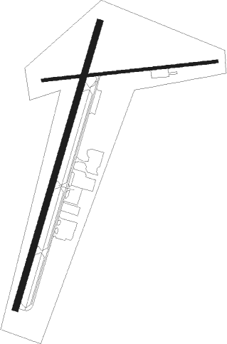
Toccoa - Toccoa Rg Letourneau Fld
Airport details
| Country | United States of America |
| State | Georgia |
| Region | K7 |
| Airspace | Atlanta Ctr |
| Municipality | Toccoa |
| Elevation | 996ft (304m) |
| Timezone | GMT -5 |
| Coordinates | 34.59281, -83.29637 |
| Magnetic var | |
| Type | land |
| Available since | X-Plane v10.40 |
| ICAO code | KTOC |
| IATA code | TOC |
| FAA code | TOC |
Communication
| Toccoa RG Letourneau Fld CTAF/UNICOM | 122.800 |
Nearby Points of Interest:
Stephens County Courthouse
-James B. Simmons House
-Jarrett-Hayes House
-Tallulah Falls School
-Southern Railway Passenger Station
-Henry Asbury House
-Mauldin House
-Retreat Rosenwald School
-Long Creek Academy
-Lavonia-Carnegie Library
-Franklin County Courthouse
-Walnut Hill Historic District
-Keil Farm
-Hamilton Historic District
-Oconee County Courthouse
-Fort Hollingsworth–White House
-Walhalla Graded School
-Stumphouse Mountain Tunnel
-Seneca Historic District (Seneca, South Carolina)
-McPhail Angus Farm
-Ram Cat Alley Historic District
-Sautee Valley Historic District
-Alexander-Hill House
-Tamassee DAR School
-McCurry-Kidd House

Nearby beacons
| code | identifier | dist | bearing | frequency |
|---|---|---|---|---|
| ODF | FOOTHILLS (TOCCOA) VOR/DME | 6.1 | 359° | 113.40 |
| ELW | ELECTRIC CITY (ANDERSON) VORTAC | 27.3 | 109° | 108.60 |
| HRS | HARRIS VORTAC | 37 | 299° | 109.80 |
| FKV | FLOWERY BRANCH (GAINESVILLE) NDB | 38.2 | 237° | 365 |
| AHN | ATHENS VOR/DME | 38.7 | 183° | 109.60 |
| BMW | BARROW COUNTY (WINDER) NDB | 42 | 204° | 404 |
| GY | DYANA (GREENVILLE) NDB | 42.5 | 83° | 338 |
| TX | GWNET (LAWRENCEVILLE) NDB | 44.4 | 225° | 419 |
| GM | JUDKY (GREENVILLE) NDB | 48 | 79° | 521 |
| BRA | BROAD RIVER (ASHEVILLE) NDB | 57.6 | 51° | 379 |
| VV | JUNNE (GREENSBORO) NDB | 58.4 | 164° | 353 |
| VOF | ALCOVY (COVINGTON) NDB | 62.6 | 207° | 370 |
| IM | KEANS (ASHEVILLE) NDB | 66.3 | 37° | 357 |
Instrument approach procedures
| runway | airway (heading) | route (dist, bearing) |
|---|---|---|
| RW03 | FARUP (40°) | FARUP HANES (5mi, 107°) 5000ft |
| RW03 | HANES (25°) | HANES 5000ft |
| RW03 | RAYBO (8°) | RAYBO HANES (5mi, 287°) 5000ft |
| RNAV | HANES 5000ft EMIYY (15mi, 25°) 2600ft KTOC (5mi, 25°) 1036ft (5074mi, 113°) 1392ft EBANE (5068mi, 293°) 6600ft EBANE (turn) | |
| RW21 | CALOK (223°) | CALOK EBANE (7mi, 288°) 6400ft |
| RW21 | DAYEL (183°) | DAYEL EBANE (7mi, 107°) 6400ft |
| RW21 | EBANE (205°) | EBANE 6400ft |
| RNAV | EBANE 6400ft WASTO (6mi, 205°) 5400ft JAPON (6mi, 205°) 3700ft GAGEY (3mi, 205°) 3100ft NARIE (4mi, 205°) 1920ft KTOC (3mi, 204°) 1001ft (5074mi, 113°) 1242ft ZIGIP (5075mi, 293°) TALLE (19mi, 285°) 5800ft TALLE (turn) |
Disclaimer
The information on this website is not for real aviation. Use this data with the X-Plane flight simulator only! Data taken with kind consent from X-Plane 12 source code and data files. Content is subject to change without notice.