Tampa - Peter O Knight
Airport details
| Country | United States of America |
| State | Florida |
| Region | K7 |
| Airspace | Miami Oceanic Ctr |
| Municipality | Tampa |
| Elevation | 4ft (1m) |
| Timezone | GMT -5 |
| Coordinates | 27.91545, -82.44939 |
| Magnetic var | |
| Type | land |
| Available since | X-Plane v10.40 |
| ICAO code | KTPF |
| IATA code | TPF |
| FAA code | TPF |
Communication
| Peter O Knight AWOS 3 | 118.925 |
| Peter O Knight CTAF/UNICOM | 122.725 |
| Peter O Knight Tampa Departure | 119.900 |
| Peter O Knight Tampa Approach | 119.900 |
Nearby Points of Interest:
House at 418 Blanca Avenue
-Bay Isle Commercial Building
-House at 301 Caspian Street
-House at 190 Bosporous Avenue
-House at 161 Bosporous Avenue
-House at 131 West Davis Boulevard
-House at 220 Blanca Avenue
-House at 116 West Davis Boulevard
-House at 202 Blanca Avenue
-House at 100 West Davis Boulevard
-House at 132 Baltic Circle
-House at 125 Baltic Circle
-House at 124 Baltic Circle
-House at 84 Adalia Avenue
-House at 97 Adriatic Avenue
-House at 59 Aegean Avenue
-House at 53 Aegean Avenue
-House at 36 Columbia Drive
-House at 36 Aegean Avenue
-Spanish Apartments
-Leiman House
-T. C. Taliaferro House
-Hyde Park Historic Districts
-Tampa City Hall
-Masonic Temple No. 25
Runway info
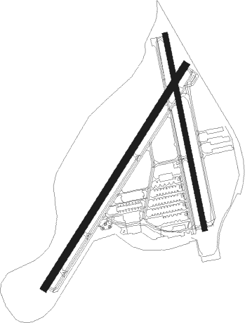
Runway 4 / 22  | ||
| length | 1093m (3586ft) | |
| bearing | 40° / 220° | |
| width | 30m (100ft) | |
| surface | asphalt | |
| displ threshold | 55m (180ft) / 55m (180ft) | |
| Runway 18 / 36 | ||
| length | 819m (2687ft) | |
| bearing | 172° / 352° | |
| width | 23m (75ft) | |
| surface | asphalt | |
| displ threshold | 61m (200ft) / 61m (200ft) | |
Nearby beacons
| code | identifier | dist | bearing | frequency |
|---|---|---|---|---|
| MCF | MACDILL (TAMPA) TACAN | 4.7 | 230° | 111 |
| TP | COSME (TAMPA) NDB | 10.9 | 336° | 368 |
| PIE | SAINT PETERSBURG VORTAC | 12.4 | 268° | 116.40 |
| PI | CAPOK(ST PETERSBURG-CLEARWATER NDB | 14.3 | 287° | 360 |
| LAL | LAKELAND VORTAC | 23.4 | 81° | 116 |
| SRQ | SARASOTA VOR/DME | 31.1 | 193° | 117 |
| PGD | PUNTA GORDA VOR | 64.7 | 155° | 110.20 |
Departure and arrival routes
| Transition altitude | 18000ft |
| Transition level | 18000ft |
| STAR starting points | distance | inbound heading | |
|---|---|---|---|
| ALL | |||
| DARBS3 | 27.9 | 124° | |
| LZARD6 | 24.2 | 200° | |
| BRDGE8 | 32.4 | 326° | |
Instrument approach procedures
| runway | airway (heading) | route (dist, bearing) |
|---|---|---|
| RW22 | DADES (204°) | DADES TIYOB (18mi, 193°) 2600ft |
| RW22 | LAL (261°) | LAL TIYOB (17mi, 285°) 2600ft |
| RW22 | PIE (88°) | PIE TIYOB (21mi, 66°) 2600ft TIYOB (turn) 2600ft |
| RNAV | TIYOB 2600ft UTOBE (6mi, 220°) 1700ft KTPF (5mi, 220°) 47ft (5005mi, 109°) 407ft LAL (4982mi, 289°) 2700ft LAL (turn) | |
| RW36 | LAL (261°) | LAL HUMKI (24mi, 235°) 2700ft HUMKI (turn) 2700ft |
| RW36 | SRQ (13°) | SRQ HUMKI (22mi, 30°) 2700ft |
| RNAV | HUMKI 2700ft JEVOD (6mi, 337°) 1700ft CUVYA (5mi, 337°) 205ft (5004mi, 109°) 407ft LAL (4982mi, 289°) 2700ft LAL (turn) |
Holding patterns
| STAR name | hold at | type | turn | heading* | altitude | leg | speed limit |
|---|---|---|---|---|---|---|---|
| BRDGE8 | BRDGE | VHF | right | 138 (318)° | < 17999ft | 1.0min timed | ICAO rules |
| DARBS3 | TABIR | VHF | right | 336 (156)° | < 17999ft | 1.0min timed | ICAO rules |
| LZARD6 | LZARD | VHF | right | 45 (225)° | < 17999ft | 1.0min timed | ICAO rules |
| LZARD6 | OLENE | VHF | left | 3 (183)° | < 17999ft | 1.0min timed | ICAO rules |
| *) magnetic outbound (inbound) holding course | |||||||
Disclaimer
The information on this website is not for real aviation. Use this data with the X-Plane flight simulator only! Data taken with kind consent from X-Plane 12 source code and data files. Content is subject to change without notice.