Terrell - Terrell Municipal
Airport details
| Country | United States of America |
| State | Texas |
| Region | K4 |
| Airspace | Ft Worth Ctr |
| Municipality | Terrell |
| Elevation | 474ft (144m) |
| Timezone | GMT -6 |
| Coordinates | 32.70850, -96.26710 |
| Magnetic var | |
| Type | land |
| Available since | X-Plane v10.40 |
| ICAO code | KTRL |
| IATA code | TRL |
| FAA code | TRL |
Communication
| Terrell Municipal ASOS | 119.275 |
| Terrell Municipal CTAF/UNICOM | 122.800 |
Nearby Points of Interest:
Matthew Cartwright House
-Warren-Crowell House
-Porter Farm
-Royse City Lodge No. 663 A.F. & A.M.
-First Methodist Church of Rockwall
-Stephen Decatur Lawrence Farmstead
-Wheatley Place, Dallas
-Dallas Fire Station No. 16
-W. A. Strain Farm-Strain House
-Fair Park
-Munger Place Historic District, Dallas
-Randlett House
-Swiss Avenue, Dallas
-South Boulevard–Park Row Historic District
-Chevrolet Motor Company Building
-Central Congregational Church
-Greenway Parks Historic District
-Wilson Block
-Grand Lodge of the Colored Knights of Pythias
-Dallas Municipal Building
-Katy Depot
-Post Office Building
-Titche-Goettinger Building
-Wilson Building
-Republic Center
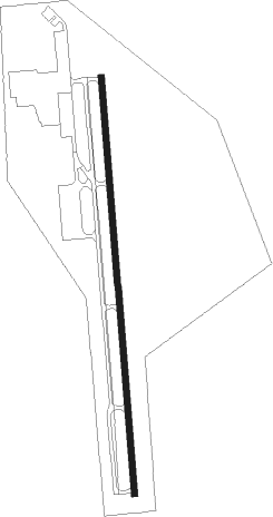
Runway info
| Runway 17 / 35 | ||
| length | 1531m (5023ft) | |
| bearing | 180° / 360° | |
| width | 23m (75ft) | |
| surface | asphalt | |
Nearby beacons
| code | identifier | dist | bearing | frequency |
|---|---|---|---|---|
| PQF | MESQUITE NDB | 14.5 | 291° | 248 |
| MJF | ARVILLA (GREENVILLE) TACAN | 23.8 | 30° | 109.60 |
| GV | MAJOR (GREENVILLE) NDB | 28.7 | 24° | 201 |
| CQY | CEDAR CREEK VORTAC | 31.4 | 175° | 114.80 |
| CVE | COWBOY (DALLAS) VOR/DME | 33.9 | 286° | 116.20 |
| CGQ | POWELL (CORSICANA) NDB | 39.5 | 194° | 344 |
| TTT | MAVERICK VOR/DME | 40.2 | 282° | 113.10 |
| CRS | CORSICANA NDB | 41.3 | 191° | 396 |
| CSZ | CROSSROADS NDB | 41.7 | 154° | 215 |
| UIM | DME | 46.6 | 79° | 114 |
| SLR | SULPHUR SPRINGS VOR/DME | 46.8 | 56° | 109 |
| FUZ | RANGER (DALLAS-FORT WORTH VORTAC | 47.3 | 281° | 115.70 |
| TYR | TYLER VOR/DME | 48.5 | 112° | 114.20 |
| BYP | BONHAM VORTAC | 49.8 | 2° | 114.60 |
| FZT | FRANKSTON VOR/DME | 53.3 | 131° | 111.40 |
| DT | PINCK (DENTON) NDB | 58.1 | 302° | 257 |
| PRX | PARIS VOR/DME | 64.8 | 44° | 113.60 |
Instrument approach procedures
| runway | airway (heading) | route (dist, bearing) |
|---|---|---|
| RW17 | ROYOR (207°) | ROYOR 3000ft TUCUN (5mi, 270°) 3000ft |
| RW17 | SENYO (152°) | SENYO 3000ft TUCUN (5mi, 90°) 3000ft |
| RW17 | TUCUN (180°) | TUCUN 3000ft |
| RNAV | TUCUN 3000ft PIKOY (6mi, 180°) 2000ft KUYPE (2mi, 180°) 1240ft KTRL (3mi, 180°) 519ft (5722mi, 109°) 756ft OLEGE (5722mi, 289°) 3000ft OLEGE (turn) | |
| RW35 | CEVGA (27°) | CEVGA 3000ft OLEGE (5mi, 90°) 3000ft |
| RW35 | LINIY (333°) | LINIY 3000ft OLEGE (5mi, 270°) 3000ft |
| RW35 | OLEGE (360°) | OLEGE 3000ft |
| RNAV | OLEGE 3000ft NACIR (6mi, 360°) 2000ft KTRL (5mi, 360°) 501ft (5722mi, 109°) 730ft TUCUN (5721mi, 289°) 3000ft TUCUN (turn) |
Disclaimer
The information on this website is not for real aviation. Use this data with the X-Plane flight simulator only! Data taken with kind consent from X-Plane 12 source code and data files. Content is subject to change without notice.