Palm Springs - Jacqueline Cochran
Airport details
| Country | United States of America |
| State | California |
| Region | K2 |
| Airspace | Los Angeles Ctr |
| Municipality | Riverside County |
| Elevation | -115ft (-35m) |
| Timezone | GMT -8 |
| Coordinates | 33.62667, -116.15967 |
| Magnetic var | |
| Type | land |
| Available since | X-Plane v10.40 |
| ICAO code | KTRM |
| IATA code | TRM |
| FAA code | TRM |
Communication
| Jacqueline Cochran ASOS | 118.325 |
| Jacqueline Cochran CTAF/UNICOM | 123.000 |
| Jacqueline Cochran SOCAL Approach/Departure | 135.275 |
Nearby Points of Interest:
North Shore Beach and Yacht Club
-Kenaston House
-Ryan House and Lost Horse Well
-Coachella Valley Savings No. 2
-Desert Queen Mine
-Cow Camp
-Keys Desert Queen Ranch
-Palm Springs Aerial Tramway Mountain Station
-Long Valley Ranger Station
-Peak Shelter Cabin
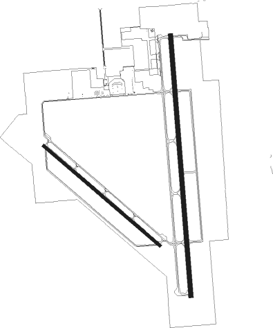
Runway info
Runway 17 / 35  | ||
| length | 2598m (8524ft) | |
| bearing | 180° / 0° | |
| width | 46m (151ft) | |
| surface | asphalt | |
| blast zone | 61m (200ft) / 61m (200ft) | |
| Runway 12 / 30 | ||
| length | 1524m (5000ft) | |
| bearing | 130° / 310° | |
| width | 30m (98ft) | |
| surface | asphalt | |
Nearby beacons
| code | identifier | dist | bearing | frequency |
|---|---|---|---|---|
| TRM | THERMAL VORTAC | 0 | 340° | 116.20 |
| PSP | PALM SPRINGS VORTAC | 19.8 | 312° | 115.50 |
| TNP | TWENTYNINE PALMS VORTAC | 35 | 39° | 114.20 |
| JLI | JULIAN VORTAC | 36.1 | 221° | 114 |
| NJK | EL CENTRO TACAN | 53.4 | 149° | 111 |
| IPL | IMPERIAL VORTAC | 62 | 143° | 115.90 |
| NKX | MIRAMAR (SAN DIEGO) TACAN | 67.5 | 233° | 109.60 |
Departure and arrival routes
| Transition altitude | 18000ft |
| Transition level | 18000ft |
| STAR starting points | distance | inbound heading | |
|---|---|---|---|
| ALL | |||
| SIZLR3 | 108.9 | 117° | |
| SBONO1 | 16.5 | 197° | |
| CLOWD1 | 19.8 | 219° | |
Instrument approach procedures
| runway | airway (heading) | route (dist, bearing) |
|---|---|---|
| RW35 | KARRO (31°) | KARRO DUDSE (13mi, 93°) 6500ft OPOSE (10mi, 54°) 4300ft |
| RW35 | OPOSE (323°) | OPOSE 4300ft |
| RW35 | SHADI (271°) | SHADI COSUK (9mi, 197°) 6500ft OPOSE (10mi, 234°) 4300ft |
| RNAV | OPOSE 4300ft OVOTE (9mi, 314°) 2700ft RODGE (5mi, 315°) 1500ft RIPSE (5mi, 347°) 1ft (6699mi, 106°) 1200ft OPOSE (6693mi, 286°) 4300ft OPOSE (turn) |
Holding patterns
| STAR name | hold at | type | turn | heading* | altitude | leg | speed limit |
|---|---|---|---|---|---|---|---|
| CLOWD1 | CLOWD | VHF | right | 72 (252)° | < 17999ft | 1.0min timed | ICAO rules |
| SBONO1 | CLOWD | VHF | right | 72 (252)° | < 17999ft | 1.0min timed | ICAO rules |
| *) magnetic outbound (inbound) holding course | |||||||
Disclaimer
The information on this website is not for real aviation. Use this data with the X-Plane flight simulator only! Data taken with kind consent from X-Plane 12 source code and data files. Content is subject to change without notice.